Russian Shahed-136 drone detected transiting Khmelnytskyi Oblast
What happened
Ukrainian air defense monitoring detected one Russian Shahed-136 reactive (jet-powered) drone transiting over Khmelnytskyi Oblast in western Ukraine on 18 September 2026 at approximately 16:57 UTC. The drone was tracked moving through the Kucha and Dunayivtsi corridor. No impacts or interceptions were reported in the initial monitoring alert.
Context and assessment
The Kucha–Dunayivtsi corridor in Khmelnytskyi Oblast lies in western Ukraine, several hundred kilometers from the main front lines, suggesting the drone was likely directed toward infrastructure, military facilities, or civilian targets deeper within Ukrainian-held territory. Shahed-136 drones, supplied by Iran to Russia, have become a persistent feature of Russian strikes on rear areas, typically targeting energy infrastructure, transportation nodes, and industrial capacity. Detection without reported impact may indicate Ukrainian air defenses engaged the drone, it transited without striking, or the monitoring alert preceded any eventual strike.
Sources and confidence
Single source: Telegram channel @war_monitor, a Ukrainian air defense monitoring outlet. The terse format and absence of secondary confirmation mean confidence remains moderate. Cross-confirmation from Ukrainian official military sources or documented interception would strengthen assessment. Lack of impact reporting does not confirm successful air defense; follow-up sources may provide outcome details.
Location
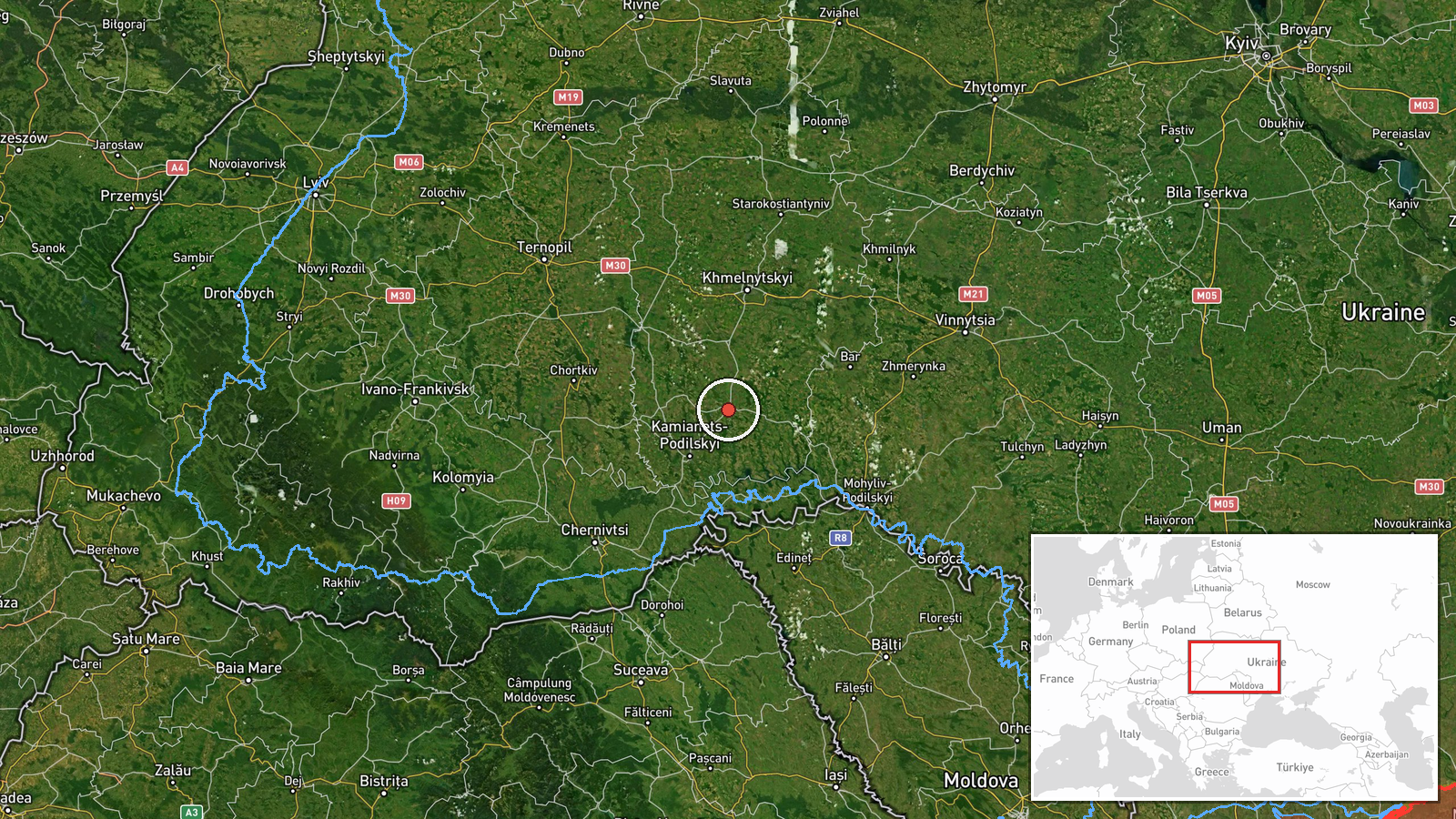
The Kucha–Dunayivtsi corridor is located in northwestern Khmelnytskyi Oblast, approximately 48.89°N, 26.85°E. This region lies in western Ukraine, roughly 350 kilometers west of Kyiv and well removed from active ground combat zones. The area is rural agricultural and settlement-based terrain in the broader Podolia region.
▶ View this event on the live map
Intel Mapper aggregates open-source reports from monitored Telegram and X channels, geolocates them, cross-checks duplicates across sources and assigns a confidence score. Entries are updated as new confirmations arrive. Read how we verify events.