Russian Shahed drone detected transiting toward Odesa Oblast from Black Sea coast
What happened
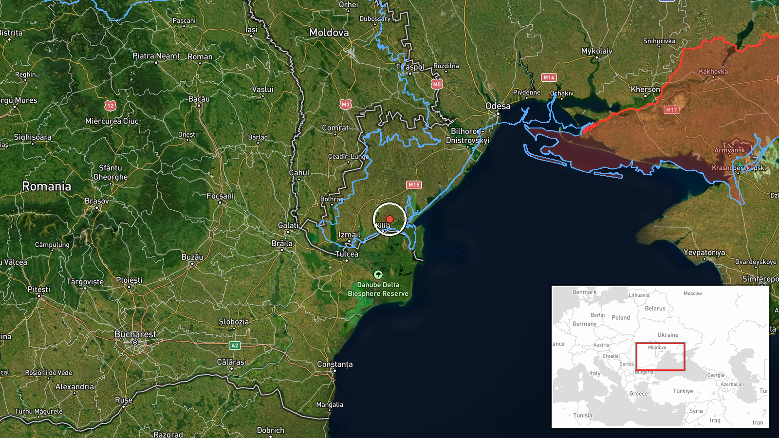
Ukrainian air monitoring reported one Russian Shahed-class reactive drone detected on September 19 at 02:53 UTC transiting from Tendrivska Spit toward Odesa Oblast. The report, issued via the Telegram channel @war_monitor, characterized the drone as a single inbound threat in an ongoing pattern of aerial activity against the region. No immediate strike confirmation was provided in this particular detection.
Context and assessment
The detection occurred amid an intensive Russian drone campaign against Odesa. Within the preceding two hours, a Shahed had struck the Arcadia district in Odesa city, and on September 18, another struck an administrative building in central Odesa causing a fire. The pattern suggests sustained pressure on the oblast's civilian infrastructure and populated areas. Tendrivska Spit, a narrow landform projecting into the northern Black Sea, has emerged as a recurring launch or transit point for Russian unmanned systems targeting Odesa region, consistent with sea-based or staging operations.
Sources and confidence
Single source: Telegram channel @war_monitor, a Ukrainian air defense monitoring account. No cross-confirmation from additional independent sources reported. Confidence score of 6.0 reflects the established credibility of the source channel and consistency with surrounding events (strikes in Odesa at 02:52 and earlier dates), but absence of corroborating reports limits certainty. Independent confirmation from Ukrainian official military channels would strengthen confidence.
Location
Tendrivska Spit, a sandy projection extending into the northern Black Sea near Odesa Oblast. Geographically situated at approximately 45.55°N, 29.35°E. The spit marks a narrow coastal feature approximately 15–20 kilometers south-southwest of central Odesa city, often positioned between mainland Odesa Oblast and open Black Sea waters, relevant to drone transit routes from offshore or southern approaches.
Related events nearby
- Russian Shahed-class (jet-powered/reactive) UAV struck Arcadia district in Odesa city. Ukrainian air monitorin2026-09-19 02:52 UTC · UAS Strike · Arcadia, Odesa, Odesa Oblast, Ukraine
- Russian reactive (jet-powered Shahed-136) drone struck an administrative building in central Odesa, causing fi2026-09-18 14:30 UTC · UAS Strike · Administrative building, Odesa, Ukraine
- Ukrainian air defense monitoring detected 2 Russian reactive (jet-powered Shahed-136) drones transiting toward2026-09-18 16:06 UTC · Drone Transit · Pidvydne, Odesa Oblast, Ukraine
- Up to 10 Russian Shahed-class (reactive/jet-powered) UAVs detected transiting past Odesa city toward the coast2026-09-19 00:53 UTC · Drone Transit · Odesa, Odesa Oblast, Ukraine
▶ View this event on the live map
Intel Mapper aggregates open-source reports from monitored Telegram and X channels, geolocates them, cross-checks duplicates across sources and assigns a confidence score. Entries are updated as new confirmations arrive. Read how we verify events.