Russian Shahed drone detected in transit toward Zatoka, Odesa Oblast
What happened
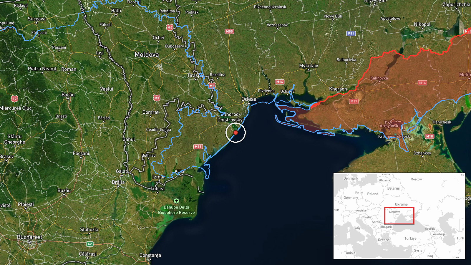
One Russian Shahed-type reactive kamikaze drone was detected in transit toward Zatoka, a coastal settlement in Odesa Oblast, on 20 September at 16:11 UTC. Ukrainian air defense monitoring systems issued an air alert for the area. The report comes from the Telegram channel @war_monitor, which noted the drone's approach without confirming whether air defenses engaged or the drone reached its target.
Context and assessment
Zatoka lies on the northern coast of the Black Sea near the mouth of the Danube Delta, a strategically sensitive location given Ukraine's maritime infrastructure and civilian population in the region. This detection occurred on a day marked by multiple Shahed transits across Odesa Oblast, including earlier reports of four drones over the Black Sea toward Odesa District and additional aircraft targeting the Hydroport and Krasnosilka area. The pattern suggests a coordinated Russian drone campaign against Odesa's coastal zone, consistent with ongoing strikes on civilian and logistical targets in the region. Such operations typically aim at disrupting port activity, civilian morale, or infrastructure resilience.
Sources and confidence
Reported by Telegram channel @war_monitor on 20 September. Single-source confirmation limits confidence assessment; cross-corroboration with other monitoring channels would strengthen reliability. Confidence score of 6.0 reflects the channel's general credibility but sole-source status. Independent confirmation from Ukrainian official sources or additional monitoring networks would increase confidence; absence of follow-up reporting on strike outcome or interception would lower it.
Location
Zatoka is a coastal settlement in Odesa Oblast located at approximately 46.06°N, 30.45°E on the Black Sea coast near the Danube Delta mouth. The settlement is situated in Ukraine's southwesternmost region, roughly 70 kilometers south of Odesa city. Its proximity to maritime borders and civilian population centers makes it a monitored area for Ukrainian air defense tracking.
Related events nearby
- Four Russian Shahed-136 (Siker) reactive jet-powered UAVs detected in transit toward Odesa District over the B2026-09-20 00:56 UTC · Drone Transit · Odesa District, Odesa Oblast, Ukraine
- One Russian reactive (jet-powered) Shahed-136 variant drone detected in transit toward Hydroport / Krasnosilka2026-09-20 02:20 UTC · Drone Transit · Hydroport / Krasnosilka, Odesa District, Odesa Obl
- Russian Shahed-136 (Siker) reactive jet-powered UAV struck Fontanka area in Odesa. Air alert monitoring confir2026-09-20 00:49 UTC · UAS Strike · Rybakivka, Mykolaiv Oblast, Ukraine
- Two Russian reactive (jet-powered) Shahed-136 variant drones detected in transit from Kherson Oblast toward Te2026-09-20 01:47 UTC · Drone Transit · Tendrivska Spit, Kherson Oblast, Ukraine
▶ View this event on the live map
Intel Mapper aggregates open-source reports from monitored Telegram and X channels, geolocates them, cross-checks duplicates across sources and assigns a confidence score. Entries are updated as new confirmations arrive. Read how we verify events.