Two Russian reconnaissance drones transit over Kirovohrad Oblast
What happened
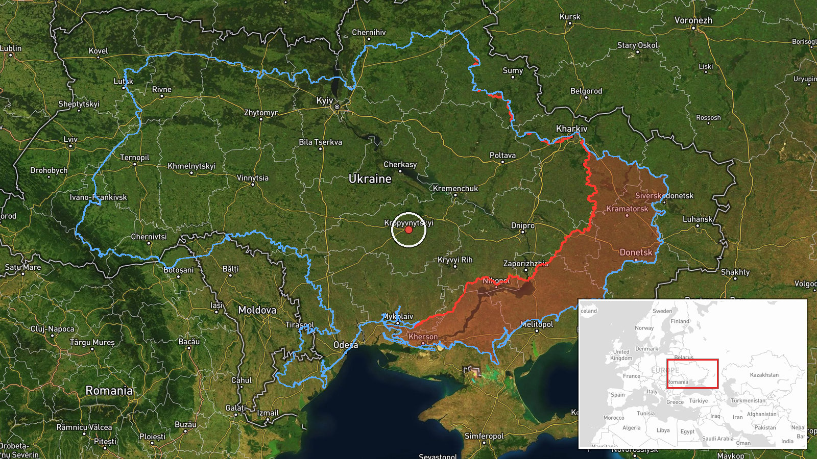
Two Russian Shahed-class jet-propelled reconnaissance drones were reportedly detected in transit over the Kropyvnytskyi area in Kirovohrad Oblast on September 21 at 17:16 UTC. The drones' destination was not specified in the report. The sighting was logged by the Telegram channel @war_monitor as part of ongoing Russian drone operations over central Ukraine.
Context and assessment
Kirovohrad Oblast lies in central Ukraine, roughly 350 kilometers from front lines. Reconnaissance drones of Shahed type typically gather intelligence on Ukrainian military positions, supply routes, and infrastructure. The same day saw similar drone transits over neighbouring Dnipropetrovsk and Cherkasy oblasts, suggesting a coordinated reconnaissance sweep across central Ukraine's industrial and transport corridor. Such patterns often precede strikes or indicate efforts to map Ukrainian air defenses and military dispositions across a broad area.
Sources and confidence
Reported by a single Telegram channel (@war_monitor) with no cross-confirmation from Ukrainian official sources in available data. Confidence score of 6.0 reflects single-source reporting and lack of independent verification. Score would increase with confirmation from Ukrainian military or civilian air defense channels; it would lower if the channel proved unreliable in previous reports.
Location
Determined by Telegram report referencing Kropyvnytskyi, the administrative center of Kirovohrad Oblast in central Ukraine. Precision is regional rather than specific; the drones' exact transit corridor within the oblast is unknown. The area contains significant transport infrastructure and logistics nodes.
Related events nearby
- Russian Shahed-type reactive (jet-powered) kamikaze drone detected in transit over Kremenchuk District, Dnipro2026-09-21 00:41 UTC · Drone Transit · Kremenchuk District, Dnipropetrovsk Oblast, Ukrain
- One Russian jet-propelled reconnaissance drone (Shahed-class) transited over Smila heading toward Cherkasy in 2026-09-21 17:16 UTC · Drone Transit · Cherkasy, Cherkasy Oblast, Ukraine
▶ View this event on the live map
Intel Mapper aggregates open-source reports from monitored Telegram and X channels, geolocates them, cross-checks duplicates across sources and assigns a confidence score. Entries are updated as new confirmations arrive. Read how we verify events.