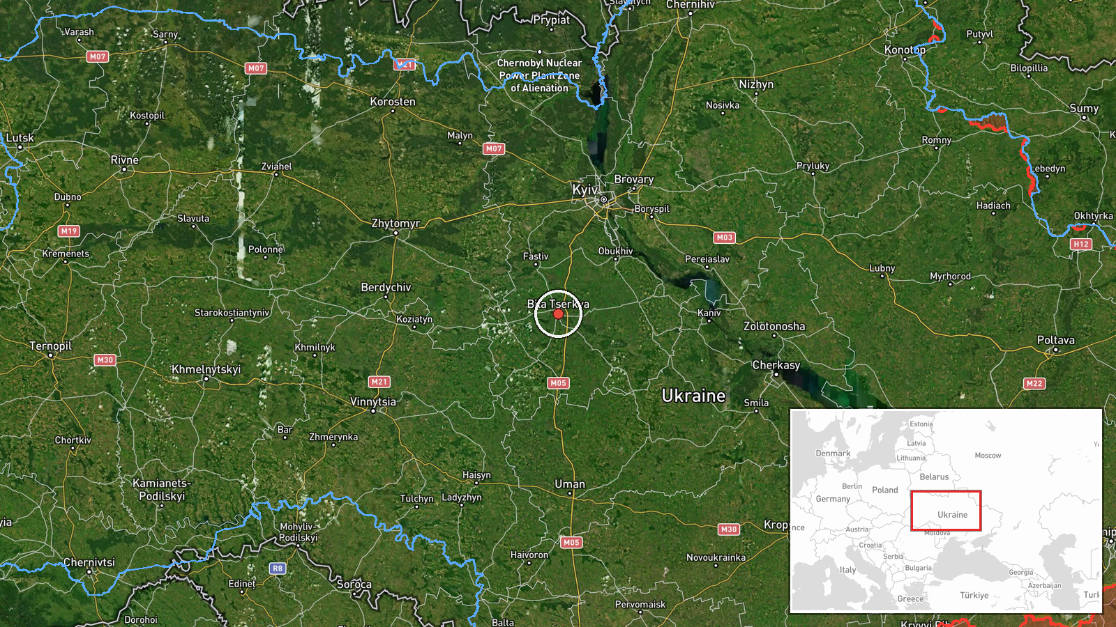
Russian Shahed-136 drone transits near Bila Tserkva in Kyiv Oblast
What happened
Ukrainian air monitoring detected one Russian Shahed-136 reactive drone in transit near Bila Tserkva, Kyiv Oblast, on 22 September at 00:53 UTC. The drone was tracked but reportedly caused no impact. The detection was reported via Telegram by war monitoring channels tracking Russian air activity over Ukraine's central region.
Context and assessment
Bila Tserkva lies approximately 80 kilometres south of Kyiv and represents a key transit corridor for Russian drone operations targeting the capital and surrounding oblast. This sighting occurred amid a sustained pattern of Russian drone activity: Ukrainian air defenses intercepted 147 of 172 attack drones overnight on 20–21 September, and reconnaissance drones were observed routing through northern Chernihiv on 21 September. Multiple Shahed transits were detected across Kyiv Oblast within hours, suggesting either coordinated waves or continued probing of Ukrainian air defenses. The location's proximity to inhabited areas and critical infrastructure makes such transit monitoring operationally significant for civil defense planning.
Sources and confidence
Single source: Telegram channel @war_monitor. Confidence score 6.0 reflects limited corroboration—only one monitoring channel reported this specific transit. Cross-confirmation by other OSINT channels or official Ukrainian statements would strengthen confidence. No impact claim is difficult to independently verify; reports of nearby interceptions on same date provide indirect support for active air defense operations.
Location
Bila Tserkva, Kyiv Oblast, central Ukraine (49.80°N, 30.11°E). The settlement is located on the Ros River approximately 80 km south-southwest of central Kyiv, in relatively open terrain typical of the Kyiv Oblast landscape. Precision rated as settlement-level based on Ukrainian monitoring reports.
Related events nearby
- Ukrainian air defenses intercepted 147 of 172 Russian attack drones (Shahed, Geran, Parody, Banderoль types) l2026-09-21 05:48 UTC · Air Defense · Kyiv Oblast, Ukraine
- Russian Shahed-136 reactive (jet-powered) drone tracked in transit near Berezniak/Poznyaky district, Kyiv. Ukr2026-09-22 00:32 UTC · Drone Transit · Berezniak/Poznyaky, Kyiv, Ukraine
- Seven Russian reconnaissance drones transited from Bryansk Oblast through northern Chernihiv Oblast (Snovsk, B2026-09-21 16:29 UTC · Drone Transit · Kyiv Oblast, Ukraine
- Ukrainian air monitoring issued all-clear (до відбою / 'all clear') signal over Kyiv region after ballistic mi2026-09-22 01:47 UTC · Siren · Kyiv, Ukraine
- Ukrainian President Zelenskyy offers Russia a ceasefire without conditions if Russia stops fighting, proposing2026-09-21 18:49 UTC · Statement · Kyiv, Ukraine
▶ View this event on the live map
Intel Mapper aggregates open-source reports from monitored Telegram and X channels, geolocates them, cross-checks duplicates across sources and assigns a confidence score. Entries are updated as new confirmations arrive. Read how we verify events.