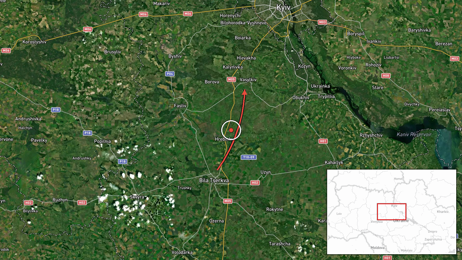
Russian Shahed drone tracked transiting from Bila Tserkva toward Vasylkiv in Kyiv Oblast
What happened
Ukrainian air-monitoring forces detected one reactive Shahed-type kamikaze drone en route from Bila Tserkva to Vasylkiv in Kyiv Oblast on the morning of September 25. The detection was reported by the Telegram channel @war_monitor at 17:11 UTC. The report indicates Ukrainian forces were tracking the drone's transit vector in real time but does not specify whether the system was intercepted, reached its target, or continued past the reported location.
Context and assessment
This detection occurred within a broader pattern of Russian drone operations against Kyiv Oblast on September 25. Earlier that morning, a Shahed-136 struck a residential building in Pecherskyi District, killing at least one teenager and injuring seven others. Multiple drones were tracked transiting over Kyiv and surrounding areas, with some successfully intercepted by Ukrainian air defense. The Vasylkiv area, lying south of central Kyiv and a key node in the capital's defensive perimeter, has faced repeated drone pressure. The reported Bila Tserkva origin point—approximately 50 kilometers southwest—represents a common launch vector for Russian unmanned systems targeting the Kyiv metropolitan region.
Sources and confidence
Single-source report from Telegram channel @war_monitor, a widely-monitored Ukrainian air-monitoring account. No cross-confirmation from independent sources or official Ukrainian military statements visible in available data. Confidence score of 6.0 reflects typical reliability of real-time air-monitoring channels but limited corroboration. Confirmation through subsequent air defense announcements or impact reports would raise confidence; absence of follow-up reporting may indicate the drone passed through the area unconfirmed.
Location
Vasylkiv, an industrial and transport hub approximately 40 kilometers south-southwest of Kyiv's center, lies in Kyiv Oblast at 50.18°N, 30.32°E. The reported origin, Bila Tserkva, sits roughly 50 kilometers further southwest. Both settlements occupy positions along major river valleys and road networks connecting central Ukraine. The transit corridor between them crosses open terrain and populated suburban zones.
Related events nearby
- One reactive (jet-powered) Shahed-136 variant drone detected transiting at altitude over Obolonski District (Х2026-09-25 00:16 UTC · Drone Transit · Telichka, Kyiv Oblast, Ukraine
- Russian Shahed-136 drone struck a 16-story residential building in Pecherskyi District, Kyiv at approximately 2026-09-25 06:31 UTC · UAS Strike · Pecherskyi District, Kyiv, Ukraine
- Ukrainian intelligence indicates preparations for a major strike campaign using drones and missiles against Ru2026-09-25 17:53 UTC · Statement · Kyiv, Ukraine
- Russian kamikaze drone attacks on Kyiv result in 7 killed and 57 wounded. Ukrainian air defense responded to m2026-09-25 17:44 UTC · Siren · Kyiv, Ukraine
- Ukrainian President Zelensky confirms USA proposed UAE as venue for trilateral talks between USA, Russia, and 2026-09-25 09:16 UTC · Diplomacy · Kyiv, Ukraine
▶ View this event on the live map
Intel Mapper aggregates open-source reports from monitored Telegram and X channels, geolocates them, cross-checks duplicates across sources and assigns a confidence score. Entries are updated as new confirmations arrive. Read how we verify events.