Russian Shahed-136 drone transits toward Kyiv from Chernihiv Oblast
What happened
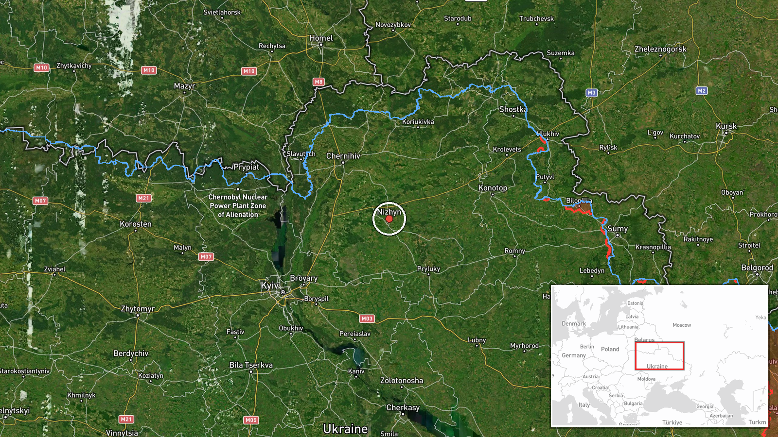
A Russian Shahed-136 jet-engine kamikaze drone was detected in flight from Nizhyn, Chernihiv Oblast, heading toward Kyiv Oblast on October 1 at approximately 08:51 UTC. Ukrainian monitoring reportedly confirmed one reactive drone unit in the Borodyanка sector, with additional drone activity noted in the area. The detection occurred as part of continued Russian aerial operations against the Kyiv region.
Context and assessment
Nizhyn lies roughly 140 kilometers north of Kyiv and serves as a staging area for Russian drone operations targeting the capital region. This transit follows an intense overnight attack cycle: Ukrainian air defense reported destroying or suppressing 87 Shahed and variant drones between September 30 and October 1 morning, while an F-16 intercepted a Geran-4 variant over Kyiv airspace hours earlier. The pattern reflects Russia's sustained campaign of attrition against Ukrainian air defenses through mass drone waves, using reactive Shaheds alongside decoys to overwhelm defensive systems. Such transits along established corridors from the north and northeast remain a primary delivery method for attacks on Kyiv's infrastructure and civilian areas.
Sources and confidence
Reported by Telegram channel @war_monitor on October 1, 2026. Single-source detection with no immediate cross-confirmation noted in available data. Confidence score of 6.0 reflects typical reliability of Ukrainian monitoring channels but absence of redundant confirmation. Score would increase with reports from additional independent monitors or Ukrainian official statements; would decrease if subsequent air defense claims contradicted the transit.
Location
Nizhyn, Chernihiv Oblast, approximately 140 km north-northeast of Kyiv city center. Located in northern Ukraine near the Belarus border region, the city sits along the Desna River valley and has functioned as a Russian staging area for drone operations throughout the conflict. Precision determined at regional level based on departure point identification.
Related events nearby
- Ukrainian air monitoring confirms 1 Russian reactive (jet-engine) Shahed-136 kamikaze drone detected transitin2026-09-30 09:23 UTC · Drone Transit · Kyiv Reservoir, Kyiv, Ukraine
- Air raid alert in Kyiv. Sirens activated in Pechersk and Troyeshchyna districts as Russian attack ongoing.2026-09-30 10:20 UTC · Siren · Pechersk District, Kyiv, Ukraine
- Ukrainian F-16 fighter intercepted and destroyed Russian Geran-4 (Shahed variant) suicide drone with air-to-ai2026-10-01 05:29 UTC · Drone Shootdown · Kyiv, Kyiv Oblast, Ukraine
- Ukrainian air defense shot down or suppressed 87 Russian Shahed, Gerbera, and decoy drones in overnight attack2026-10-01 05:06 UTC · Air Defense · Kyiv, Kyiv Oblast, Ukraine
- Air raid sirens activated across Kyiv and Kyiv Oblast. All-clear signal issued ('дорозвідка до відбою') follow2026-10-01 00:01 UTC · Siren · Kyiv, Kyiv Oblast, Ukraine
▶ View this event on the live map
Intel Mapper aggregates open-source reports from monitored Telegram and X channels, geolocates them, cross-checks duplicates across sources and assigns a confidence score. Entries are updated as new confirmations arrive. Read how we verify events.