Russian Shahed-type drone transits toward Lisovyi in ongoing Kyiv air assault
What happened
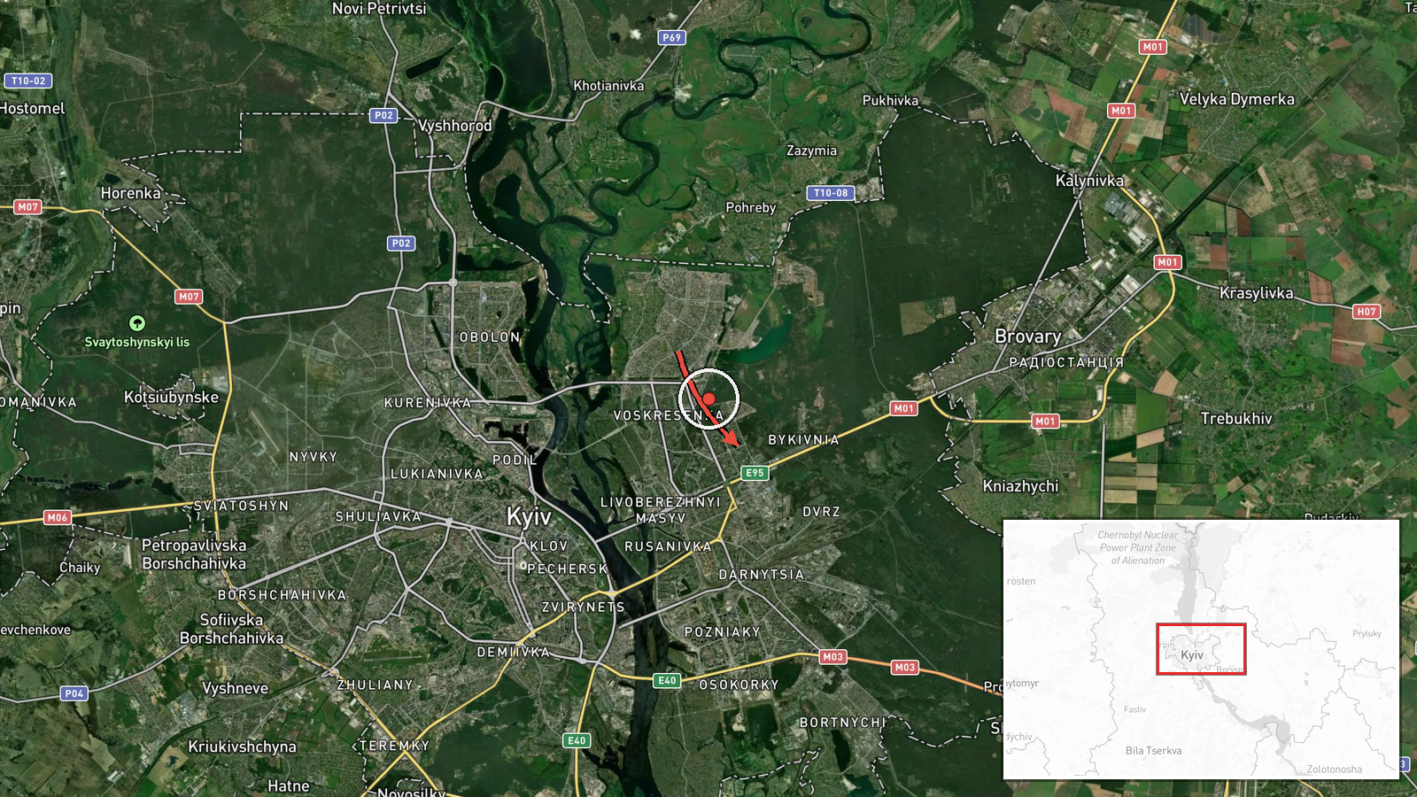
Ukrainian air monitoring detected a single Russian Shahed-type kamikaze drone in transit from Troieshchyna toward Lisovyi on October 1st at 17:02 UTC. The drone's movement was tracked as it crossed the Kyiv area. The report comes from the Telegram channel @war_monitor and describes the aircraft's path without confirming interception or impact at this stage.
Context and assessment
Lisovyi lies in the northeastern approaches to Kyiv and has been on the receiving end of Russian drone operations targeting the capital's infrastructure. This October 1st transit occurred amid an intensive Russian drone campaign: Ukrainian air defense reported destroying or suppressing 87 Shahed and variant drones overnight (September 30–October 1), while F-16 fighters scored at least one confirmed kill. Russian drones also struck a major bridge in central Kyiv earlier that day. The sustained frequency and variety of unmanned aircraft suggest Russia is maintaining pressure on Kyiv's air defenses and civilian infrastructure through distributed attacks that strain Ukrainian response capacity.
Sources and confidence
Reported by single Telegram channel @war_monitor with high location confidence but limited source corroboration. Confidence score of 6.0 reflects reliable Ukrainian air monitoring networks but dependence on one reporting channel. Cross-confirmation from Ukrainian official air defense summaries or additional monitors would strengthen confidence; absence of interception reports or damage assessment would lower it.
Location
Lisovyi is a settlement in northeastern Kyiv Oblast, approximately 15 km northeast of central Kyiv at coordinates 50.47°N, 30.64°E. The origin point Troieshchyna is a northwestern Kyiv district. The transit path crosses urban and suburban terrain around the capital.
Related events nearby
- Ukrainian F-16 fighter intercepted and destroyed Russian Geran-4 (Shahed variant) suicide drone with air-to-ai2026-10-01 05:29 UTC · Drone Shootdown · Kyiv, Kyiv Oblast, Ukraine
- Ukrainian air defense shot down or suppressed 87 Russian Shahed, Gerbera, and decoy drones in overnight attack2026-10-01 05:06 UTC · Air Defense · Kyiv, Kyiv Oblast, Ukraine
- Air raid sirens activated across Kyiv and Kyiv Oblast. All-clear signal issued ('дорозвідка до відбою') follow2026-10-01 00:01 UTC · Siren · Kyiv, Kyiv Oblast, Ukraine
- Ukraine confirms first combat deployment of FP-7 tactical ballistic missile in ongoing war against Russia. Ukr2026-10-01 15:45 UTC · Statement · Kyiv, Ukraine
- Russian drones struck a major bridge in Kyiv. Two unmanned aircraft hit the structure, per Kyiv's mayor. Part 2026-10-01 10:02 UTC · UAS Strike · Kyiv, Kyiv City, Ukraine
▶ View this event on the live map
Intel Mapper aggregates open-source reports from monitored Telegram and X channels, geolocates them, cross-checks duplicates across sources and assigns a confidence score. Entries are updated as new confirmations arrive. Read how we verify events.