Russian Shahed drone tracked over Pivdennyi Bridge in southern Kyiv during massed attack
What happened
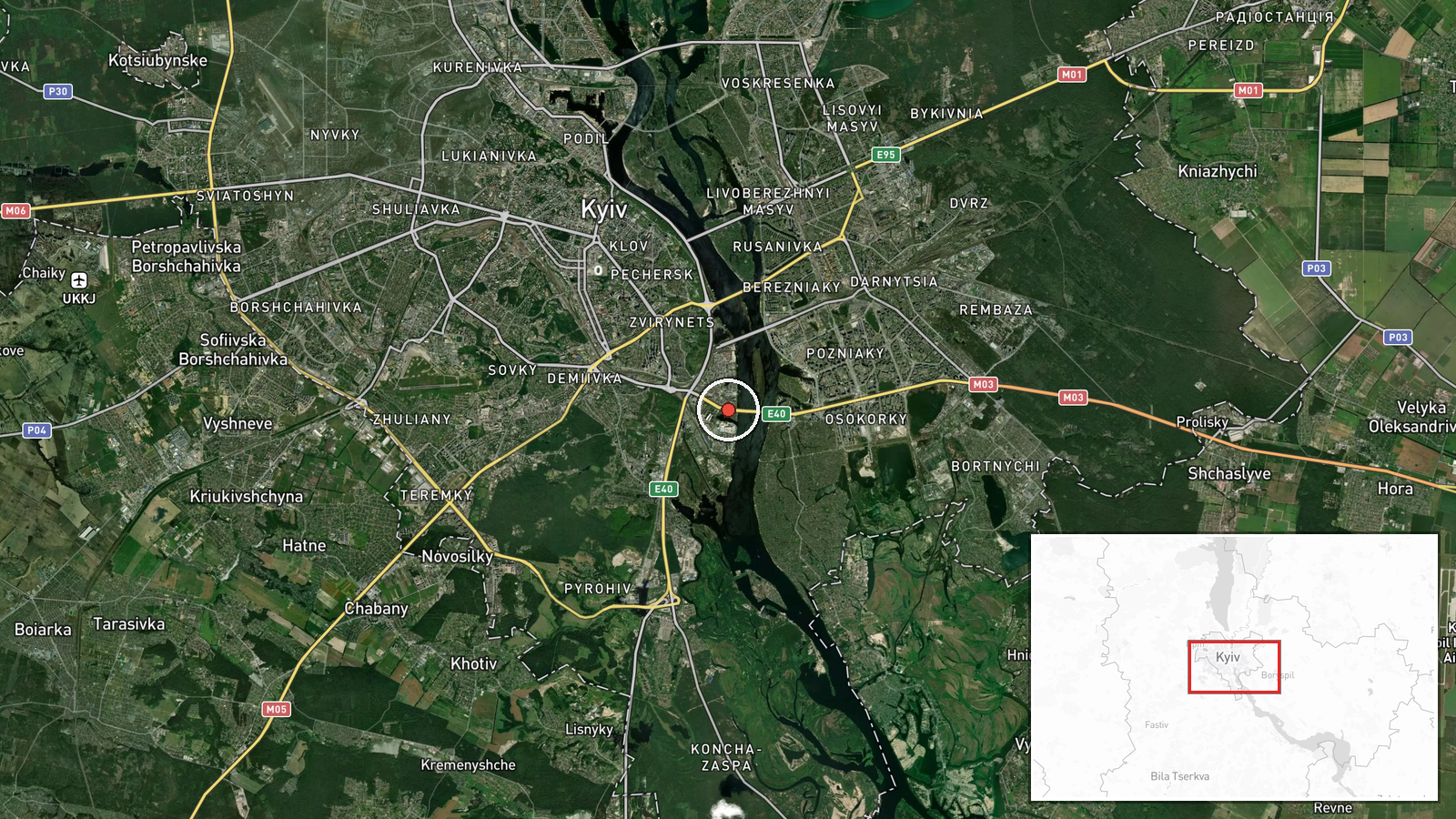
A Russian Shahed-variant kamikaze drone was tracked transiting the Pivdennyi Bridge area in southern Kyiv on the morning of October 2, 2026, at approximately 03:01 UTC. The drone was reportedly en route to an undisclosed target as part of a broader massed drone assault against the Kyiv region. The sighting places the aircraft roughly 1.5 kilometers from the bridge itself, in the city's southern administrative zone.
Context and assessment
Pivdennyi Bridge, spanning the Dnipro River in southern Kyiv, connects central and outlying districts and serves as critical civilian and military transport infrastructure. This drone sighting is one of multiple transits tracked across Kyiv on October 1–2, suggesting a coordinated multi-axis drone operation. Related reports from the same period document Shahed variants crossing through Osokorky, Bereznyki, and other northern and eastern approaches to the city, indicating Russia may have launched a sustained aerial campaign targeting Kyiv's infrastructure or military positions. Such massed attacks have become routine in the conflict and typically aim to overwhelm Ukrainian air defenses.
Sources and confidence
Reported solely by Telegram channel @war_monitor on October 2, 2026. Confidence is moderate (6.0/10) owing to single-source reporting and lack of independent cross-confirmation. The confidence level reflects typical OSINT verification standards for drone transit claims. Corroboration from official Ukrainian air force statements or multiple independent channels would strengthen confidence. Unconfirmed impact or interception status lowers certainty further.
Location
Pivdennyi Bridge, a major river crossing in southern Kyiv, determined via facility-level precision (latitude 50.39555, longitude 30.57726). The bridge spans the Dnipro River between Kyiv's central and southern districts, approximately 1.5 kilometers from the reported drone position. The area is densely populated with residential and industrial zones.
Related events nearby
- Russian Shahed-136 reactive (jet-engine) kamikaze drone detected transiting from Pirogovo through Lisnyky dist2026-10-01 17:54 UTC · Drone Transit · Telychka, Ukraine
- Russian Shahed-variant kamikaze drones transiting through Kyiv city toward targets. One drone tracked en route2026-10-02 03:01 UTC · Drone Transit · Osokorky, Kyiv, Ukraine
- Russian reactive/jet-powered Shahed-variant kamikaze drone tracked transiting past Osokорки district (3.9 km r2026-10-02 02:49 UTC · Drone Transit · Osokorky, Kyiv City, Ukraine
- Russian Shahed/reactive kamikaze drone(s) transiting through Kyiv Oblast, spotted over Bereznyki district (4.52026-10-02 01:57 UTC · Drone Transit · Bereznyki, Kyiv Oblast, Ukraine
- Russian Shahed-type kamikaze drone detected over Nova Zabudova (Ukrainian air monitoring).2026-10-01 15:28 UTC · Drone Transit · Nova Zabudova, Ukraine
▶ View this event on the live map
Intel Mapper aggregates open-source reports from monitored Telegram and X channels, geolocates them, cross-checks duplicates across sources and assigns a confidence score. Entries are updated as new confirmations arrive. Read how we verify events.