Russian Shahed drone tracked toward Kyiv in ongoing massed assault
What happened
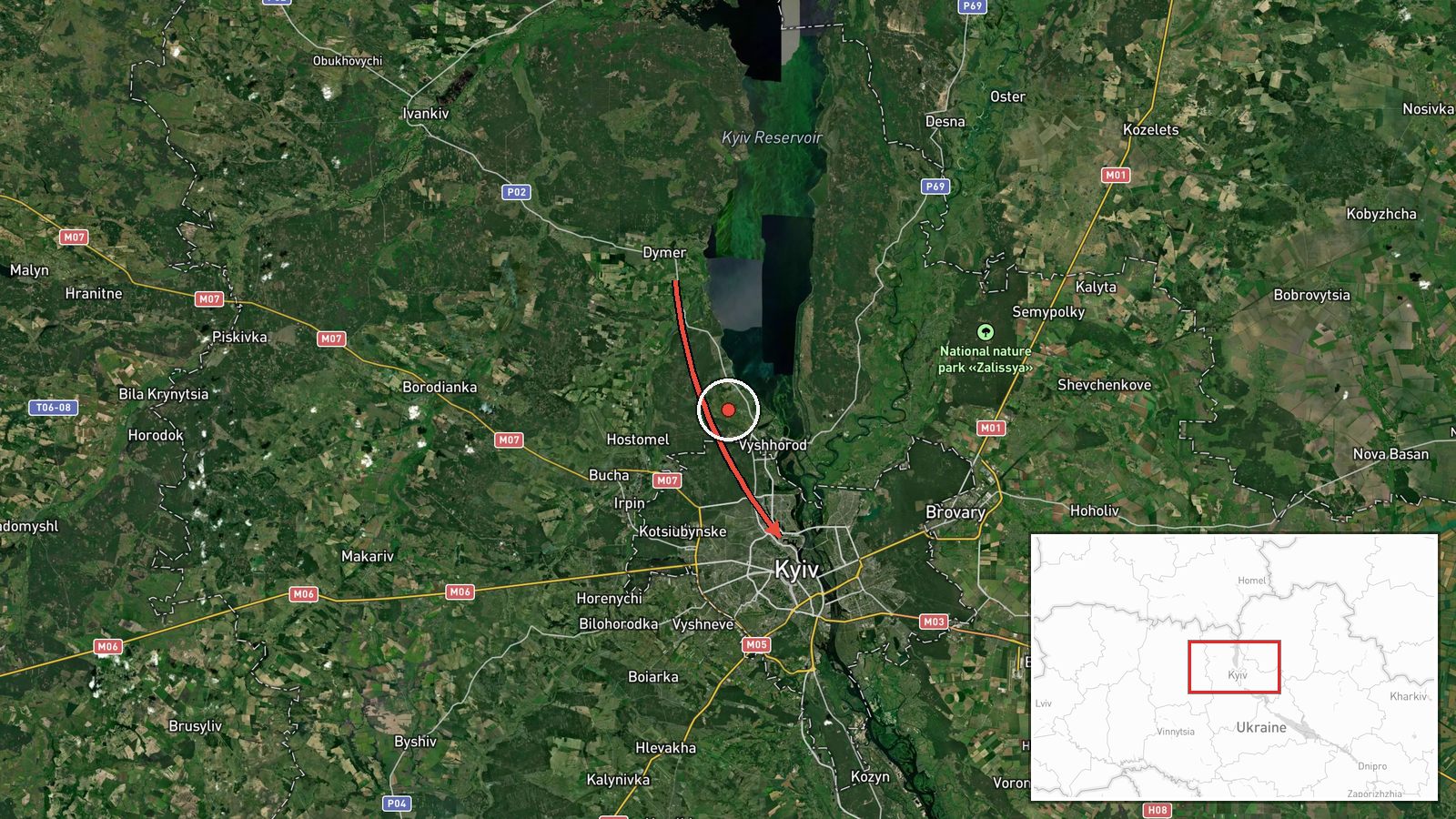
Ukrainian air monitoring reportedly detected one Russian Shahed-variant reactive kamikaze drone in transit from Dymera toward Kyiv city on October 2 at 03:40 UTC. The drone was tracked as part of a wider Russian massed attack on the Kyiv region. Shahed-136 variants are jet-engine-powered loitering munitions typically used for strikes against infrastructure and populated areas. The report comes from Telegram channel @war_monitor, a Ukrainian open-source monitoring source.
Context and assessment
This transit represents a continuation of intensive Russian drone operations against Kyiv documented over preceding hours. Related events show multiple Shahed drones detected approaching the city on October 1, including strikes on a major bridge in Kyiv's central area. The pattern suggests a sustained Russian campaign targeting Ukrainian critical infrastructure in and around the capital. Dymera, located northwest of Kyiv, has emerged as a staging or transit point for Russian drone operations in recent reporting. The tempo and scale of these operations may indicate Russian efforts to degrade Ukrainian air defenses and strike capacity ahead of possible ground operations, though intent cannot be confirmed from transit data alone.
Sources and confidence
Reported by Telegram channel @war_monitor, a Ukrainian military/civil monitoring source. Single-source report limits confidence to 6.0 (moderate). Cross-confirmation from related events on October 1 showing similar transits from nearby origin points increases plausibility of this routing pattern. Confidence would rise with corroboration from Ukrainian official air defense statements or secondary monitoring channels; it would lower if transit was not subsequently confirmed as completed.
Location
Dymery (origin) to Kyiv city (target direction). Dymera is a settlement approximately 40 kilometers northwest of central Kyiv in the Kyiv Oblast. Kyiv city center lies at approximately 50.45°N, 30.52°E. The route represents a typical northern approach vector to the capital observed in recent Russian drone operations.
Related events nearby
- Russian Shahed-type kamikaze drone detected transiting from Kaharlyka toward Kyiv (Ukrainian air monitoring).2026-10-01 16:55 UTC · Drone Transit · Kyiv, Ukraine
- Two Russian Shahed-136 reactive (jet-engine) kamikaze drones detected transiting from Khaharlyky toward Kyiv c2026-10-01 16:43 UTC · Drone Transit · Kyiv, Ukraine
- Ukraine confirms first combat deployment of FP-7 tactical ballistic missile in ongoing war against Russia. Ukr2026-10-01 15:45 UTC · Statement · Kyiv, Ukraine
- Russian drones struck a major bridge in Kyiv. Two unmanned aircraft hit the structure, per Kyiv's mayor. Part 2026-10-01 10:02 UTC · UAS Strike · Kyiv, Kyiv City, Ukraine
- Russian Shahed-type kamikaze drone detected transiting toward Kyiv (Ukrainian air monitoring).2026-10-01 08:51 UTC · Drone Transit · Kyiv, Ukraine
▶ View this event on the live map
Intel Mapper aggregates open-source reports from monitored Telegram and X channels, geolocates them, cross-checks duplicates across sources and assigns a confidence score. Entries are updated as new confirmations arrive. Read how we verify events.