Russian Shahed-136 drone detected transiting over central Kyiv
What happened
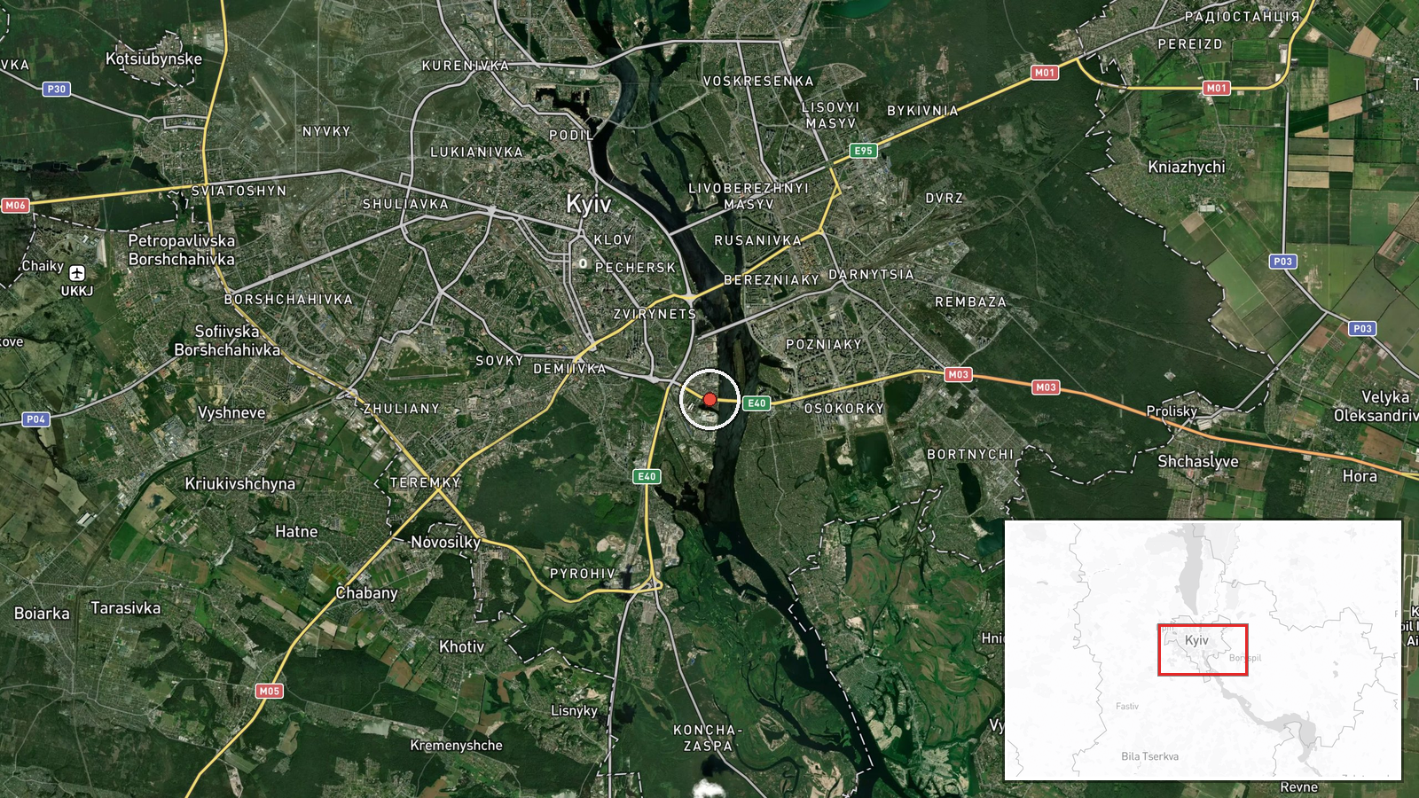
Ukrainian air monitoring systems reported detecting a Russian Shahed-136 variant attack drone in transit over the Pivnichnyi Bridge area of central Kyiv on October 4 at 00:01 UTC. The drone was tracked on a northwestward trajectory. The report was issued via Telegram channel @war_monitor, which monitors Ukrainian air defense activity. No interception or impact was reported in the available data.
Context and assessment
The detection occurred within 24 hours of a major overnight drone assault on October 2–3, during which Ukrainian air defense reportedly intercepted 131 Russian attack drones launched from multiple directions. Russian drone operations over Kyiv have intensified recently, targeting bridges and energy infrastructure. This transit detection, combined with a similar sighting over Troieshchyna District the previous evening, suggests sustained Russian drone reconnaissance or attack preparation in the capital. Ukrainian leadership has pledged retaliatory strikes on Russian oil infrastructure in response to recent attacks on Ukrainian bridges and critical facilities, indicating heightened escalation risk.
Sources and confidence
Single source: Telegram channel @war_monitor, a recognized Ukrainian air monitoring account. No cross-confirmation from official Ukrainian military or SBU statements is noted in available data. Confidence score of 6.0 reflects the single-source limitation and lack of official corroboration, though the channel's consistent reporting on air activity provides partial mitigation. Independent verification from multiple Ukrainian defense sources would strengthen confidence.
Location
Pivnichnyi Bridge (North Bridge), a major transport crossing in central Kyiv spanning the Dnieper River at approximately 50.40°N, 30.58°E. The facility-level precision reflects the specific bridge identified in the report. Located in Kyiv City proper, the bridge is part of critical civilian and potential military logistics infrastructure in the capital.
Related events nearby
- Ukrainian air defense intercepted 131 Russian attack drones (Shahed, Geran, decoys) launched from four directi2026-10-03 06:24 UTC · Air Defense · Kyiv, Kyiv Oblast, Ukraine
- Ukrainian President Zelensky promises Ukraine will strike Russian oil refineries in response to recent Russian2026-10-03 17:33 UTC · Statement · Kyiv, Ukraine
- Ukrainian President Zelensky states Ukraine must respond to Russian attacks on energy infrastructure by target2026-10-03 17:13 UTC · Statement · Kyiv, Ukraine
- Ukrainian Security Service designates all personnel of Russian 50th Drone Brigade 'Varyag' as legitimate milit2026-10-03 09:16 UTC · Statement · Kyiv, Ukraine
- One Russian reactive/jet-powered drone (Shahed-136 variant) detected transiting over Troieshchyna District, Ky2026-10-03 22:38 UTC · Drone Transit · Troieshchyna District, Kyiv, Ukraine
▶ View this event on the live map
Intel Mapper aggregates open-source reports from monitored Telegram and X channels, geolocates them, cross-checks duplicates across sources and assigns a confidence score. Entries are updated as new confirmations arrive. Read how we verify events.