Russian Shahed-136 drone transits toward Kyiv from Zhytomyr Oblast
What happened
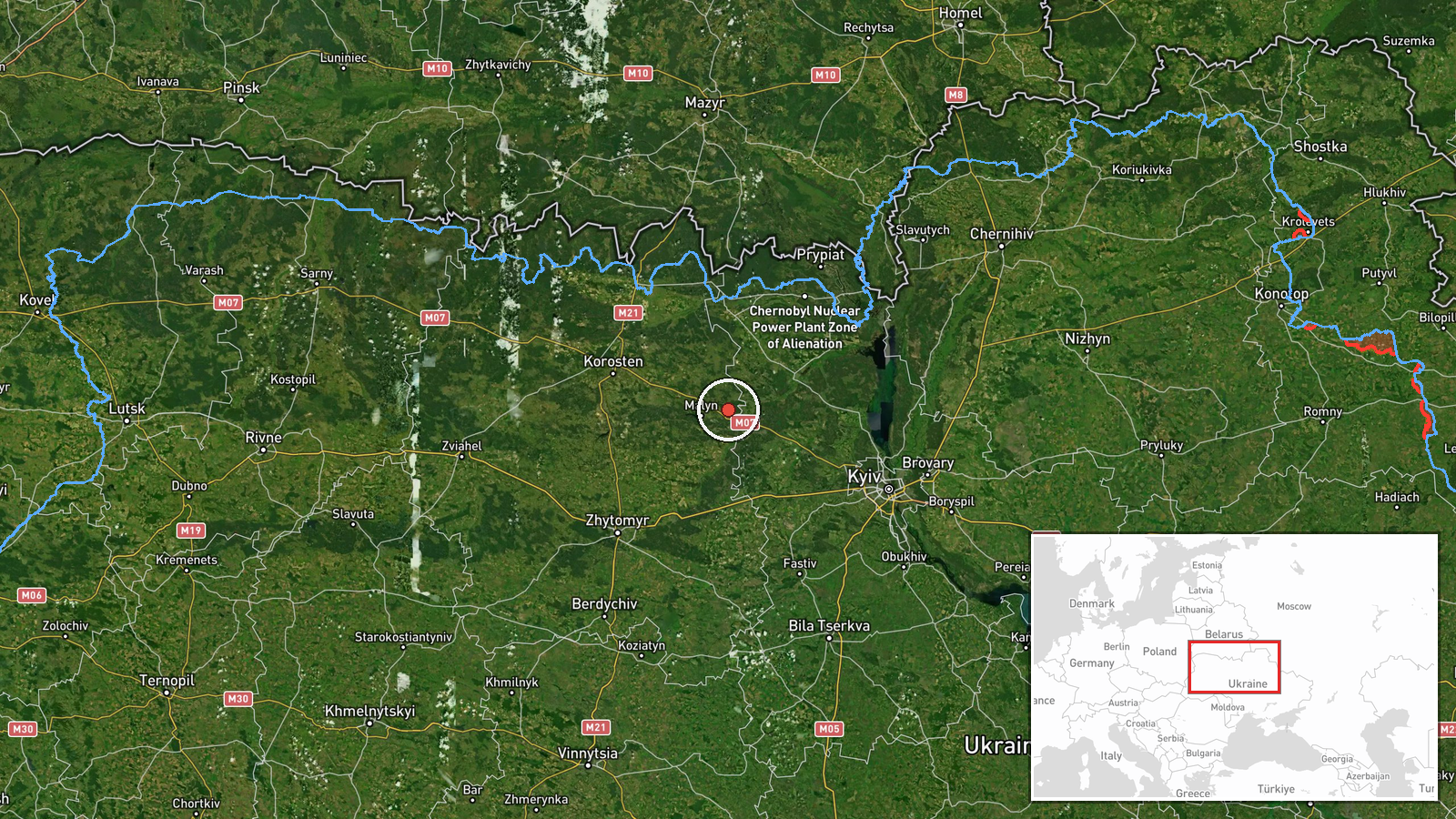
Ukrainian air monitoring detected one Russian Shahed-136 jet-powered attack drone passing over Liubychiv in Zhytomyr Oblast on a trajectory toward Kyiv on 4 October at 07:13 UTC. The drone was reported transiting the region as part of what appears to be a broader aerial operation. The report comes from Ukrainian air defense monitoring channels tracking Russian unmanned systems.
Context and assessment
This transit occurred within an escalating pattern of Russian drone and missile activity targeting the Kyiv region. Between 3 and 4 October, Ukrainian monitors documented multiple Shahed-136 transits over western Kyiv Oblast (Nalyvaykivka, Buzova, Bucha) and concurrent ballistic missile strikes on the Kyiv Reservoir area. Liubychiv sits approximately 130 kilometers west of Kyiv, positioning it along a likely ingress corridor for Russian aircraft approaching the capital from the northwest. The clustering of detected drones and missiles over consecutive hours suggests a coordinated multi-vector strike operation, though the extent of damage or interception remains unclear from available reporting.
Sources and confidence
Single source: Telegram channel @war_monitor, a Ukrainian air monitoring account. No cross-confirmation from independent sources reported. Confidence score of 6.0 reflects standard Ukrainian military reporting credibility but relies on one channel. Confirmation by additional monitoring accounts or Ukrainian official statements would strengthen confidence. Lack of post-strike damage or interception reports does not lower confidence in the transit detection itself.
Location
Liubychiv is a settlement in Zhytomyr Oblast, northwestern Ukraine, located approximately 130 kilometers west-northwest of central Kyiv. The town lies in flat terrain typical of central Ukrainian geography, with access to regional road networks. Precision is regional rather than point-specific, as air monitoring reports typically indicate general transit areas rather than exact coordinates.
Related events nearby
- One Russian reactive (jet-powered) Shahed-136 drone detected transiting past Radomyshl in Zhytomyr Oblast duri2026-10-04 07:36 UTC · Drone Transit · Radomyshl, Zhytomyr Oblast, Ukraine
- Russian reactive/jet-powered drone (Shahed-136 variant) transiting over Nalyvaykivka in Kyiv Oblast, western d2026-10-03 20:13 UTC · Drone Transit · Nalyvaykivka, Kyiv Oblast, Ukraine
- One Russian Shahed-136 reactive (jet-powered) drone detected transiting from Khoroshiv toward Korosten in Zhyt2026-10-04 07:42 UTC · Drone Transit · Korosten, Zhytomyr Oblast, Ukraine
- Russian reactive/jet-powered drone (Shahed-136 variant) transiting from Brusylov toward Buzova in Kyiv Oblast,2026-10-03 20:08 UTC · Drone Transit · Buzova, Ukraine
- One Russian reactive (jet-powered) Shahed-136 drone detected transiting from Dimер toward Kyiv during overnigh2026-10-04 07:30 UTC · Drone Transit · Dimer, Kyiv Oblast, Ukraine
▶ View this event on the live map
Intel Mapper aggregates open-source reports from monitored Telegram and X channels, geolocates them, cross-checks duplicates across sources and assigns a confidence score. Entries are updated as new confirmations arrive. Read how we verify events.