9 Russian Shahed drones tracked toward Odesa district from Black Sea
What happened
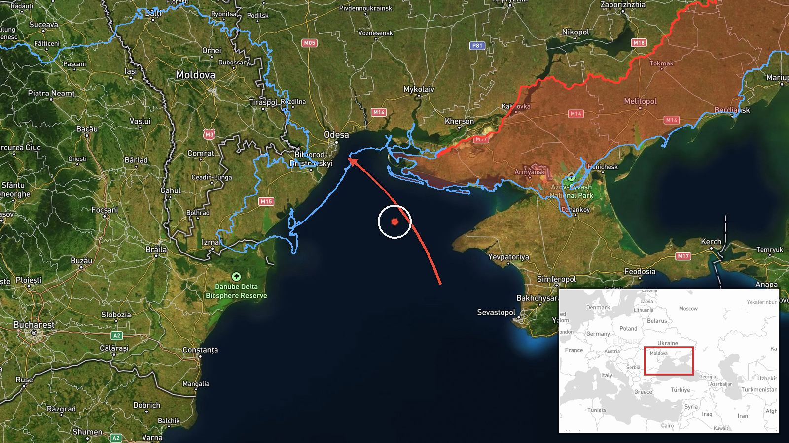
Ukrainian air monitoring reported nine Russian Shahed-type unmanned aerial vehicles transiting the Black Sea toward Odesa district on October 5 at 03:38 UTC. The drones were identified as modified Siker variants operating over open water in the direction of the Odesa district. No immediate impact assessment was included in the monitoring alert. The report comes from official Ukrainian air defense tracking.
Context and assessment
This drone transit represents the latest in a sustained campaign against Odesa region infrastructure over a 24-hour period. Related incidents on October 4 included cruise missiles launched from Crimea toward Odesa district, guided glide bombs targeting the nearby port city of Chornomors'k and coastal settlements, and strikes reported over Sanzhiika, Pivdennyi, and Mayaky. The Black Sea launch point and consistent targeting pattern suggest Russian efforts to degrade port facilities, logistics infrastructure, and civilian-military infrastructure in Ukraine's primary maritime gateway. Shahed drones are typically used for area targets and attrition strikes rather than precision impact.
Sources and confidence
Single source: Telegram channel @war_monitor, a Ukrainian air monitoring outlet. No cross-confirmation from independent sources is noted in available data. Confidence score of 6.0 reflects the single-source reporting and lack of secondary verification, though the channel's institutional position provides baseline credibility. Confirmation from Ukrainian official air defense statements or damage reports would strengthen confidence.
Location
Odesa district, located on Ukraine's southwestern Black Sea coast. The coordinates (46.49°N, 30.74°E) indicate the Odesa urban area proper. The drones were tracked in the sea approach from the south and southeast, typical route from Russian positions in occupied Crimea. The region includes critical port infrastructure at Odesa and nearby Chornomors'k.
Related events nearby
- Ukrainian air monitoring: 1 Russian guided glide bomb (UMPB) heading toward Odesa district.2026-10-04 23:25 UTC · Airstrike · Odesa district, Ukraine
- Ukrainian air monitoring: 2 Russian cruise missiles from Crimea toward Odesa district.2026-10-04 08:12 UTC · Cruise Missile · Odesa district, Ukraine
- Ukrainian air monitoring: 2 Russian guided glide bombs (UMPB) heading toward Chornomors’k; 1 Russian guided gl2026-10-04 23:30 UTC · Airstrike · Chornomors’k, Ukraine
- Ukrainian air monitoring: 2 Russian guided glide bombs (UMPB) over Sanzhiika; 1 Russian guided glide bomb (UMP2026-10-04 23:36 UTC · Airstrike · Sanzhiika, Ukraine
- Ukrainian air monitoring: 1 Russian guided glide bomb (UMPB) heading toward Mayaky.2026-10-04 23:46 UTC · Airstrike · Mayaky, Ukraine
▶ View this event on the live map
Intel Mapper aggregates open-source reports from monitored Telegram and X channels, geolocates them, cross-checks duplicates across sources and assigns a confidence score. Entries are updated as new confirmations arrive. Read how we verify events.