Ukrainian monitors detect two Russian jet-powered Shahed drones over Kremenchuk
What happened
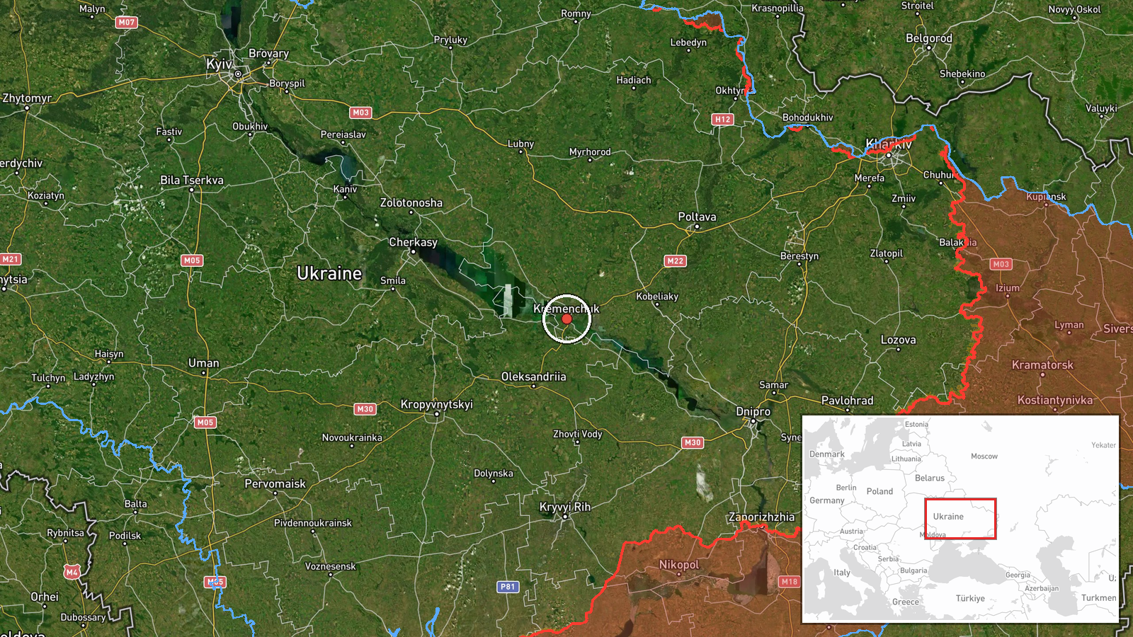
Ukrainian air monitoring channels reported detection of two Russian Shahed drones equipped with jet engines (Geran-3 variant) transiting over Kremenchuk in central Ukraine on 8 October at approximately 11:07 UTC. The drones were observed but the report does not specify their intended target or outcome. Kremenchuk, a city of roughly 200,000 on the Dnipro River, hosts significant industrial infrastructure including an oil refinery and power generation facilities.
Context and assessment
Kremenchuk remains a recurring target for Russian drone operations, reflecting its strategic value as an industrial and energy hub. The use of jet-powered Shahed variants—heavier and longer-range than earlier models—suggests Russia is deploying advanced unmanned assets to penetrate Ukrainian air defenses over defended urban areas. This detection occurred one day after a reported successful Ukrainian interception of an attack drone by a MiG-29 pilot, indicating sustained Russian drone activity and Ukrainian defensive posture. The pattern of continued strikes against central Ukrainian infrastructure suggests Russia is maintaining pressure on energy and industrial targets despite Ukrainian air defense improvements.
Sources and confidence
Report sourced solely from Telegram channel @war_monitor, a Ukrainian air-monitoring account. Single-source reporting limits independent cross-confirmation. Confidence score of 6.0 reflects the dedicated nature of the monitoring channel and specificity of the observation, but absence of corroboration from other independent sources. Satellite imagery or additional channel confirmation would strengthen confidence; absence of reported engagement or outcome creates some ambiguity.
Location
Kremenchuk, a city in central Ukraine on the Dnipro River in Poltava Oblast, located at 49.06°N, 33.40°E. The settlement-level precision reflects urban monitoring. Nearby features include the Kremenchuk oil refinery to the south and thermal power plant, making it a likely waypoint or target zone for Russian drone operations transiting inland from occupied territory.
Related events nearby
- Ukrainian MiG-29 pilot shot down a Russian attack drone. Photograph shows pilot celebrating with gesture towar2026-10-07 20:14 UTC · Drone Shootdown · Ukraine (location not reported)
▶ View this event on the live map
Intel Mapper aggregates open-source reports from monitored Telegram and X channels, geolocates them, cross-checks duplicates across sources and assigns a confidence score. Entries are updated as new confirmations arrive. Read how we verify events.