Two Russian Shahed drones reported heading toward Slavutych in northern Ukraine
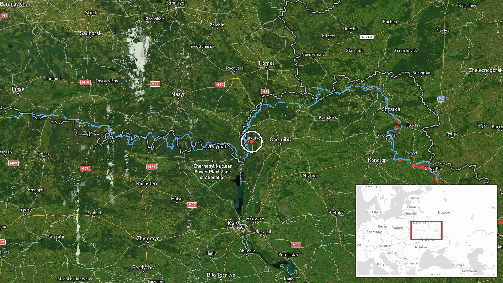
What happened
Ukrainian air monitoring channels reported two Russian jet-powered Shahed (Geran-3) drones en route to Slavutych, Chernihiv Oblast, on the morning of October 8, 2026. The report was posted to Telegram at 12:08 UTC. Shahed drones are loitering munitions capable of striking targets at range. The notification indicates detection during transit rather than confirmation of impact.
Context and assessment
Slavutych lies approximately 50 kilometers north of Kyiv near the Dnieper River and sits close to the Chornobyl Nuclear Power Station exclusion zone. The city has been periodically targeted in the conflict. This incident occurred amid a broader pattern of Russian drone operations on October 8, with Shahed units also tracked over Borodianka, Bucha, and Kyiv earlier that morning. The tempo of such transit reports suggests sustained Russian aerial reconnaissance and strike campaigns. Multiple drones moving simultaneously toward different locations may indicate coordinated strikes or reconnaissance sorties across northern Ukraine.
Sources and confidence
Single source: Telegram channel @war_monitor. The report lacks cross-confirmation from other independent monitoring channels or Ukrainian official statements as of reporting time. Confidence is moderate (6.0/10) owing to single-source attribution. Confirmation from Ukrainian air defense statements, secondary channels, or post-strike assessments would strengthen confidence. Continued monitoring of the same channel and corroboration from additional open-source channels would reduce uncertainty.
Location
Slavutych is a purpose-built city in Chernihiv Oblast, approximately 50 kilometers north-northeast of Kyiv. It was constructed to house workers from the Chornobyl Nuclear Power Station. The settlement sits on the western bank of the Dnieper River in relatively open terrain. Geographic precision is high based on named settlement identification.
Related events nearby
- Ukrainian air monitoring: 1 Russian guided glide bomb (KAB) heading toward Berylivka.2026-10-08 12:03 UTC · Airstrike · Berylivka, Ukraine
- Ukrainian President Zelenskiy claims Russia conducted missile and drone strikes on Ukraine on Putin's birthday2026-10-07 18:48 UTC · Statement · Kyiv, Kyiv Oblast, Ukraine
- Ukrainian air monitoring: 1 Russian jet-powered Shahed (Geran-3) drone over Borodianka.2026-10-08 11:18 UTC · Drone Transit · Borodianka, Ukraine
- Ukrainian air monitoring: 1 Russian jet-powered Shahed (Geran-3) drone over Bucha.2026-10-08 10:05 UTC · Drone Transit · Bucha, Ukraine
- Ukrainian air monitoring: 1 Russian jet-powered Shahed (Geran-3) drone passing Pushcha-Vodytsia, Kyiv, heading2026-10-08 09:19 UTC · Drone Transit · Vynohradar, Kyiv, Ukraine
▶ View this event on the live map
Intel Mapper aggregates open-source reports from monitored Telegram and X channels, geolocates them, cross-checks duplicates across sources and assigns a confidence score. Entries are updated as new confirmations arrive. Read how we verify events.