Ukrainian monitors track ~30 Russian Shahed drones toward Pivdennoukrainsk
What happened
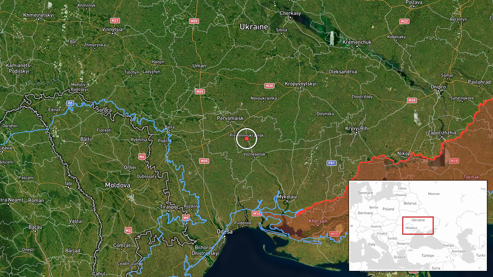
Ukrainian air monitoring channels reported approximately 30 Russian Shahed-type drones (identified as Geran-2/Gerbera-2 variants in Ukrainian terminology) in transit toward Pivdennoukrainsk and the Pervomaysk area in Mykolaiv Oblast on October 14 at 19:50 UTC. The alert was issued via Telegram channel @war_monitor, which aggregates Ukrainian air defense and civil monitoring reports. No details were provided regarding the drones' point of origin, intended targets, or outcome of any interception attempts.
Context and assessment
Pivdennoukrainsk lies in southern Mykolaiv Oblast, an area that has experienced repeated Russian drone attacks throughout the conflict, particularly targeting infrastructure and populated settlements. The scale of this reported transit—approximately 30 unmanned aircraft—aligns with Russian strike patterns documented earlier on October 14, when Ukrainian monitors tracked multiple Shahed variants and a ballistic missile threat across northern and central Ukraine. This incident follows air raid alerts issued for Kirovohrad and Mykolaiv oblasts, suggesting a coordinated or sustained campaign. The use of Shahed-2 drones indicates a saturation approach designed to overwhelm air defenses, consistent with Russian operational doctrine employed since autumn 2022.
Sources and confidence
Single source: Telegram channel @war_monitor, which curates real-time Ukrainian air monitoring data. No cross-confirmation from other channels is noted in the dataset. Confidence score of 6.0 reflects the credibility of the monitoring channel but relies on a single report with no independent verification. Confirmation from Ukrainian air force or defense ministry statements, or reports of successful interceptions, would strengthen confidence. Clarification of the drones' origin and any casualties or damage would improve assessment.
Location
Pivdennoukrainsk is a settlement in southern Mykolaiv Oblast, located approximately 80 kilometers north of the Black Sea coast and roughly 50 kilometers east of the regional capital Mykolaiv. The settlement sits in an agricultural and industrial zone; nearby Pervomaysk is a smaller adjacent community. The area is positioned in the ongoing southern theater of operations, with Russian forces operating across the Black Sea and from Crimea.
Related events nearby
- Ukrainian air monitoring: 1 Russian jet-powered Shahed (Geran-3) drone from Mykolaiv Oblast toward Voznesensk.2026-10-14 00:31 UTC · Drone Transit · Voznesensk, Ukraine
- Air raid alert issued for Kropivnytskyi and Oleksandriia sectors in central Ukraine. Civilian population advis2026-10-14 19:21 UTC · Siren · Kropivnytskyi to Oleksandriia sector, Kirovohrad O
- Ukrainian air monitoring: 1 Russian jet-powered Shahed (Geran-3) drone from Black Sea toward Mykolaiv Oblast.2026-10-14 00:34 UTC · Drone Transit · Mykolaiv Oblast, Ukraine
- Ukrainian air alert system warns of ballistic missile threat from the north. Multiple Russian Shahed drone tra2026-10-14 01:39 UTC · Siren · Ukraine (Northern Region)
▶ View this event on the live map

Intel Mapper aggregates open-source reports from monitored Telegram and X channels, geolocates them, cross-checks duplicates across sources and assigns a confidence score. Entries are updated as new confirmations arrive. Read how we verify events.