Banderol cruise missile tracked toward Pohrebyshche in Ukrainian air monitoring report
What happened
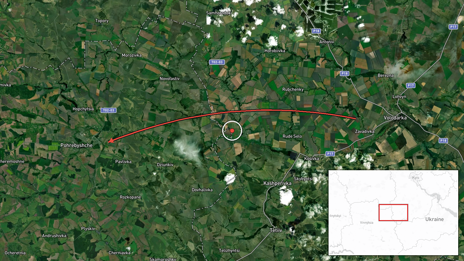
A Ukrainian air monitoring account posted on the Telegram channel @war_monitor reported one Russian Banderol mini cruise missile passing near Volodarka, with the post stating it was heading onward toward Pohrebyshche. The timestamp is 18 October 2026 at 19:10 UTC. The original Ukrainian post opens with the heading Київщина (Kyiv region) before naming Pohrebyshche, in Vinnytsia oblast, as the next point on the track. The report describes a flight track, not an impact. It says nothing about detonation, damage, casualties, or interception. Related entries from the same day place a jet-powered Shahed-type drone over Pohrebyshche earlier and a second Banderol heading toward Kalynivka shortly after, which suggests a sequence of tracked objects rather than a single isolated launch.
Context and assessment
Pohrebyshche sits in the Vinnytsia region of central Ukraine, a corridor that Russian long-range and low-cost strike systems have crossed repeatedly on routes toward western and central targets. The Banderol is a small, low-flying cruise missile. Its appeal to an attacker lies in its low cost, modest radar signature, and ability to fly low through terrain that complicates detection and interception. Monitoring entries earlier on 18 October describe jet-powered Shahed-type drones, designated Geran-3, over Pohrebyshche and heading toward Kozyatyn, beginning at 05:24 UTC, before the cruise missile tracks appeared. Taken together, the pattern points to a multi-system series in which drones and missiles are tracked over overlapping corridors. Operationally, repeated transits through the same settlements may indicate routing toward infrastructure or logistics nodes in the region, or may simply reflect the geometry of launch and flight paths. The entries alone do not establish which. Air defence and monitoring units often relay track headings in sequence, so a single heading should not be read as a confirmed target.
Sources and confidence
Only one channel, Telegram @war_monitor, carries this report, so cross-confirmation is currently absent. The score of 6.0 reflects a plausible Ukrainian air monitoring format and a consistent run of related entries that day, offset by the single-source basis and the fact that the post describes a heading rather than an observed impact. Confidence would rise with matching Ukrainian Air Force or regional administration reports, or with independent monitor tracks at similar times. It would fall if corrections altered the missile type, heading, or timing.
Location
The coordinates correspond to Pohrebyshche, a town in Vinnytsia oblast, placed at settlement precision. The location confidence is recorded as high, but the point is a town centroid rather than a specific site, and the event refers to a track heading toward the town rather than an impact there. The setting is rolling farmland and river valleys in central Ukraine, with the Kyiv oblast border lying to the north and east. Other settlements named in related reports sit within the same broad region.
Related events nearby
- Ukrainian air monitoring: 1 Russian jet-powered Shahed (Geran-3) drone over Pohrebyshche.2026-10-18 08:53 UTC · Drone Transit · Pohrebyshche, Ukraine
- Ukrainian air monitoring: 1 Russian jet-powered Shahed (Geran-3) drone heading toward Kozyatyn.2026-10-18 08:54 UTC · Drone Transit · Kozyatyn, Ukraine
- Ukrainian air monitoring: 1 Russian jet-powered Shahed (Geran-3) drone heading toward Kozyatyn.2026-10-18 05:24 UTC · Drone Transit · Kozyatyn, Ukraine
- Ukrainian air monitoring: 1 Russian Banderol mini cruise missile heading toward Volodarka.2026-10-18 19:02 UTC · Cruise Missile · Volodarka, Ukraine
- Ukrainian air monitoring: 1 Russian Banderol mini cruise missile heading toward Kalynivka.2026-10-18 19:18 UTC · Cruise Missile · Kalynivka, Ukraine
▶ View this event on the live map

Intel Mapper aggregates open-source reports from monitored Telegram and X channels, geolocates them, cross-checks duplicates across sources and assigns a confidence score. Entries are updated as new confirmations arrive. Read how we verify events.