PDF reportedly used FPV kamikaze drones against Myanmar military positions in Kachin State
What happened
A Telegram channel, @war_noir, posted a report that People's Defense Forces fighters in Kachin State, northern Myanmar, used numerous FPV kamikaze drones to attack Burmese military positions. The post, dated 18 October 2026 in UTC, describes the drones as seeming to be armed with improvised explosive devices. The wording is tentative, so the IED claim rests on the poster's visual assessment rather than on confirmed details. The post was shared on X and links to that account's status. The report does not name specific positions, give a count of strikes, or describe outcomes. The channel's own description of the drones as seeming to carry IEDs should be read as an observation, not a verified finding.
Context and assessment
Kachin State is the northernmost state of Myanmar, bordering China and India, and it has been a major theatre of conflict since the military seized power in February 2021. Armed groups including the Kachin Independence Army have long held territory there, and resistance forces formed after the coup, including People's Defense Forces aligned with the National Unity Government, have operated in the region alongside them. Low-cost FPV drones have spread quickly among non-state forces in recent years, and their use by Myanmar resistance groups fits a broader pattern in which small units adopt commercially sourced airframes and improvised warheads to strike fixed positions. Operationally, such use may suggest an effort to offset the military's advantages in artillery and airpower, though a single report cannot show whether the attacks were sustained, coordinated or effective. The database contains no related events for this item, so no trend can be drawn from linked incidents, and any assessment of frequency or targeting pattern would require further reporting.
Sources and confidence
The item rests on a single Telegram channel, @war_noir, which the post also linked on X. No independent outlet, local media organisation or official statement in the event data confirms the attack, the location or the use of explosives. Confidence is scored at 6.7 because the report is specific about weapon type and actor but comes from one unverified source with no corroborating material. Confidence would rise with geolocated or time-stamped video, imagery matching the claimed position, or confirmation from local monitoring groups or established Myanmar conflict reporters. It would fall if the footage were traced to earlier incidents or to a different theatre, or if the IED claim could not be supported.
Location
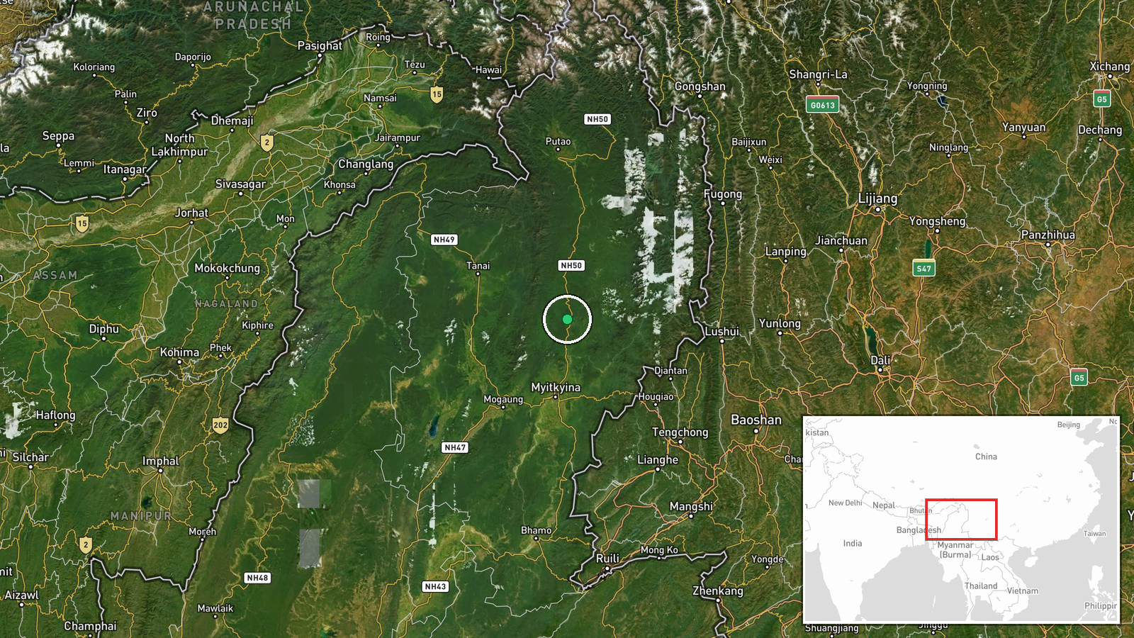
The location is recorded only as Kachin State at region level, with coordinates of 26.0 north and 97.5 east, which represent an approximate point within the state rather than a settlement or facility. The true site of the reported attack is therefore unknown beyond the state boundary. Kachin is mountainous and heavily forested, with dense jungle, river valleys and the Irrawaddy headwaters in the north, and its road links are limited, which shapes both military movement and the terrain where drones would be launched and flown. Towns such as Myitkyina and Bhamo lie in the wider state, but the event data does not connect the report to any of them.
▶ View this event on the live map

Intel Mapper aggregates open-source reports from monitored Telegram and X channels, geolocates them, cross-checks duplicates across sources and assigns a confidence score. Entries are updated as new confirmations arrive. Read how we verify events.