Israeli warplanes strike town of Mansouri in southern Lebanon
What happened
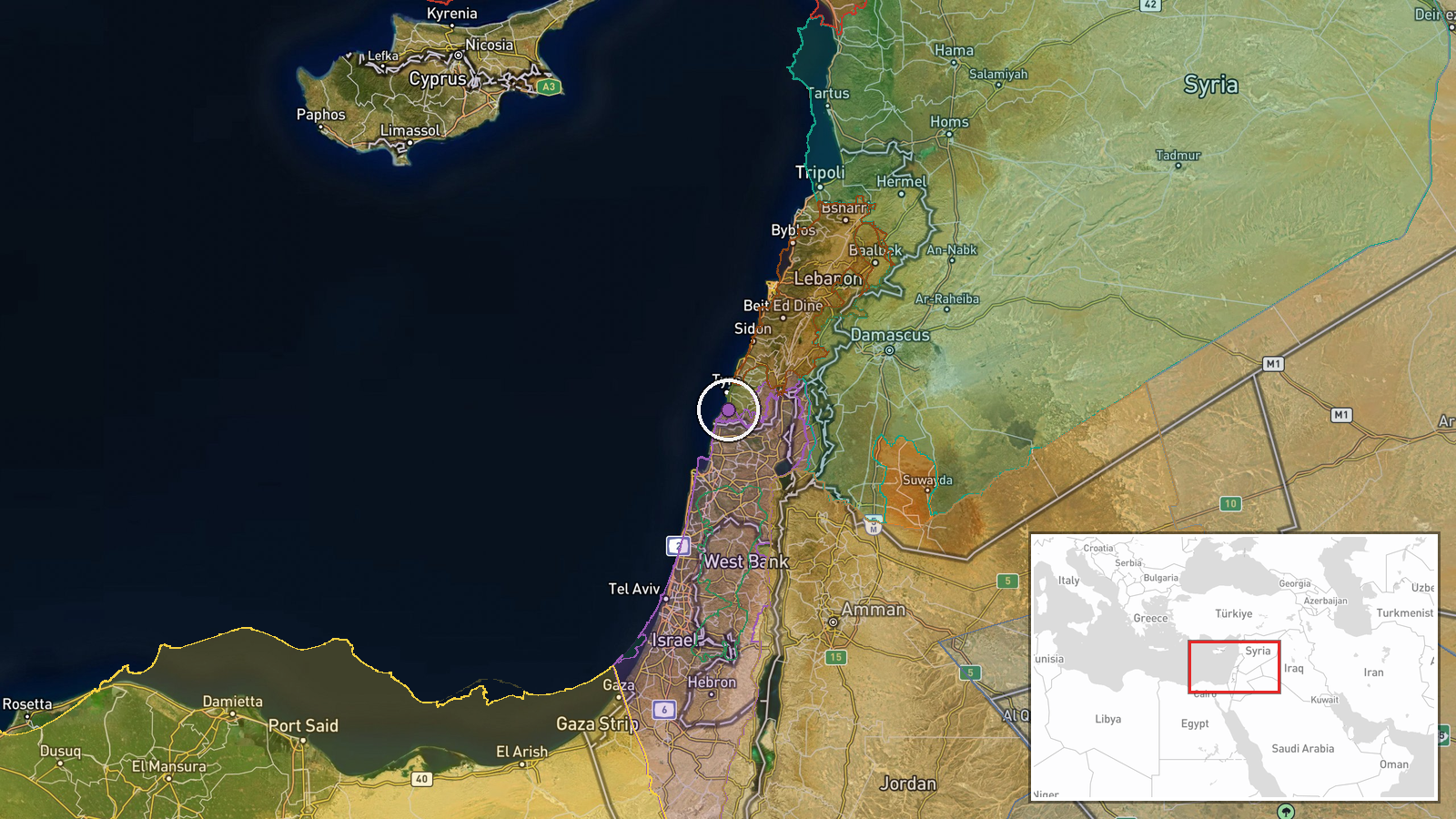
Israeli warplanes conducted an airstrike on the town of Mansouri in southern Lebanon on 17 September at approximately 14:07 UTC, according to an Al-Mayadeen correspondent reporting via the Telegram channel @warmonitors. The report provides limited detail on the strike itself, including no immediate information on targets, damage, or casualties. Mansouri is located in Lebanon's southern region, an area that has experienced sustained Israeli military activity in recent days.
Context and assessment
Mansouri lies in southern Lebanon, a border region that has been subject to intensifying Israeli air operations over the past 24 hours. This strike follows another reported airstrike on southern Lebanon on 16 September and occurs amid a broader pattern of Israeli military activity across the Levant. Related operations include artillery strikes on Syrian targets in Rif Dimashq on 16 September and documented Israeli military convoys in western Daraa countryside on 17 September, suggesting coordinated or concurrent operations across multiple theaters. The timing aligns with stated Israeli operational activity in the Syrian sector, though the specific targeting rationale for Mansouri remains unclear from available reporting.
Sources and confidence
Single source: Telegram channel @warmonitors reporting an Al-Mayadeen correspondent account. No cross-confirmation from independent outlets or Israeli military statements is currently available. Confidence score of 6.0 reflects the specificity of location naming and timestamp but limited corroboration. Confirmation from additional news outlets or visual documentation would raise confidence; absence of follow-up reporting or clarification on targets would lower it.
Location
Mansouri is a town in southern Lebanon situated at approximately 33.17°N, 35.21°E. The settlement is located in the southern border region near the Israel-Lebanon frontier. Geographic precision is assessed as high based on named settlement identification, placing the strike in an area of recent military activity along the volatile southern border zone.
Related events nearby
- Israeli airstrikes conducted on southern Lebanon. Details limited; source references video link (inaccessible 2026-09-16 23:20 UTC · Airstrike · Southern Lebanon, Lebanon
- Israeli military reduces reserve forces from Carmeli Brigade ahead of ~110-day operational mission in Syrian s2026-09-17 10:40 UTC · Deployment · Quneitra, Syria
- Israeli forces conducted artillery strikes on the outskirts of Bayt Jan in western Rif Dimashq (Damascus Count2026-09-16 17:51 UTC · Artillery · Bayt Jan, Rif Dimashq, Syria
- Video documentation shows Israeli military convoy of 7 vehicles operating in western Daraa countryside, Syria.2026-09-17 07:09 UTC · Deployment · Western Daraa Countryside, Daraa, Syria
- Lebanese PM Nawaf Salam announces a plan to facilitate Syrian refugee returns in coordination with the Syrian 2026-09-16 18:29 UTC · Statement · Beirut, Lebanon
▶ View this event on the live map
Intel Mapper aggregates open-source reports from monitored Telegram and X channels, geolocates them, cross-checks duplicates across sources and assigns a confidence score. Entries are updated as new confirmations arrive. Read how we verify events.