Israeli aircraft strike southern Lebanese town of Nabatieh al-Fawqa
What happened
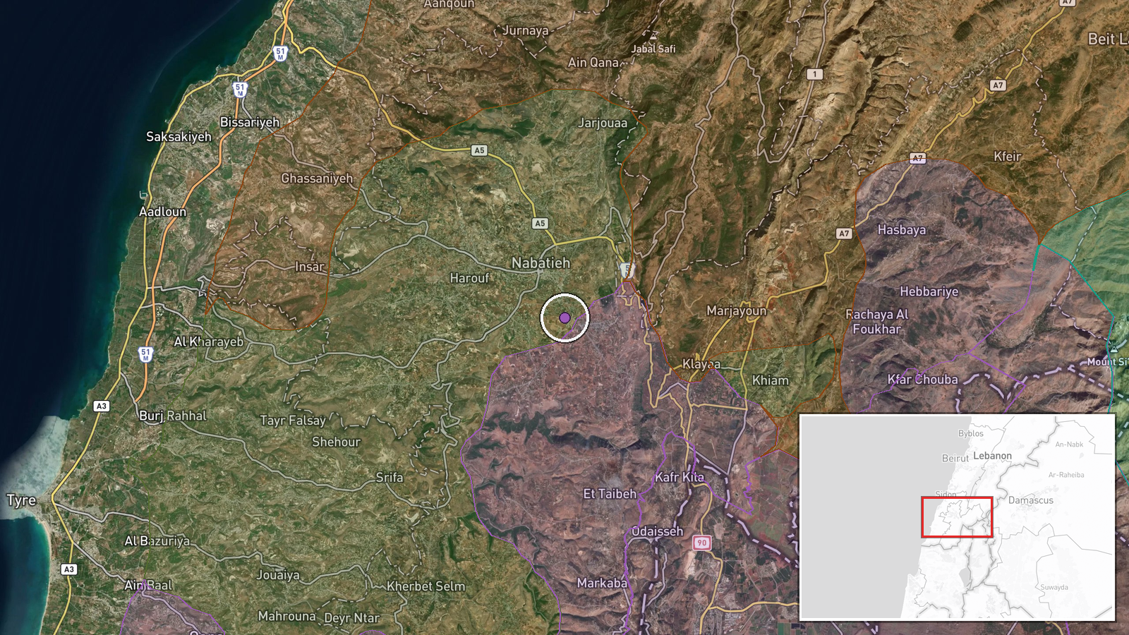
Israeli aircraft reportedly conducted four airstrikes against the town of Nabatieh al-Fawqa in Lebanon's South Governorate on September 19. The report was carried by Al-Mayadeen's correspondent in the region via Telegram. The strikes targeted the populated town located approximately 12 kilometers inland from the Mediterranean coast. No immediate casualty figures or damage assessments were provided in the available reporting.
Context and assessment
Nabatieh al-Fawqa lies in southern Lebanon, a region that has seen escalating Israeli military operations in recent months as tensions with Hezbollah intensify. The strike fits a broader pattern of Israeli air and artillery activity across the Lebanese-Syrian border zone, as evidenced by concurrent Israeli shelling operations in rural Damascus governorate on September 18. The town's location in the South Governorate, traditionally a Hezbollah stronghold, suggests the strikes may target militant infrastructure or personnel. The timing and frequency of such operations may indicate Israeli efforts to degrade capabilities or deter cross-border activity, though this cannot be confirmed from available reporting.
Sources and confidence
Single source: Al-Mayadeen correspondent reporting via Telegram (@warmonitors). Confidence score of 6.0 reflects reliance on a single channel without independent cross-confirmation. Score would increase with corroboration from additional news agencies or Israeli military statements; would decrease if subsequent reporting contradicts casualty or target claims.
Location
Nabatieh al-Fawqa is located in Lebanon's South Governorate at coordinates 33.35°N, 35.49°E, approximately 12 kilometers inland from the Mediterranean coast and roughly 15 kilometers north of the Israeli border. The town sits in the Nabatieh District, a predominantly populated rural area. Exact coordinates indicate precise geographic identification rather than approximate targeting area.
Related events nearby
- IDF reports two soldiers sustained minor injuries from an IED explosion in the southern Lebanese security zone2026-09-19 12:05 UTC · Security · Marjayoun, South Lebanon
- Israeli forces conducted artillery shelling on Bat al-Warda hill adjacent to Bayt Jinn in western rural Damasc2026-09-18 18:16 UTC · Artillery · Bat al-Warda Hill, Kisweh, Rif Dimashq, Syria
- One youth killed, another wounded by unexploded ordnance detonation at a nursing school in Daraya, Rif Dimashq2026-09-18 14:56 UTC · Explosion · Nursing School, Daraya, Rif Dimashq, Syria
- HTS Interior Security arrested Walid al-Fallah, a leading figure in a cell responsible for the killing of 3 HT2026-09-19 05:50 UTC · Security · Sanamein, Daraa Governorate, Syria
- IDF patrol detained a shepherd in Houran Basin, western Daraa countryside, during incursion. Detainee was rele2026-09-19 06:54 UTC · Security · Houran Basin, Daraa Governorate, Syria
▶ View this event on the live map
Intel Mapper aggregates open-source reports from monitored Telegram and X channels, geolocates them, cross-checks duplicates across sources and assigns a confidence score. Entries are updated as new confirmations arrive. Read how we verify events.