Massive explosion reported in Mays Al Jabal, South Lebanon; cause unclear
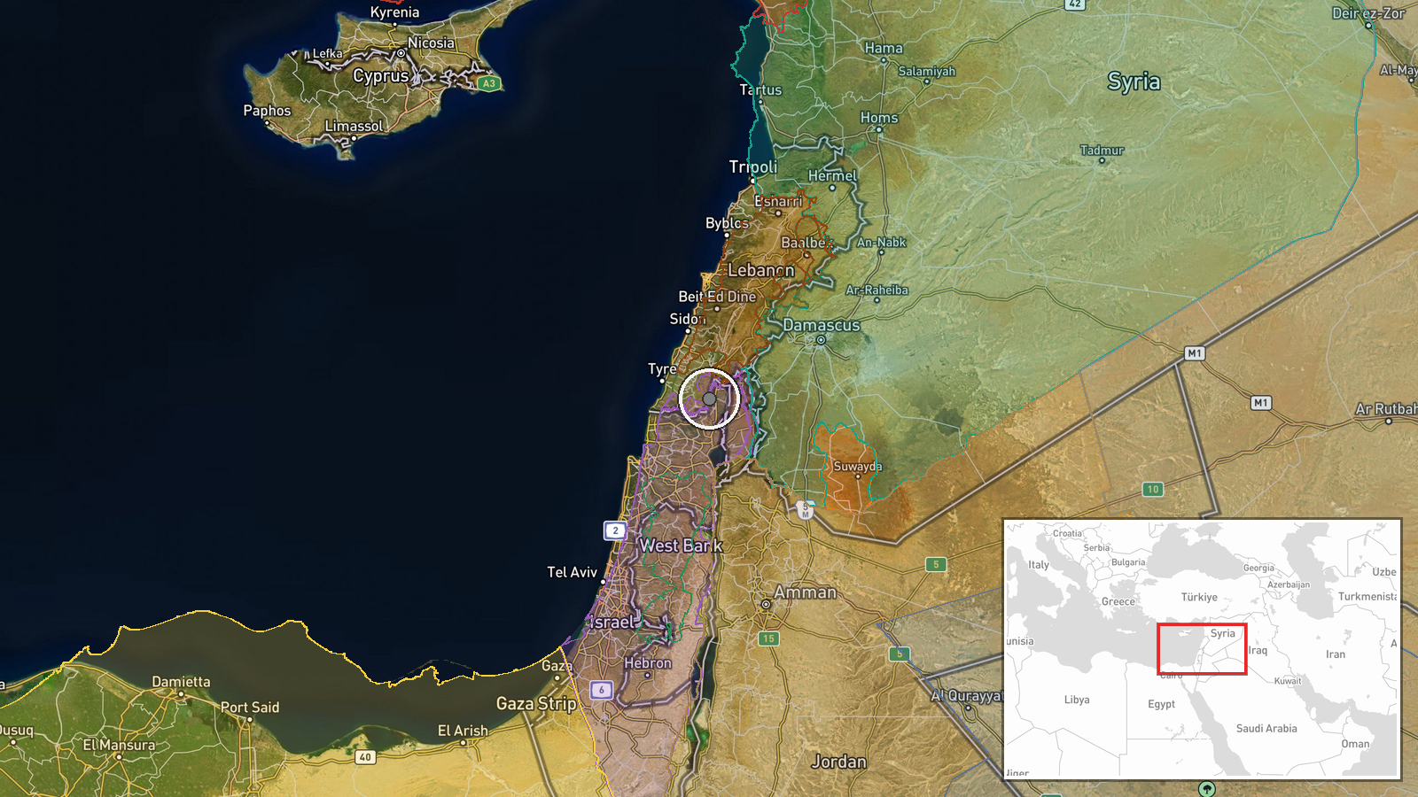
What happened
A significant explosion was reported in Mays Al Jabal, a settlement in South Lebanon, on October 2 at approximately 14:20 UTC. The initial report, sourced from Telegram channel @warmonitors, does not specify the origin of the blast or provide details on casualties or structural damage. The announcement was brief and noted only the occurrence and location of the explosion.
Context and assessment
Mays Al Jabal lies in South Lebanon, a region experiencing heightened instability amid broader regional tensions. The same day saw a separate explosion reported in nearby Al-Mansouri town, also in South Lebanon, suggesting a pattern of incidents in the area. Recent days have witnessed Israeli military operations across the Syria-Lebanon border region, including artillery strikes near Quneitra and ground incursions, though the direct connection between these operations and the Lebanese explosions remains unconfirmed. South Lebanon's proximity to the Syria-Lebanon border and the region's complex security dynamics make it sensitive to cross-border activity.
Sources and confidence
Single source: Telegram channel @warmonitors. No cross-confirmation from other open-source channels or independent verification reported. The confidence score of 6.0 reflects the single-source reporting and absence of corroborating details about cause, scale, or casualties. Verification from additional regional monitors or official Lebanese statements would strengthen confidence significantly.
Location
Mays Al Jabal is a populated settlement in South Lebanon, located at approximately 33.17°N, 35.52°E. The settlement sits in the hilly terrain of South Lebanon near the Israeli-Lebanese border region. Geographic precision is classified as settlement-level, with high confidence in the location identification based on available coordinates.
Related events nearby
- Massive explosion reported in Al-Mansouri town in South Lebanon. Cause and casualties not yet confirmed from t2026-10-02 10:28 UTC · Explosion · Al-Mansouri, South Lebanon
- Israeli occupation forces conducted heavy artillery bombardment on the edges of Mantra Dam in central Quneitra2026-10-01 21:34 UTC · Artillery · Mantra Dam, Quneitra Countryside, Syria
- Israeli occupation forces conducted a raid on Al-Humaidiyah village in Quneitra countryside, detaining at leas2026-10-01 20:11 UTC · Security · Al-Humaidiyah, Quneitra Countryside, Syria
- Israeli forces allegedly abducted a young man from his home during an incursion into Maaria village in the Yar2026-10-02 09:26 UTC · Security · Maaria, Quneitra Governorate, Syria
- Lebanese Army intercepted smugglers transporting ~245 kg TNT explosive material, 4 detonators, and electrical 2026-10-01 16:19 UTC · Security · Syria-Lebanon Border, Bekaa Valley
▶ View this event on the live map
Intel Mapper aggregates open-source reports from monitored Telegram and X channels, geolocates them, cross-checks duplicates across sources and assigns a confidence score. Entries are updated as new confirmations arrive. Read how we verify events.