Drones strike two commercial vessels in Bulgaria's Black Sea economic zone
What happened
Two commercial ships were struck by drones in Bulgaria's Black Sea exclusive economic zone on October 6, according to Bulgarian President Rumen Radev. The exact source of the unmanned aircraft, specific damage to the vessels, and their identities remain unconfirmed. The incident was reported via Telegram but has not yet been independently verified or detailed by Bulgarian maritime or defense authorities.
Context and assessment
The Black Sea has seen sustained drone and missile activity since 2022, with both Russian and Ukrainian forces employing unmanned systems against maritime targets and infrastructure. Bulgaria's economic zone, extending 200 nautical miles from the coast, encompasses major shipping routes and commercial activity. Strikes on merchant vessels in this area typically reflect efforts to disrupt regional trade or demonstrate maritime reach. The lack of attribution and sparse initial reporting suggests investigation is ongoing; confirmation of damage assessment and vessel details would clarify operational intent and capability.
Sources and confidence
Report originated from Telegram channel @warmonitors on October 6. Single source with no cross-confirmation from Bulgarian state media, naval authorities, or independent maritime monitors at time of reporting. Confidence score of 6.0 reflects unverified claim and lack of corroboration. Score would increase with official Bulgarian government statement, vessel damage documentation, or reports from additional independent sources.
Location
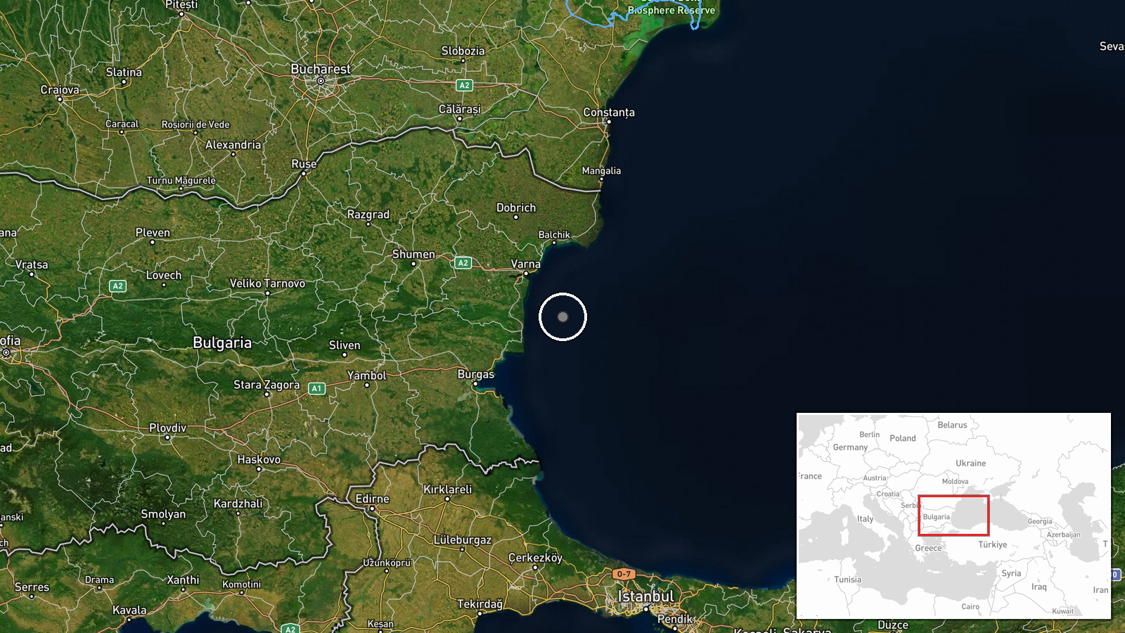
The strike coordinates place the incident in Bulgaria's Black Sea economic zone, approximately 40–80 nautical miles offshore depending on vessel position. This area lies northwest of the Bosphorus strait and forms part of the broader Black Sea maritime corridor used by commercial traffic. Precise location determination relies on reported presidential statement rather than confirmed vessel positions.
▶ View this event on the live map
Intel Mapper aggregates open-source reports from monitored Telegram and X channels, geolocates them, cross-checks duplicates across sources and assigns a confidence score. Entries are updated as new confirmations arrive. Read how we verify events.