U.S. military intercepts Panamanian-flagged vessel attempting to breach Iran blockade
What happened
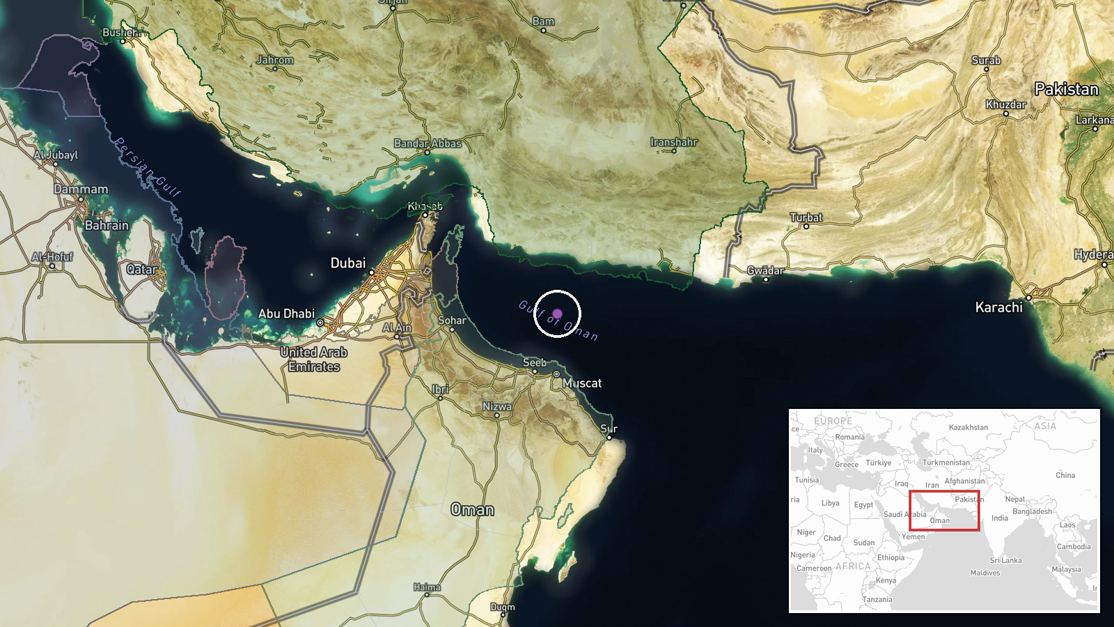
The U.S. military reportedly intercepted a commercial ship flying a Panamanian flag in the Gulf of Oman on October 11, 2026. According to the account, the vessel's crew ignored repeated warnings before attempting to break the maritime blockade of Iran. The interception was completed without reported harm to crew members. The operation reflects ongoing U.S. naval enforcement of sanctions-related restrictions in the region.
Context and assessment
The Gulf of Oman is a critical chokepoint for Middle Eastern shipping and a frequent site of U.S. naval operations maintaining economic pressure on Iran through maritime interdiction. Commercial vessels, particularly those flagged to smaller maritime nations, are sometimes used to circumvent blockades through transshipment or sanctions evasion. This interception suggests either deliberate sanctions circumvention or a logistical attempt to supply Iran despite U.S. restrictions. The incident is consistent with the pattern of U.S. Coast Guard and Navy presence enforcing regional maritime controls, though the specific operational context and cargo remain unclear from available reporting.
Sources and confidence
Reported solely through Telegram channel @warmonitors on October 11, 2026. No corroborating independent confirmation or official U.S. Department of Defense statement is cited. The confidence score of 6.3 reflects single-source reporting and regional location imprecision. Confirmation by official U.S. military statements or additional maritime tracking sources would substantially strengthen assessment.
Location
Gulf of Oman, between Iran and the Oman coast. Coordinates approximate to the central waterway (24.6°N, 58.6°E). The region precision reflects the broad reporting; exact interception coordinates were not specified. The Gulf of Oman connects the Persian Gulf to the Arabian Sea and Indian Ocean.
▶ View this event on the live map

Intel Mapper aggregates open-source reports from monitored Telegram and X channels, geolocates them, cross-checks duplicates across sources and assigns a confidence score. Entries are updated as new confirmations arrive. Read how we verify events.