Houthis expand control by 41 km² in Sa'dah Governorate
What happened
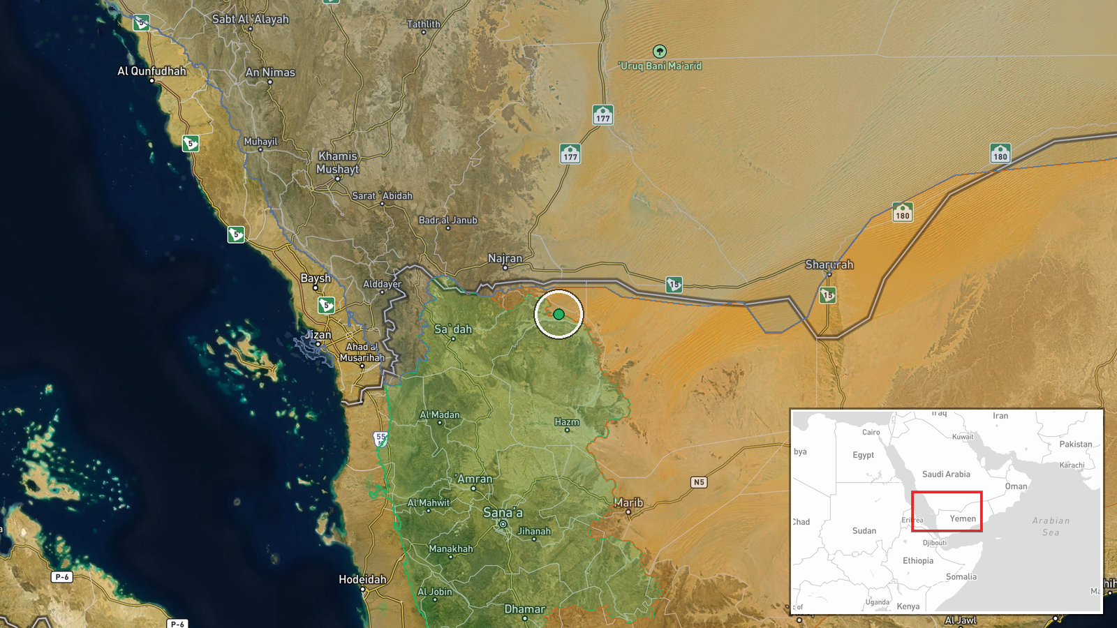
According to conflict control mapping data, Houthi (Ansar Allah) forces expanded their territorial control in Sa'dah Governorate by approximately 41 square kilometers as of October 6, 2026. The expansion was documented through updated conflict mapping sources tracking factional control lines in Yemen's northwestern region. Sa'dah has long served as a stronghold for Houthi operations and remains strategically significant in Yemen's ongoing civil conflict.
Context and assessment
Sa'dah Governorate represents core Houthi territory in northwestern Yemen and has been a center of Houthi power since the movement's emergence in the 1990s. Territorial expansion in this region may indicate consolidation of existing positions or advancement against rival factions rather than major shifts in the broader conflict geography. The reported expansion follows a Saudi Arabian airstrike targeting a ballistic missile depot in Houthi-controlled territory on the same date, suggesting concurrent military operations by multiple parties. Such localized territorial gains in established stronghold areas often reflect tactical repositioning or administrative boundary adjustments rather than strategic breakthroughs, though they may signal operational momentum in specific subregional contests.
Sources and confidence
The expansion was reported by Wiki conflict control map based on updated territorial analysis. Confidence is moderate (7.5/10) due to reliance on a single mapping source without independent corroboration from news agencies or military statements. Confirmation from additional independent mapping projects or statements from Houthi or opposing forces would strengthen confidence. Satellite imagery analysis or cross-referenced reports would reduce ambiguity around the expansion's timing and precise nature.
Location
Sa'dah Governorate is located in northwestern Yemen, approximately 240 kilometers north of the capital Sana'a. The governorate sits near the Saudi Arabian border and encompasses rugged mountainous terrain. Precision is regional rather than site-specific; the 41 km² expansion area is not pinpointed to a particular settlement or facility but represents adjusted control mapping across the governorate's territory.
Related events nearby
- Saudi Arabian fighter jets struck a ballistic missile depot operated by Houthi forces in Yemen. The specific t2026-10-06 00:03 UTC · Airstrike · Yemen (Houthi-controlled territory)
▶ View this event on the live map
Intel Mapper aggregates open-source reports from monitored Telegram and X channels, geolocates them, cross-checks duplicates across sources and assigns a confidence score. Entries are updated as new confirmations arrive. Read how we verify events.