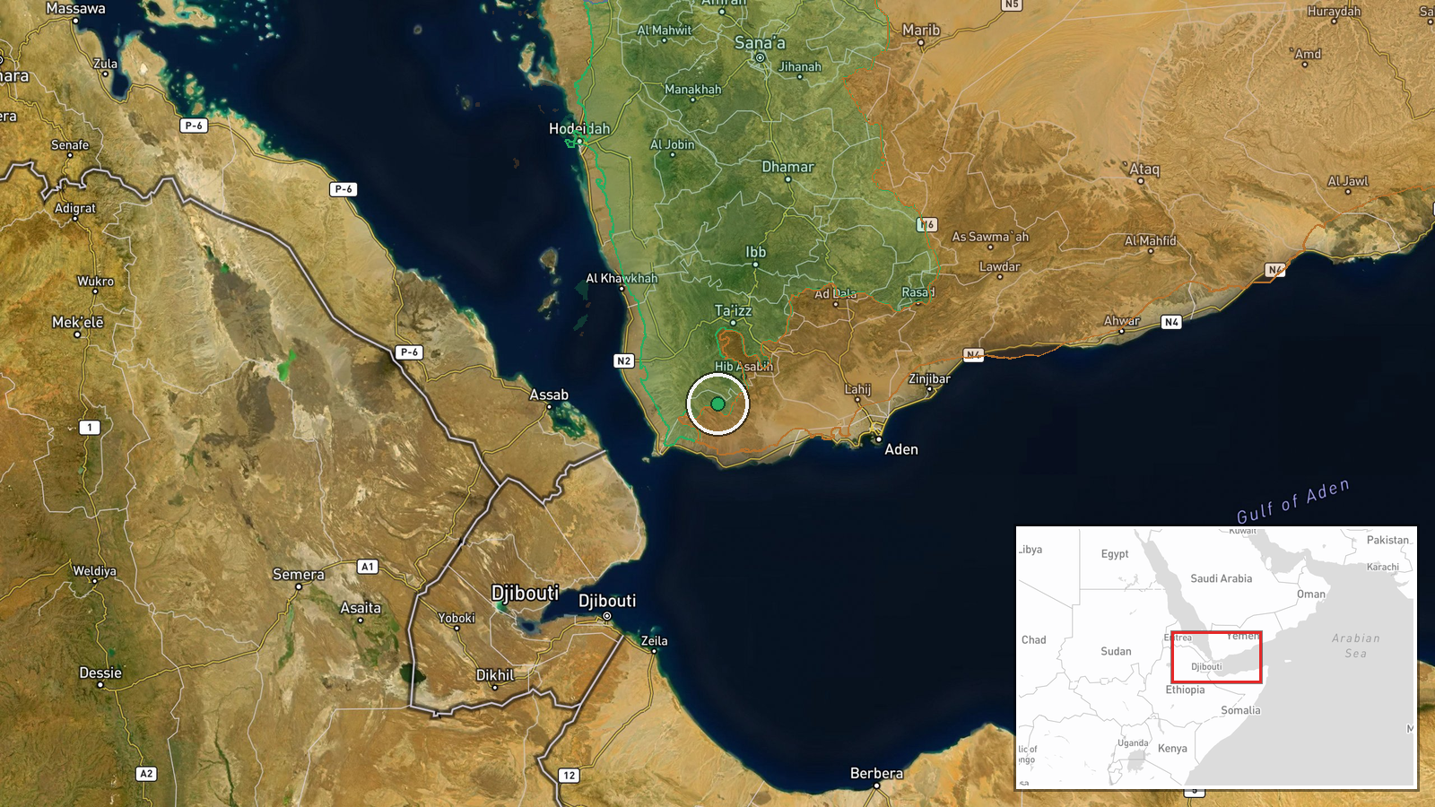
Conflict control map shows Houthi forces expanding to about 445 km² in Lahij Governorate, Yemen
What happened
A conflict-control map update records Houthi (Ansar Allah) forces expanding their control across roughly 445 square kilometres in the Lahij Governorate area of southwestern Yemen, with the entry dated 19 October 2026 at 05:44 UTC. The report is a cartographic update rather than an account of a single engagement, so it does not name specific clashes, dates of advance, or individual positions taken. The event record classifies the item as combat activity and attributes it to the Houthis. No casualty figures are given. The source wording describes forces that have expanded control in the governorate area, and the record is not marked as corrected. Reporting from the previous day, covered in the related events, describes fighting on other fronts in the same wider contest.
Context and assessment
Lahij lies in the southwestern highlands of Yemen, north of Aden and bordering Ta'izz, Al Dhale and Abyan. Its terrain of wadis, plateaus and mountain passes makes it a corridor between the Houthi-held north and the government-aligned south, and control of it bears on routes toward Aden and the Red Sea coast. The related events point to a broader pattern of contested activity across this region. On 18 October, a Yemeni Armed Forces spokesman reportedly claimed 370 Houthi fighters were neutralized and more than 1,300 strikes were carried out against militia positions, vehicles and fortifications near Al Qihfah in Ta'izz. These are official claims that independent reporting has not confirmed. The same day, Southern Giants forces, reportedly with Arab Coalition support, seized Khazzan Hill and nearby camps at Bab al-Mandab, with dozens of Houthis reportedly killed. Taken together, these reports suggest a campaign in which both air and ground pressure are being applied at the edges of Houthi-held territory. A cartographic gain in Lahij could reflect an actual shift on the ground, but control maps often lag behind events and can aggregate claims made at different times, so the figure should be read as an estimate of contested territory rather than a confirmed frontline.
Sources and confidence
The item comes from a single channel, a wiki-based conflict control map, with no linked sources listed and a source count of one. The confidence score of 7.5 reflects that single-channel basis: the location and actor attribution are clear, but no independent outlet has been identified to confirm the 445 square kilometre figure or the timing of the change. Confidence would rise with reporting from wire services, local Yemeni outlets or analysts that gives named positions, dates or satellite imagery supporting the change. It would fall if the map were revised, reverted or contradicted by reporting from Lahij or Ta'izz.
Location
The coordinates mark the approximate centre of Lahij Governorate, not a settlement or facility, and the location is recorded at region-level precision. Lahij is largely mountainous and agricultural, with terraced slopes, seasonal wadis and highland plateaus. Aden lies to its south, Ta'izz to its northwest, and the Bab al-Mandab strait is farther to the southwest. Because the pin is a broad area marker, the event should not be read as pinpointing any particular town or front line.
Related events nearby
- Yemeni Armed Forces spokesman claims 370 Houthi fighters neutralized and 1,326 precision strikes on militia po2026-10-18 13:36 UTC · UAS Strike · Near Al Qihfah, Ta'izz, Yemen (front line, estimat
- Southern Giants forces, with Arab Coalition support, seized Khazzan Hill and nearby Houthi camps at Bab al-Man2026-10-18 15:10 UTC · Capture · Khazzan Hill, Bab al-Mandab, Yemen
- Yemen's Interior Minister alleges Houthis are infiltrating their members among displaced civilians fleeing con2026-10-18 13:27 UTC · Statement · Aden, Yemen
▶ View this event on the live map

Intel Mapper aggregates open-source reports from monitored Telegram and X channels, geolocates them, cross-checks duplicates across sources and assigns a confidence score. Entries are updated as new confirmations arrive. Read how we verify events.