Israeli warplanes strike Nabatieh region in southern Lebanon
What happened
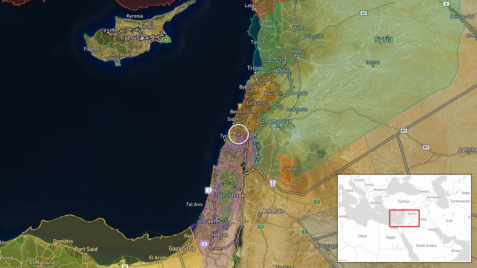
Israeli warplanes conducted airstrikes on Lebanese territory in the Nabatieh region of South Governorate on September 6, 2026, at approximately 17:23 UTC. The report originated from the X account @ConflictTR and provides limited detail on specific targets or damage assessment. This strike follows an earlier drone strike on Nabatieh city reported the same day at 15:11 UTC, indicating a sustained air campaign in the same area.
Context and assessment
Nabatieh, located in southern Lebanon near the Israeli border, has been a focal point of Israeli operations during the broader regional escalation. The town sits within traditional areas of Israeli military operations and falls along the stated security perimeter Israel has indicated it plans to establish in southern Lebanon. The successive airstrikes on Nabatieh within hours of each other suggest a concentrated campaign against specific targets in the region, possibly related to infrastructure or military positions. This activity coincides with reported Israeli force repositioning in southern Lebanon, where Israeli military stated it is reducing presence after tunnel destruction operations near Ali al-Tahir. The temporal clustering of strikes indicates operational tempo remains high despite stated force reductions.
Sources and confidence
Reported by X account @ConflictTR, a conflict monitoring channel. Single-source confirmation limits confidence to 6.0. Cross-verification from other regional correspondents or official statements would strengthen confidence. A related drone strike in the same location earlier on September 6 provides partial corroboration of Israeli activity in the area, though it does not independently verify this specific airstrike. Additional reporting from Lebanese authorities or international media would significantly raise confidence.
Location
Nabatieh, South Governorate, Lebanon, approximately 33.38°N, 35.48°E. The settlement lies in southern Lebanon roughly 10 kilometers north of the Israeli border and represents a significant population center in the region. Geographic precision is designated as 'region' due to the absence of specific target identification; the coordinates indicate the town center rather than a precise strike location.
Related events nearby
- Israeli airstrike struck Nabatieh, Lebanon. Lebanese reporter injured during live broadcast coverage; stable c2026-09-07 12:12 UTC · Airstrike · Nabatieh, South Governorate, Lebanon
- Israeli airstrikes struck a three-story residential building and civilian vehicle in Kfar Raman, southern Leba2026-09-07 06:07 UTC · Airstrike · Kafr Ruman, Nabatieh Governorate, Lebanon
- Israeli artillery and gunfire targeted Quneitra Countryside in southern Syria amid escalating military tension2026-09-06 20:13 UTC · Artillery · Quneitra Countryside, Quneitra Governorate, Syria
- Families of detainees held in Israeli prisons from Daraa, Quneitra, and Rif Dimashq governorates organized a p2026-09-07 08:20 UTC · Statement · Nab'a al-Fuar, Quneitra Governorate, Syria
- Israeli occupation forces established a temporary checkpoint on the Ofaniya–Khan Arnabah road in northern Qune2026-09-07 16:49 UTC · Deployment · Ofaniya, Quneitra Governorate, Syria
▶ View this event on the live map
Intel Mapper aggregates open-source reports from monitored Telegram and X channels, geolocates them, cross-checks duplicates across sources and assigns a confidence score. Entries are updated as new confirmations arrive. Read how we verify events.