CSIS satellite analysis shows accelerated construction at Iranian underground nuclear facility
What happened
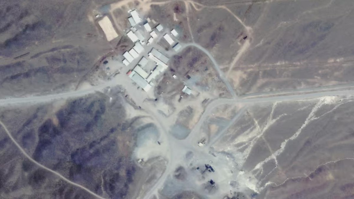
The Center for Strategic and International Studies has released satellite imagery analysis indicating increased construction activity at an underground nuclear facility near Kazma Mountain in Tehran during 2024-2025. The analysis reportedly documents expanded activity at the site, suggesting intensified Iranian nuclear program development. The report was circulated via X on September 10, 2026, by conflict monitoring account @ConflictTR, citing CSIS findings.
Context and assessment
The facility's underground location and reported acceleration in construction activity occur amid escalating regional tensions. Iran issued a joint statement with Russia and China on September 9 rejecting Western efforts to escalate the nuclear issue through the UN Security Council, while IRGC officials simultaneously issued threats of proportionally expanded retaliation. The timing suggests Iran may be advancing nuclear infrastructure development while rhetorically rejecting international pressure. If confirmed, expanded underground construction could indicate either defensive hardening against potential strikes or advancement of nuclear capabilities, though satellite imagery alone cannot definitively distinguish operational purpose.
Sources and confidence
CSIS satellite analysis disseminated via X account @ConflictTR on September 10, 2026. Confidence score of 6.0 reflects reliance on a single reporting channel with no cross-confirmation from independent imagery analysts or official Iranian acknowledgment. Score would increase with analysis from Bellingcat, James Martin Center, or other independent open-source imagery specialists, or decrease if CSIS methodology faces peer review criticism.
Location
Kazma Mountain nuclear facility, located approximately 35.8°N, 51.4°E in Tehran province, Iran. The site sits within Iran's established nuclear infrastructure zone. Facility coordinates indicate underground construction beneath terrain near Kazma Mountain, consistent with Iran's hardened facility development pattern. Geographic precision based on CSIS satellite analysis rather than confirmed facility designation.
Related events nearby
- Iran, Russia, and China issued a joint statement rejecting US and European attempts to escalate the Iranian nu2026-09-09 16:56 UTC · Statement · Tehran, Iran
▶ View this event on the live map
Intel Mapper aggregates open-source reports from monitored Telegram and X channels, geolocates them, cross-checks duplicates across sources and assigns a confidence score. Entries are updated as new confirmations arrive. Read how we verify events.