Saudi Civil Defense alerts Najran to expected Houthi launches from Yemen
What happened
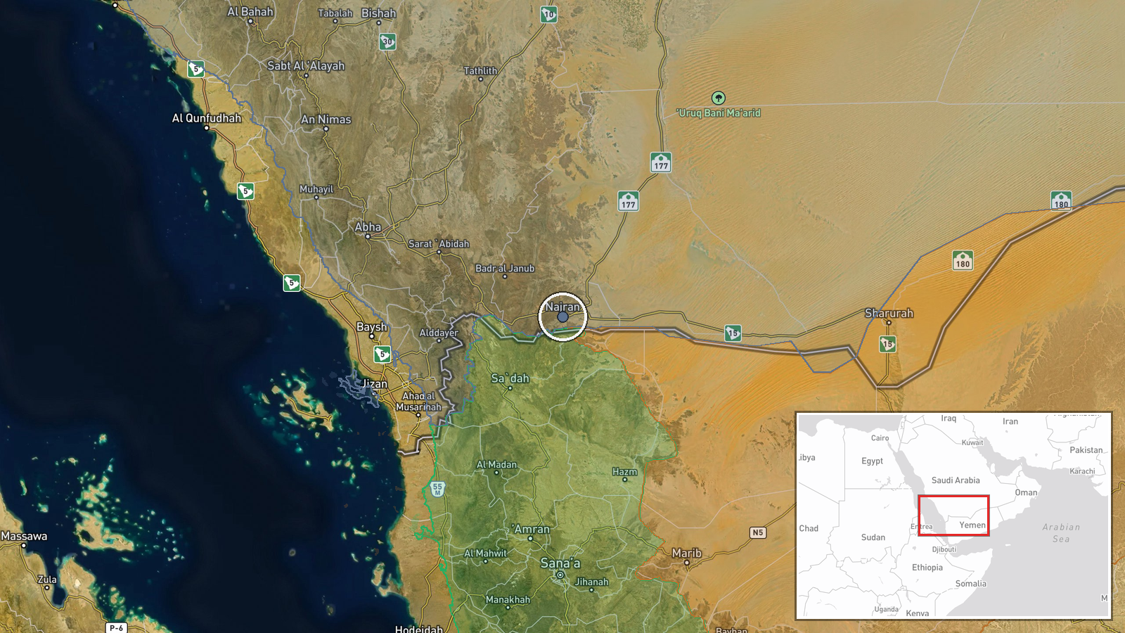
Saudi Arabia's Civil Defense Authority issued a public alert on September 22 for Najran, a southwestern city near the Yemen border, warning of expected projectile launches from Yemeni territory. The alert did not specify the type or number of projectiles expected, though Houthi forces are the primary armed actor capable of conducting such cross-border strikes. The alert was issued at 09:17 UTC and represents a precautionary measure to allow civilian protective action.
Context and assessment
Najran lies approximately 200 kilometers from the Yemen border and has been periodically targeted by Houthi drone and missile strikes throughout their conflict with Saudi Arabia. The alert follows a pattern of Houthi operational activity along the border region. On the same date, Houthi forces were reportedly consolidating territorial gains in Hajjah Governorate's highlands, a strategic area that separates Yemen's Red Sea coast from government-held southern zones. Such territorial consolidation may indicate increased Houthi capacity to stage attacks across the border, though direct causation between ground operations and specific strike threats requires careful interpretation. Civil defense alerts serve both operational and psychological functions in managing cross-border threat perceptions.
Sources and confidence
Reported via X by @Osint613, a single open-source intelligence channel. The alert itself originated from Saudi Arabia's official Civil Defense Authority. Confidence score of 6.0 reflects the single-source confirmation and the routine nature of such alerts, balanced against the official Saudi attribution. Cross-confirmation from Saudi media or direct Civil Defense statements would strengthen confidence. Absence of reported strikes would lower confidence in the alert's basis.
Location
Najran is a city settlement in Najran Region, southwestern Saudi Arabia, approximately 200 kilometers north of the Yemen border and roughly 800 kilometers south-southeast of Riyadh. The city sits on the edge of the Asir plateau overlooking the Tihama coastal plain to the south. Proximity to Yemen and open terrain to the south make it vulnerable to aerial attack from Yemeni territory.
Related events nearby
- Houthi forces are pressing into strategic highlands separating Yemen's Red Sea coast from government-held sout2026-09-22 09:23 UTC · Combat · Usaylan, Hajjah Governorate, Yemen
▶ View this event on the live map
Intel Mapper aggregates open-source reports from monitored Telegram and X channels, geolocates them, cross-checks duplicates across sources and assigns a confidence score. Entries are updated as new confirmations arrive. Read how we verify events.