Smoke plume observed at Saudi Arabia's Abqaiq Oil Processing Facility after reported Houthi strike
What happened
Satellite imagery captured a large smoke plume at the Abqaiq Oil Processing Facility in Saudi Arabia's Eastern Province on 30 September 2026. The facility reportedly came under attack from Houthi forces using drones and missiles. Abqaiq is one of the world's most critical energy installations, capable of processing approximately 7 million barrels of oil per day. The satellite imagery provides visual confirmation of damage or fire at the site, though the extent of disruption to operations remains unclear from available reporting.
Context and assessment
Abqaiq represents a critical chokepoint in global oil supply and has historically been a target for regional actors seeking to pressure Saudi Arabia and affect international energy markets. The facility's strategic importance—processing roughly 6–7 percent of global crude oil—means even temporary disruption can influence global oil prices and energy security. Houthi drone and missile capabilities have expanded over recent years, and strikes on Saudi energy infrastructure align with the group's stated opposition to Saudi-led military operations. If operations are significantly impaired, the impact could extend beyond the region given global energy market interconnection.
Sources and confidence
Report originates from @Osint613 on X platform, citing weather satellite imagery as the primary evidence. Imagery corroborates the attack claim with visual confirmation of large smoke plume. Confidence scored at 6.0 due to single-source reporting and lack of independent cross-confirmation from Saudi officials, facility operators, or secondary monitoring. Confirmation from Saudi Aramco statements or sustained energy market reactions would strengthen confidence; lack of follow-up reporting or access to high-resolution post-strike imagery would lower it.
Location
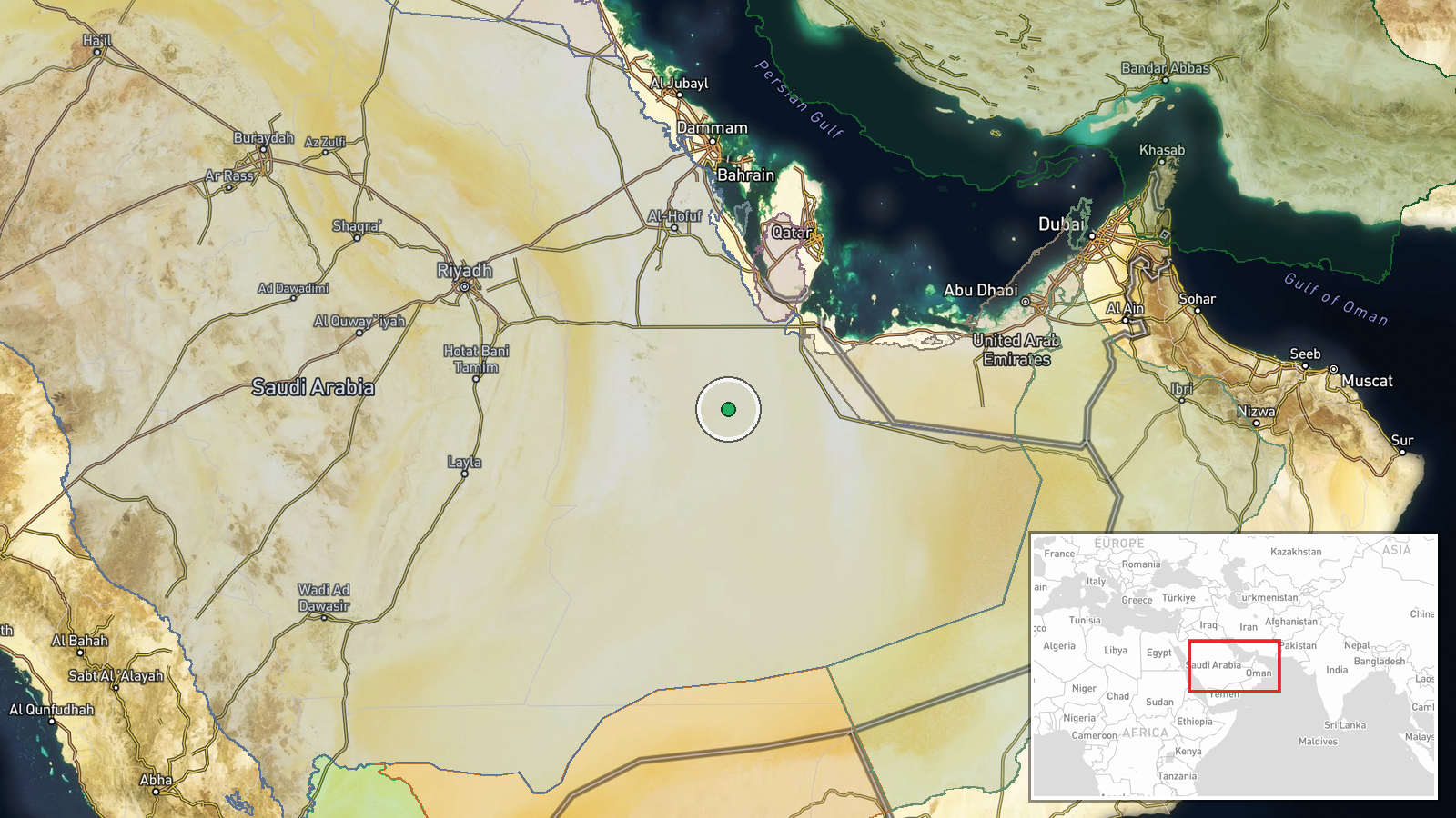
Abqaiq Oil Processing Facility is located in the Eastern Province of Saudi Arabia, approximately 40 kilometres northwest of Dhahran in the Ghawar oilfield region. The facility sits at coordinates 23.1114°N, 50.3169°E. Geographic precision is noted as regional rather than exact facility boundary, reflecting the satellite imagery source. The area is flat desert terrain with extensive oil and gas infrastructure clustered nearby.
Related events nearby
- Aramco-owned oil pump facility in Saudi Arabia's Eastern Province caught fire. Cause unknown; investigation on2026-09-30 15:52 UTC · Explosion · Aramco Pump Station, Eastern Province, Saudi Arabi
▶ View this event on the live map
Intel Mapper aggregates open-source reports from monitored Telegram and X channels, geolocates them, cross-checks duplicates across sources and assigns a confidence score. Entries are updated as new confirmations arrive. Read how we verify events.