U.S. deploys 2,000 Marines via USS Makin Island to Gulf of Oman
What happened
The United States military reportedly deployed approximately 2,000 Marines as part of the USS Makin Island Amphibious Ready Group to the Gulf of Oman, a body of water bordering Iran's southeastern coast. The operation was reported on 1 October 2026. The announcement signals a significant movement of naval and expeditionary forces to a strategically sensitive region. Such amphibious ready groups typically carry transport and attack helicopters, landing craft, and embarked Marine infantry capable of rapid response operations.
Context and assessment
The Gulf of Oman sits at a critical maritime chokepoint between the Arabian Sea and the Strait of Hormuz, through which a substantial portion of global oil passes. This deployment appears part of a broader U.S. force posture adjustment in the Middle East. A related report from the same date indicates the USS Theodore Roosevelt carrier strike group was simultaneously deployed to the North Arabian Sea, with three carriers and two amphibious groups expected to position around Iran by late November. These concurrent deployments may reflect escalating regional tensions or a coordinated deterrence posture. The presence of amphibious forces specifically suggests readiness for non-traditional naval operations, humanitarian response, or rapid-reaction contingencies beyond carrier-based air operations.
Sources and confidence
Reported by X account @WarMonitor3 on 1 October 2026. Single-source reporting at low confidence due to lack of cross-confirmation from established defense or military news outlets. Confidence score of 6.0 reflects limited sourcing. Confirmation by U.S. military statements, Department of Defense releases, or additional independent reporting would substantially raise confidence. The claim involves routine military posture information typically disclosed publicly, supporting plausibility.
Location
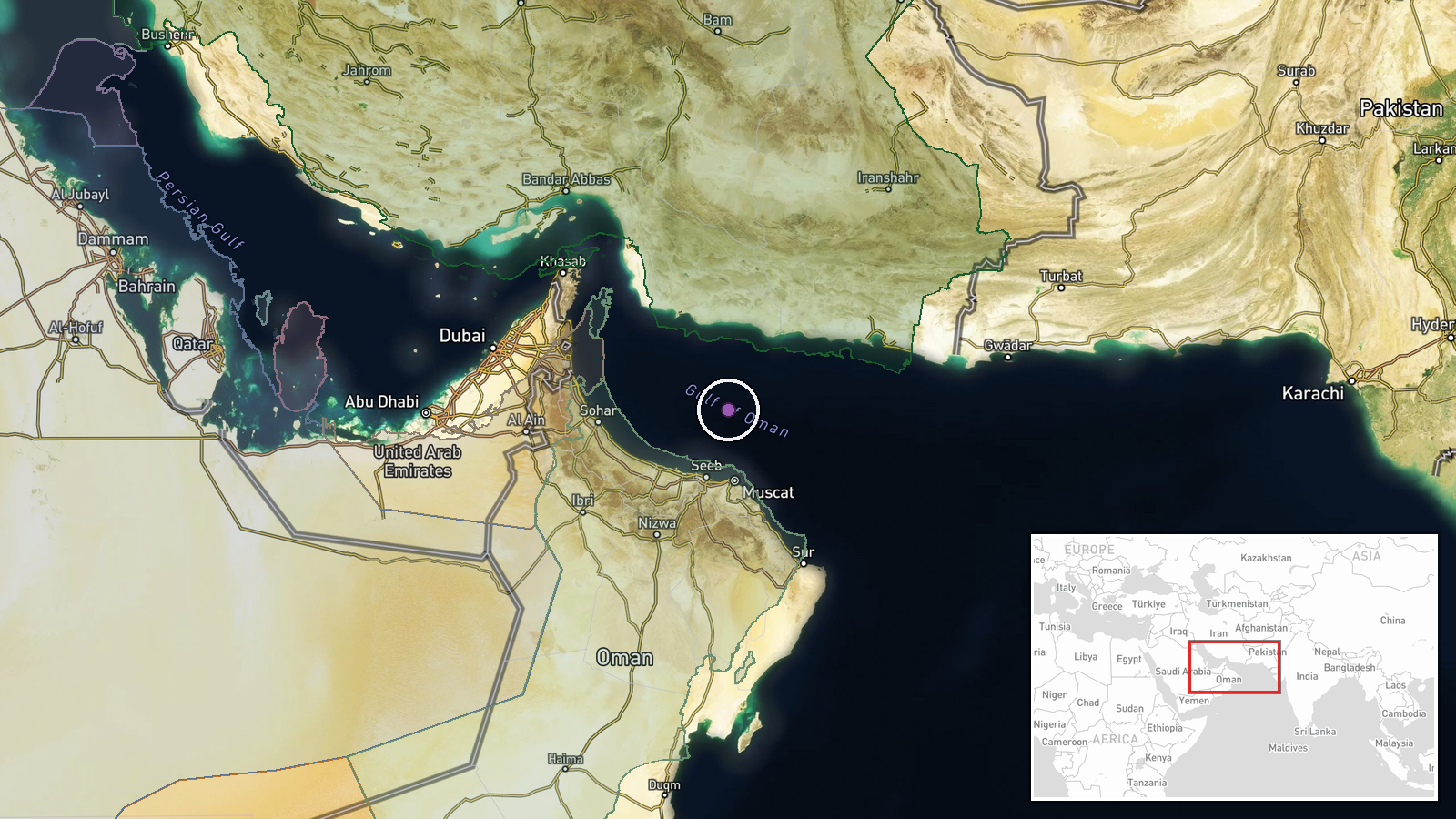
Gulf of Oman, determined at regional precision level (24.5°N, 58.5°E). The gulf extends roughly 400 kilometers from the Strait of Hormuz westward into the Arabian Sea. It is bordered to the north by Iran and to the south by Oman. The region is permanently monitored by multiple naval powers and serves as a major transit route for commercial shipping and military vessels.
Related events nearby
- U.S. deploys USS Theodore Roosevelt carrier strike group to Middle East. Three carriers and two amphibious gro2026-10-01 14:58 UTC · Aircraft Carrier · North Arabian Sea
▶ View this event on the live map
Intel Mapper aggregates open-source reports from monitored Telegram and X channels, geolocates them, cross-checks duplicates across sources and assigns a confidence score. Entries are updated as new confirmations arrive. Read how we verify events.