Saudi military releases photos of Houthi drone damage to Medina power plant
What happened
Saudi military spokesman Turki al-Maliki released photographs on Tuesday showing damage to a power plant near Medina following an early morning Houthi unmanned aerial vehicle strike. The release constitutes an official damage assessment by Saudi authorities. Medina, Islam's second holiest city, hosts critical infrastructure including the Prophet's Mosque, which depends on regional power supply networks. The images were disseminated via social media, marking a public acknowledgment of the attack and its effects on civilian infrastructure.
Context and assessment
Attacks on Saudi energy infrastructure near Medina represent a continuation of Houthi targeting patterns that have escalated since 2015. The choice of a power facility supplying Medina—rather than distant oil refineries or military installations—suggests an operational shift toward disrupting services in population centers and religious sites. Related reporting from October 1st documented imagery of an attack on the power station supplying Masjid al-Nabawi itself, indicating sustained pressure on the city's electrical grid. Such strikes may indicate Houthi capability to conduct precision strikes deep within Saudi territory, or an intent to amplify the propaganda value of attacks on religiously significant locations by coupling them with infrastructure damage.
Sources and confidence
The event is sourced to a single X post from @Osint613 sharing the Saudi military spokesman's release. Cross-confirmation from additional independent sources is absent. The confidence score of 6.0 reflects the official nature of the Saudi military statement but the single-channel reporting pathway. Independent verification of damage or confirmation by Saudi state media would increase confidence; contradictory accounts or lack of secondary reporting over time could lower it.
Location
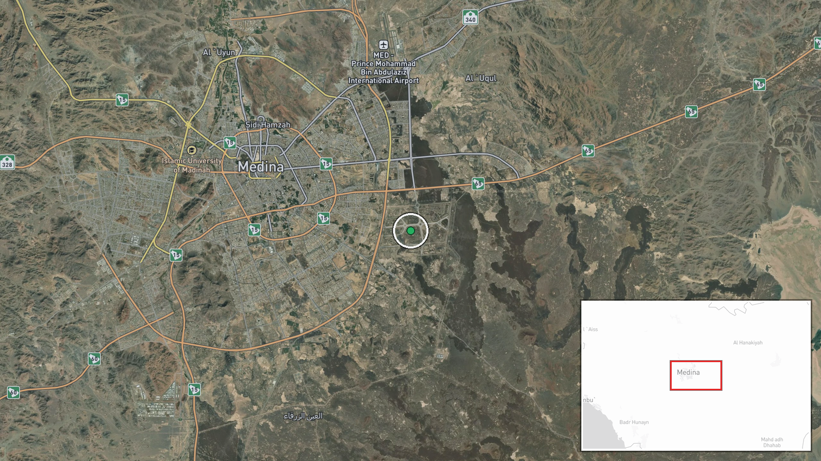
The power plant is located near Medina in western Saudi Arabia at coordinates 24.427°N, 39.725°E, with exact precision. Medina lies approximately 400 kilometers north of Riyadh in the Hejaz region. The facility's proximity to Masjid al-Nabawi and the city's dense urban area makes it a high-visibility target for strikes intended to affect both civilian services and religious infrastructure.
Related events nearby
- Saudi Arabia releases imagery of attack on power station supplying Masjid al-Nabawi (Prophet's Mosque) in Medi2026-10-01 17:05 UTC · Report · Power Station supplying Masjid al-Nabawi, Medina,
▶ View this event on the live map
Intel Mapper aggregates open-source reports from monitored Telegram and X channels, geolocates them, cross-checks duplicates across sources and assigns a confidence score. Entries are updated as new confirmations arrive. Read how we verify events.