Houthi forces conduct fiber-optic drone strikes against Saudi-backed Yemeni military
What happened
Houthi forces reportedly conducted unmanned aerial vehicle strikes using fiber-optic guided drones against positions held by Saudi Arabia-backed Yemeni military forces on October 5, 2026. The attack was characterized as part of the ongoing Operation Yemen Dawn campaign. The report does not specify the number of drones deployed, targets struck, or any resulting damage or casualties. The strike was reported via social media on the same day as a separate Saudi-led air operation.
Context and assessment
Yemen has remained fractured by conflict since 2014, with Saudi-led coalition forces supporting the internationally recognized government against the Iran-aligned Houthi movement. The Houthis have progressively developed and deployed increasingly sophisticated unmanned systems, including fiber-optic guided variants that reduce electronic jamming vulnerability. This strike follows a significant Saudi air operation launched the same morning involving 100 fighter jets, suggesting an intensification of operations along both sides. The use of fiber-optic guidance represents a tactical refinement in Houthi capabilities, potentially indicating either captured or transferred technology and a shift toward more resilient attack profiles.
Sources and confidence
Reported by X account @ConflictTR on October 5, 2026. Single-source confirmation only. No independent corroboration from coalition, Yemeni government, or international monitoring agencies is noted. Confidence score of 6.0 reflects plausible operational context but absence of secondary confirmation. Score would increase with Saudi or Yemeni military statements or journalist verification.
Location
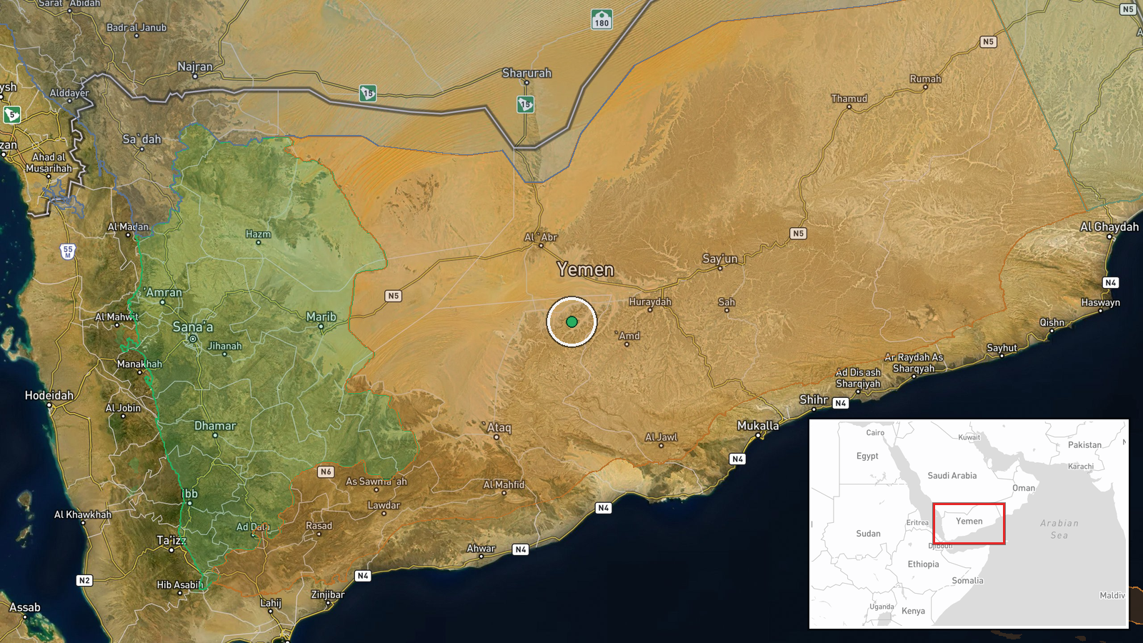
The event is geo-referenced to central Yemen (latitude 15.5°N, longitude 47.5°E) at regional precision, indicating Saudi-backed military positions across Yemen rather than a specific facility. This coordinate range covers much of central Yemen including territories contested between Houthi and coalition-aligned forces, particularly in the vicinity of Ma'rib and surrounding provinces where military concentrations are highest.
Related events nearby
- Saudi Defense Ministry announces 100 fighter jets conducted operations against Houthi positions in Yemen today2026-10-05 09:14 UTC · Combat Aircraft · Yemen
▶ View this event on the live map
Intel Mapper aggregates open-source reports from monitored Telegram and X channels, geolocates them, cross-checks duplicates across sources and assigns a confidence score. Entries are updated as new confirmations arrive. Read how we verify events.