Iran's IRGC conducts 12 tanker attacks in Strait of Hormuz over one week
What happened
Between September 29 and October 5, the UK Maritime Trade Operations (UKMTO) issued 13 advisories documenting 12 separate attacks on tanker vessels and one threat incident in the Strait of Hormuz, reportedly linked to Iran's Islamic Revolutionary Guard Corps (IRGC). Vessels were struck with projectiles across multiple days, resulting in fires, engine damage, power failures, and blackouts. Targets included crude oil tankers and an LPG carrier. A separate IRGC threat incident was reported near Khasab, Oman on October 5. No U.S. military response to the incidents has been reported.
Context and assessment
The Strait of Hormuz handles roughly one-third of global maritime oil traffic, making it one of the world's most strategically critical chokepoints. These coordinated attacks over a compressed seven-day period represent a significant escalation in Iranian maritime pressure. The targeting of both crude and liquefied petroleum gas carriers suggests an intent to disrupt energy supplies broadly rather than strike specific commercial opponents. The pattern of daily strikes, combined with the documented use of projectile weapons, aligns with Iranian capabilities and past assertiveness in the waterway. Such escalations often occur amid regional tensions or as messaging regarding sanctions and geopolitical disputes, though the immediate operational trigger for this campaign is not specified in available reporting.
Sources and confidence
Single source: X account @Osint613, citing UKMTO advisories as the evidentiary basis. The confidence score of 6.0 reflects reliance on a single reporting channel despite citation of official maritime authority records (UKMTO), which carry inherent credibility. Confirmation from independent maritime safety organizations, shipping companies, or U.S. Navy statements would elevate confidence. Lower confirmation or contradictory reports would lower the score.
Location
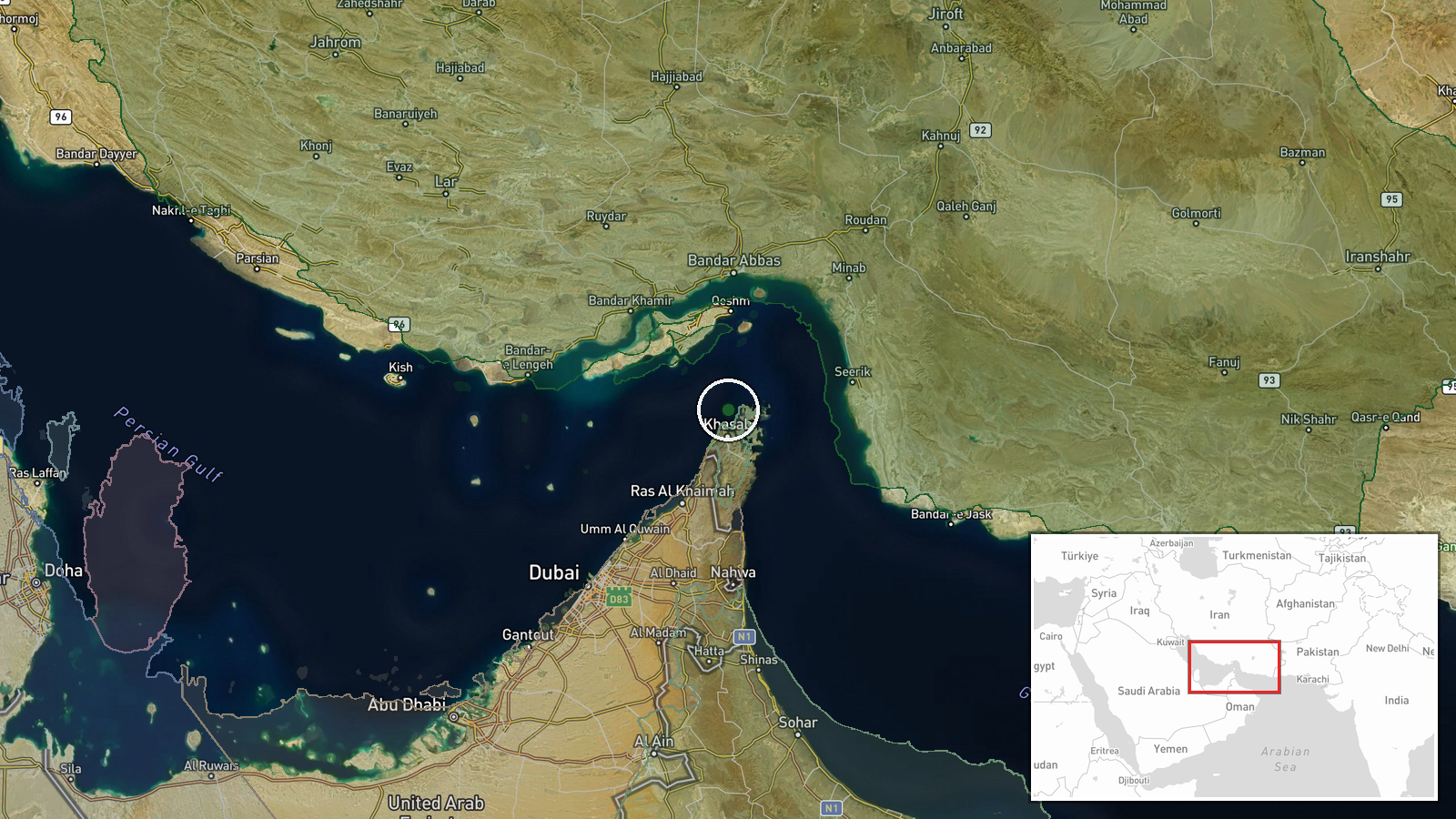
The Strait of Hormuz, a narrow waterway between Iran and Oman approximately 21 miles wide at its narrowest point (the Strait proper). Coordinate 26.35°N, 56.25°E places the area in the central strait. One separate incident occurred near Khasab, Oman, on the Musandam Peninsula's eastern coast, at the strait's southern entrance.
▶ View this event on the live map
Intel Mapper aggregates open-source reports from monitored Telegram and X channels, geolocates them, cross-checks duplicates across sources and assigns a confidence score. Entries are updated as new confirmations arrive. Read how we verify events.