Saudi-led coalition aircraft strike Sana'a in ongoing Yemen air campaign
What happened
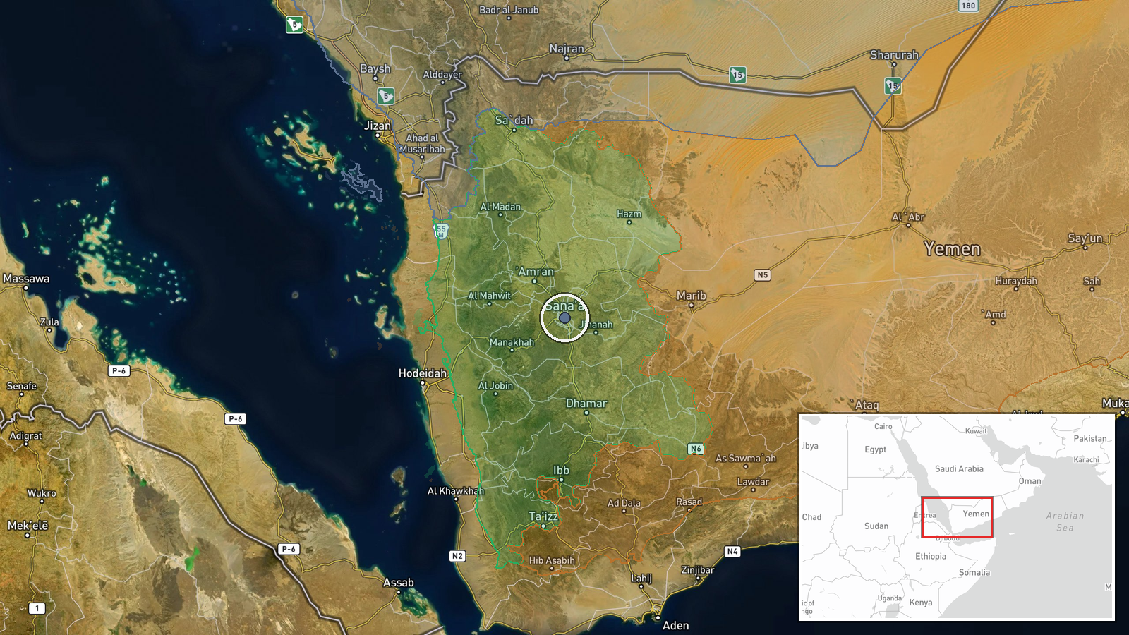
Saudi Arabian fighter jets conducted an airstrike on Sana'a, Yemen's capital, on 9 October 2026 at approximately 17:22 UTC. The strike represents part of the Saudi-led coalition's sustained air campaign targeting Houthi-controlled territory in northwestern Yemen. The report was initially disseminated via X by the conflict monitoring account @ConflictTR, which cited video evidence of the strike.
Context and assessment
Sana'a has served as the de facto Houthi administrative center since 2015, making it a recurring target of coalition air operations. The strike follows a period of continued Saudi-led military pressure on Houthi-held areas, with coalition aircraft maintaining regular operational tempo across Yemen's northern regions. Such strikes typically target government infrastructure, military facilities, or dual-use installations within the capital. The timing and character of this operation are consistent with the coalition's multi-year campaign to degrade Houthi organizational capacity and contest their territorial control in Yemen's most populous region.
Sources and confidence
Single source: X account @ConflictTR, a recognized conflict monitoring channel. Cross-confirmation status unclear from available data. Confidence score of 6.0 reflects the account's established track record in conflict reporting but relies on single-source confirmation. Score would increase with independent visual confirmation from additional open-source channels or regional media; it would decrease if visual evidence proved inconsistent with claimed strike location or timing.
Location
Sana'a, Yemen's capital city, located in the northwestern portion of the country at approximately 15.35°N, 44.21°E. Precision level: settlement. The city sits in a highland basin at roughly 2,300 meters elevation and has functioned as Yemen's administrative seat and largest urban center since Houthi forces took control in 2015. Geographic setting: northwestern Yemen, Amanat Al Asimah governorate.
Related events nearby
- Senior researcher at Sana'a Center for Strategic Studies gives interview analyzing Houthi governance model: mo2026-10-09 12:45 UTC · Statement · Sana'a, Yemen
▶ View this event on the live map

Intel Mapper aggregates open-source reports from monitored Telegram and X channels, geolocates them, cross-checks duplicates across sources and assigns a confidence score. Entries are updated as new confirmations arrive. Read how we verify events.