Iranian UAV strikes tanker near Sohar anchorage in Oman
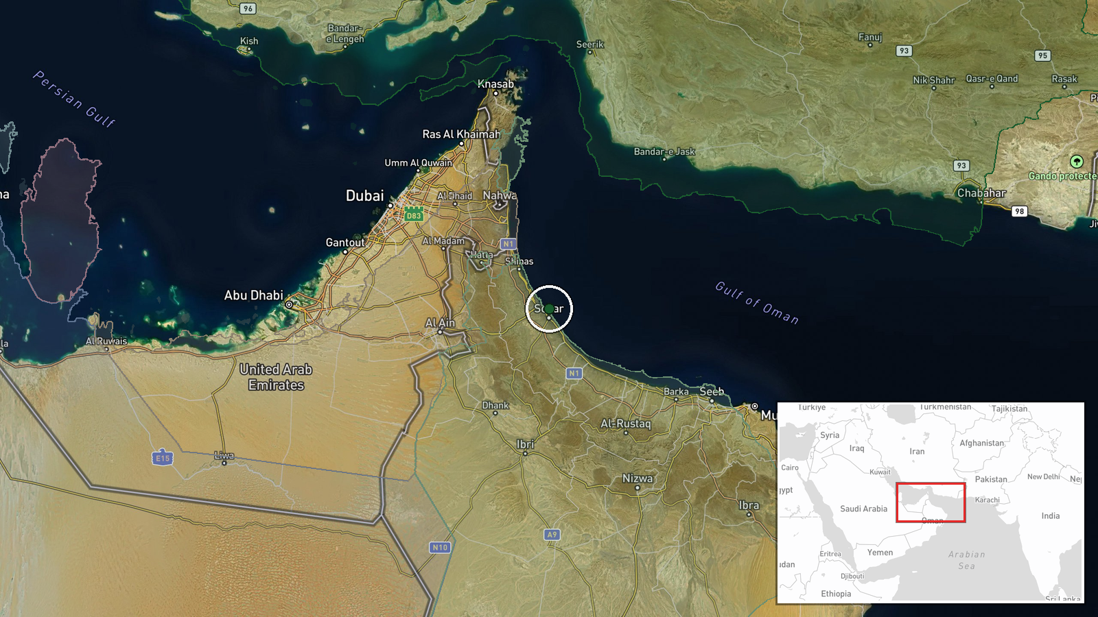
What happened
A tanker near Sohar anchorage off the coast of Oman was struck by an Iranian unmanned aerial vehicle on 11 October 2026, according to the UK Maritime Trade Operations centre. The fire resulting from the strike was subsequently detected by the NOAA-20 meteorological satellite, providing independent confirmation of the impact. The incident occurred in the Arabian Sea, a strategically important shipping corridor.
Context and assessment
Sohar lies on Oman's northeastern coast and serves as a major anchorage for commercial shipping transiting between the Strait of Hormuz and broader Indian Ocean routes. Attacks on vessels in this region have intensified in recent months, reflecting broader regional tensions. Such strikes against merchant shipping typically aim to disrupt commerce, assert maritime influence, or signal political messaging. The use of armed unmanned aircraft demonstrates operational capability and willingness to conduct operations in international waters. The targeting pattern suggests potential escalation of maritime pressure in Gulf waters, though motives remain contested.
Sources and confidence
The UK Maritime Trade Operations centre, an official maritime security body, provided direct confirmation of the strike. Fire detection by NOAA-20, an independent US meteorological satellite system, corroborates the reported attack. The single primary source channel and lack of cross-reporting from major news agencies accounts for the moderate confidence score of 6.6. Independent analysis of satellite imagery or additional maritime authority statements would strengthen confidence.
Location
Sohar anchorage lies approximately 200 kilometres northeast of Muscat on Oman's Al Batinah coast, at coordinates 24.42°N, 56.73°E. The anchorage serves as a sheltered holding area for large vessels in the Arabian Sea, situated between the Strait of Hormuz to the north and the Gulf of Oman shipping lanes. It is a recognized international maritime waypoint.
▶ View this event on the live map

Intel Mapper aggregates open-source reports from monitored Telegram and X channels, geolocates them, cross-checks duplicates across sources and assigns a confidence score. Entries are updated as new confirmations arrive. Read how we verify events.