Iranian Shahed-136 drone transits into Iraqi Kurdistan airspace
What happened
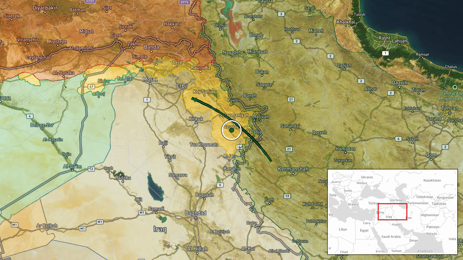
A delta-wing unmanned aerial vehicle, believed to be an Iranian Shahed-136, crossed from Iranian airspace into the Kurdistan Region of Iraq on 12 October at approximately 08:57 UTC. The drone's origin was estimated as Kermanshah Province in western Iran. No confirmed target or impact has been reported as of the time of posting. The observation was made by an open-source intelligence analyst monitoring regional air activity.
Context and assessment
The Kurdistan Region of Iraqi territory has experienced periodic drone transits and strikes originating from Iran, particularly targeting Kurdish opposition groups and armed factions based there. The Shahed-136 is a loitering munition designed for standoff strikes, typically carrying a warhead of several kilograms. The specific purpose of this transit—whether reconnaissance, a delivery attempt, or passage to another target—remains unclear. Such incursions reflect broader patterns of Iranian drone operations across Iraq, though the absence of reported impact suggests either interception, malfunction, or a transit without immediate engagement.
Sources and confidence
Reported by a single OSINT account (@Osint613) on X (Twitter). No cross-confirmation from secondary sources, military statements, or regional media has been identified. Confidence remains low due to single-source reporting, lack of visual verification, and absence of target or impact confirmation. Independent corroboration or official statements would significantly strengthen confidence.
Location
Kurdistan Region, Iraqi territory, approximately 36.2°N, 44.0°E. The precision is regional rather than site-specific. The area spans the northernmost provinces of Iraq adjacent to Turkey and Iran, mountainous terrain with dispersed population centers. The estimated origin point was Kermanshah Province, western Iran, approximately 150–200 km southwest of the detection point.
▶ View this event on the live map

Intel Mapper aggregates open-source reports from monitored Telegram and X channels, geolocates them, cross-checks duplicates across sources and assigns a confidence score. Entries are updated as new confirmations arrive. Read how we verify events.