Saudi-led coalition strikes Houthi facilities in Sana'a amid escalating threats
What happened
Saudi-led coalition warplanes conducted airstrikes on Houthi-controlled targets in Sana'a on 13 October 2026 at approximately 14:24 UTC. Strikes reportedly targeted missile and oil facilities within the city and surrounding areas, with multiple explosions reported by observers. The attack followed a series of explicit Houthi threats issued earlier that day warning of retaliation against Saudi targets including Aramco facilities and King Khalid International Airport if strikes were launched against Sana'a infrastructure.
Context and assessment
Sana'a, Yemen's de facto capital and Houthi stronghold since 2014, has been a recurring target of Saudi-led coalition operations throughout the Yemen conflict. Oil and military production facilities in the city represent key Houthi capabilities for projecting force regionally. This strike sequence reflects an established pattern of escalation: Houthi leadership issued three separate threat statements between 07:00 and 12:42 UTC naming specific Saudi targets for retaliation, then issued evacuation warnings for Riyadh and Dammam facilities at 14:24 UTC—the same moment airstrikes were reported. The rapid cycle suggests both sides anticipated military action, with the Houthis attempting deterrence through public targeting announcements before coalition strikes proceeded.
Sources and confidence
Two X accounts (@Osint613 and @ConflictTR) reported the strikes with immediate eyewitness descriptions of ongoing explosions. Confidence of 7.7 reflects corroboration between two independent OSINT sources observing real-time impact, though no official coalition statement was included in available data. Confirmation of specific facility types relies on source characterization. Independent verification of damage assessment or casualty figures would strengthen confidence; contradicting reports of strike timing or scope would lower it.
Location
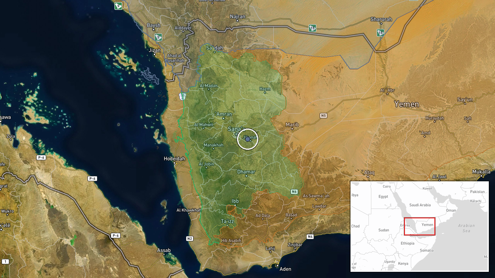
Sana'a city and surrounding areas, Sana'a Governorate in northwestern Yemen. Precision determined at regional level (coordinates 15.26°N, 44.42°E) based on Houthi-controlled city center and nearby economic infrastructure. Notable nearby features include port facilities to the west and Saudi border approximately 200 kilometers northeast, making the location strategically significant for both coalition operations and Houthi missile production.
Related events nearby
- Houthi (Ansar Allah) issues evacuation warnings for King Khalid International Airport in Riyadh and Saudi Aram2026-10-13 14:24 UTC · Statement · Sana'a, Yemen
- Houthi leadership names three Saudi targets for retaliation if Saudi-led coalition strikes Sana'a oil depot: A2026-10-13 12:42 UTC · Statement · Sana'a, Yemen
- Houthi spokesperson warns Saudi Arabia that any attack on Sana'a will trigger a 'harsh' military response targ2026-10-13 12:32 UTC · Statement · Sana'a, Yemen
- Senior Houthi official Mohammed al-Bukhaiti threatens a 'swift and painful response' against U.S. interests ac2026-10-13 10:19 UTC · Statement · Sana'a, Yemen
- Houthi official threatens swift and painful response if US joins Saudi-led military operations against the gro2026-10-13 07:00 UTC · Statement · Sana'a, Yemen
▶ View this event on the live map

Intel Mapper aggregates open-source reports from monitored Telegram and X channels, geolocates them, cross-checks duplicates across sources and assigns a confidence score. Entries are updated as new confirmations arrive. Read how we verify events.