Ukrainian forces strike Borisoglebsk airfield in Voronezh Oblast
What happened
Ukrainian forces reportedly launched a substantial unmanned aerial system attack against Borisoglebsk airfield in Voronezh Oblast, Russia, on 14 October 2026 at approximately 19:55 UTC. The airfield, located roughly 500 kilometres from the Ukrainian border, hosts Russian military aviation assets. Initial reports provided limited detail on the scale of damage or specific facilities targeted. Damage assessment was pending at the time of reporting.
Context and assessment
Borisoglebsk airfield serves as a major Russian military aviation base deep within Russian territory. Strikes on rear-area airfields represent an escalation in Ukraine's ability to project power, targeting aircraft, fuel storage, and logistics infrastructure that support Russian flight operations over Ukraine. Such attacks, if sustained, could degrade Russian aviation sortie rates and force costly dispersal of aircraft. The strike reflects Ukraine's ongoing effort to contest Russian air superiority and disrupt supply lines, though individual attacks rarely produce decisive operational effects. The range and complexity required suggest possible use of longer-range or coordinated unmanned systems.
Sources and confidence
Reported by X account @WarMonitor3, a single open-source intelligence channel. No independent cross-confirmation from other OSINT sources, Russian military officials, or Ukrainian official statements noted at time of report. Confidence score of 6.0 reflects initial reporting with unconfirmed damage assessment. Corroboration from additional channels or Ukrainian military statements would strengthen confidence significantly.
Location
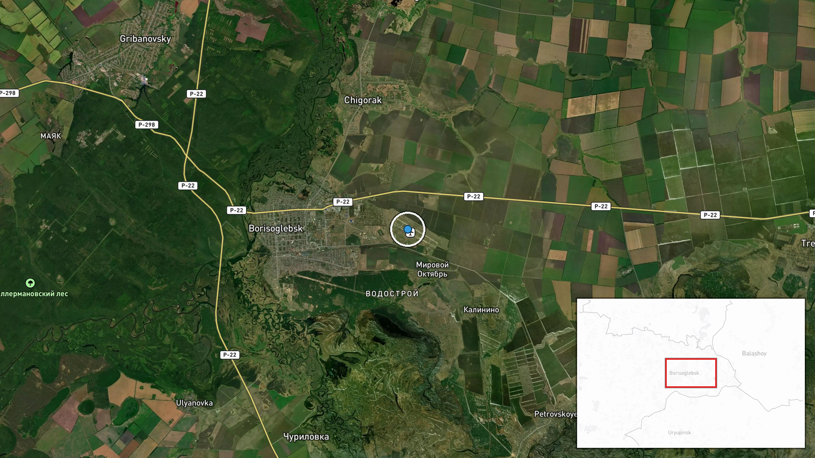
Borisoglebsk airfield is situated at 51.37°N, 42.18°E in Borisoglebsk, Voronezh Oblast, approximately 500 kilometres southeast of Moscow and roughly 460 kilometres from the Ukrainian border. The facility is a major operational airbase in western Russia, positioned in relatively flat terrain typical of the region.
▶ View this event on the live map

Intel Mapper aggregates open-source reports from monitored Telegram and X channels, geolocates them, cross-checks duplicates across sources and assigns a confidence score. Entries are updated as new confirmations arrive. Read how we verify events.