Iranian Revolutionary Guards conduct naval strike in Persian Gulf Basra Basin
What happened
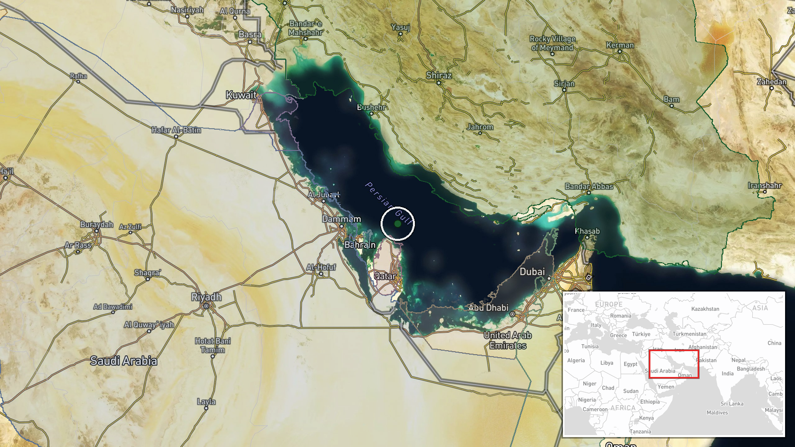
The Iranian Revolutionary Guards (IRGC) reportedly struck a vessel in the Persian Gulf's Basra Basin area on October 15, according to a report posted on X by @ConflictTR. No vessel identification, damage assessment, or casualty figures were provided in the initial report. The incident occurred in waters shared by Iran and Iraq, a strategically sensitive area for regional shipping and energy infrastructure.
Context and assessment
The Basra Basin is a critical waterway through which substantial crude oil and liquefied natural gas shipments transit to global markets. This strike follows a period of elevated regional tensions, with Qatar's leadership warning of imminent conflict on October 14 and reports of frequent Iranian ballistic missile testing. A fire at Saudi Aramco headquarters in Dhahran the same day underscores broader vulnerability of Gulf energy infrastructure. The reported naval action may signal Iranian pressure tactics in contested waters, though the context—whether opportunistic, deterrent, or part of a coordinated escalation—remains unclear without additional details on the target vessel's nationality or the operational intent.
Sources and confidence
Single source: X account @ConflictTR posted the report. No cross-confirmation from other OSINT channels, Iranian state media, or maritime tracking services is noted. Confidence score of 6.3 reflects this single-source constraint and low geographic precision. Score would rise significantly with confirmation from vessel tracking data, maritime authorities, or secondary reporting; would fall if the report is retracted or contradicted.
Location
Persian Gulf Basra Basin (approximately 26.5°N, 51.5°E), located in the shallow waters shared between Iran and Iraq at the northern end of the Gulf. The region encompasses major shipping lanes and contains offshore oil and gas fields. Geographic precision is regional rather than specific, as the report provides no exact coordinates or named facility reference.
Related events nearby
- OSINT analyst assessment: U.S., Israel, and Iran in heightened alert posture ahead of potential escalation. Ir2026-10-14 17:40 UTC · Statement · Persian Gulf Region
- Qatar's Interior Minister arrives in Damascus for bilateral talks with Syrian counterpart, marking diplomatic 2026-10-15 08:52 UTC · Diplomacy · Doha, Qatar
- Emir of Qatar addresses citizens with cautionary remarks on preparedness for worst-case scenarios, calling for2026-10-14 17:05 UTC · Statement · Doha, Qatar
- Emir of Qatar warns war is imminent and urges all institutions and citizens to prepare for worst-case scenario2026-10-14 12:33 UTC · Statement · Doha, Qatar
- Saudi Aramco headquarters in Dhahran sustained extensive damage with fire spreading across multiple floors on 2026-10-14 10:59 UTC · Report · Saudi Aramco Headquarters, Dhahran, Saudi Arabia
▶ View this event on the live map

Intel Mapper aggregates open-source reports from monitored Telegram and X channels, geolocates them, cross-checks duplicates across sources and assigns a confidence score. Entries are updated as new confirmations arrive. Read how we verify events.