Japanese destroyer Takanami reports 111 merchant ships checked in Gulf of Aden zone defense
What happened
Japan's Joint Staff public affairs account on X reported that the destroyer Takanami, deployed on Japan's anti-piracy mission in the Gulf of Aden, checked 111 merchant ships during a 24-day zone defense conducted in September. The post, logged on 16 October 2026 at 06:14 UTC, stated that no unusual incidents were confirmed and said the force would continue working to secure safe maritime traffic. It links to a short official note but does not name the patrol area, shipping routes, or flags of the vessels checked. The report is an operational status update rather than an account of an attack, confrontation, or casualties.
Context and assessment
The Gulf of Aden lies between Yemen and the Horn of Africa and links the Bab el-Mandeb strait with the Arabian Sea, making it a major passage for Asia-Europe trade. Piracy off Somalia surged in the late 2000s, prompting multinational naval deployments, and Japan has maintained a destroyer-based anti-piracy presence in the area since 2009, supported from Djibouti. The dataset contains no related events, so this report cannot be tested against neighboring incidents in this feed. Operationally, a zone defense typically means ships positioned to monitor, deter, and screen traffic, so the count of 111 vessels indicates the scale of screening rather than any engagement. The phrase reporting no unusual incidents suggests no piracy approaches or hostile contacts were recorded during the window. Because the Red Sea and Bab el-Mandeb area has seen attacks on shipping in recent years linked to the Yemen conflict, a quiet report here should not be read as a general all-clear for the wider region. The update most likely signals routine continuity of the mission rather than a change in threat level.
Sources and confidence
The report comes from a single channel, the official X account of Japan's Joint Staff (@jointstaffpa). No other outlet, maritime security bulletin, or independent monitor in the feed corroborates it. The confidence score of 6.1 reflects a credible official source combined with single-channel reporting and no cross-confirmation. Confidence would rise if Japan's Ministry of Defense publishes the same figures, if maritime security services reference the same period, or if the linked note is confirmed. It would fall if the linked material is unavailable or if the reported dates or figures are revised.
Location
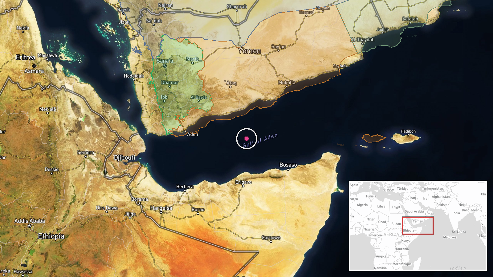
The location is region-level with low confidence. The coordinates of 12.5N, 47.5E are a generalized point in open water of the Gulf of Aden, offshore from Aden Governorate in Yemen, and do not mark the ship's actual position. The report gives no patrol box or route. The setting is open sea between the Yemeni coast and the Horn of Africa, with Bab el-Mandeb to the west and the Socotra archipelago to the east.
▶ View this event on the live map

Intel Mapper aggregates open-source reports from monitored Telegram and X channels, geolocates them, cross-checks duplicates across sources and assigns a confidence score. Entries are updated as new confirmations arrive. Read how we verify events.