Yemeni government forces reportedly repel Houthi ground assault on Mount Han west of Taiz
What happened
According to a post on X by the account @Osint613, Yemeni Government forces repelled an overnight Houthi ground assault on Mount Han, west of Taiz in southwestern Yemen. The post, logged at 06:23 UTC on 16 October 2026, states that the attack was defeated and that significant Houthi losses occurred, citing local military sources. The wording is brief. It does not give the number of attackers, the length of the fighting, or the units involved. No casualty figures for either side are provided, and the dataset contains no imagery or independent corroboration. The event is classified as a combat engagement with the Houthis as the actor.
Context and assessment
Taiz is one of Yemen's largest cities and has been a persistent front in the conflict between Houthi forces and the internationally recognized government. Mount Han sits on high ground to the west of the city, and control of such terrain typically matters for observation, fire coverage, and the movement of troops and supplies along nearby roads. The engagement fits a broader pattern visible in the related reporting. On the evening of 15 October, a post on X reportedly described Saudi aircraft striking Houthi positions near Rada', in Ta'izz governorate, though targets and impacts were not confirmed. Roughly fourteen hours earlier, Houthi forces reportedly launched multiple cruise missiles at the Maashiq Presidential Palace in Aden, the seat of the government, with four to five explosions reported. Taken together, these reports suggest intensified activity across several fronts within a short window. They do not establish a single coordinated campaign, and each remains thinly sourced.
Sources and confidence
The report comes from a single channel, X (@Osint613), with no second source in the dataset. Cross-confirmation is therefore absent, and the confidence score of 6.5 reflects that limitation along with the lack of specific detail. Confidence would rise with independent reporting from established outlets, statements from Yemeni government or Houthi-affiliated media, geolocated footage, or satellite imagery showing fighting or damage at the site. It would fall if the claim were contradicted, if the account were found to have recycled older material, or if subsequent reporting failed to repeat the claim.
Location
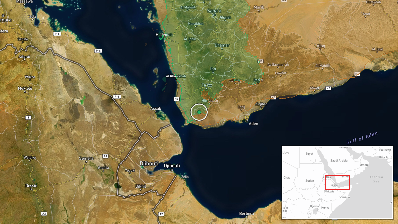
The location is recorded at settlement precision, meaning the coordinates approximate the general area of Mount Han rather than a verified point on the ground. The dataset does not record a separate location confidence value. Mount Han lies west of Taiz in mountainous terrain, where elevated positions and surrounding roads shape military movement. The coordinates are roughly 13.00 N, 43.83 E, placing the marker within the broader western Taiz hills.
Related events nearby
- Saudi aircraft reportedly struck Houthi positions, per X video post; specific targets and impacts unconfirmed.2026-10-15 23:04 UTC · Airstrike · Near Rada`, Ta'izz, Yemen (front line, estimated)
- Houthi forces launched multiple cruise missiles at al-Maashiq Presidential Palace in Aden, Yemen's internation2026-10-15 14:17 UTC · Cruise Missile · Maashiq Presidential Palace, Aden, Yemen
▶ View this event on the live map

Intel Mapper aggregates open-source reports from monitored Telegram and X channels, geolocates them, cross-checks duplicates across sources and assigns a confidence score. Entries are updated as new confirmations arrive. Read how we verify events.