Saudi-led coalition reports two cruise missiles destroyed over Red Sea and three drones downed
What happened
A single social media channel, the X account @Osint613, reports that Saudi-led coalition air defenses destroyed two cruise missiles over the Red Sea and downed three drones over Saudi Arabia's southern and Riyadh regions. The original wording is terse and attributes the claim to the coalition: two cruise missiles destroyed over the Red Sea, three drones downed over the southern and Riyadh regions. The report is time-stamped 16 October 2026 at 14:07 UTC. No independent outlet, official coalition release describing this specific engagement, or damage report appears in the supplied data, so the account of the interceptions rests on that one post. The event is mapped to Riyadh, but the wording covers several areas, so the pin marks the wider region rather than a site where debris or impacts were recorded.
Context and assessment
The report sits within a short run of Saudi statements. On 15 October the coalition accused the Houthis of acquiring advanced weapons, including ballistic missiles, attack and suicide drones, and explosive speedboats, with what it described as regional party support. The next morning the Saudi Foreign Ministry, based in Riyadh, urged the UN Security Council to help block Houthi access to such weapons and thanked the council for its solidarity over attacks on civilians. Read together, these statements suggest the coalition is framing the threat as one of weapons supply and interdiction, not only of individual strikes. Riyadh matters as the capital and seat of government, and an air defense claim there carries political weight beyond its tactical content. The Red Sea coast is a shipping corridor and lies close to Yemen, while the southern regions border Yemen directly, so a mix of cruise missiles and drones across those areas would be consistent with the threat the coalition has been describing. The event data does not name the launching party, so any link to the Houthis remains an inference from the surrounding statements.
Sources and confidence
All information traces to one channel, X account @Osint613, and the event is recorded with a single source and no corrections. The confidence score of 6.5 reflects that single-source status, a plausible link to an ongoing public dispute, and a clear but unverified claim. It would rise with wire agency confirmation, a coalition statement describing this specific interception, or geolocated debris or imagery. It would fall if the coalition or another credible outlet contradicts the claim, or if the channel revises or retracts its post.
Location
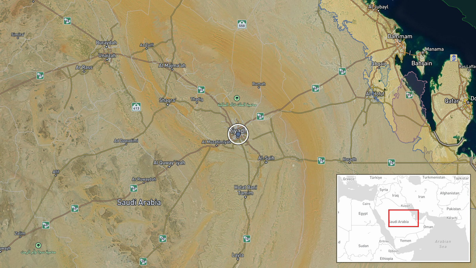
The location is recorded at region level, with the pin placed at central Riyadh. That anchor reflects the city named in the report rather than any confirmed interception point, and the Red Sea and southern regions mentioned in the report are not pinned. Riyadh sits on the interior Najd plateau, far from the Red Sea coast. The southern regions named in the report border Yemen, which is the nearest relevant geography to the drone reports.
Related events nearby
- Saudi Foreign Ministry urges UN Security Council to help block Houthi weapons access and thanks it for solidar2026-10-16 10:03 UTC · Statement · Riyadh, Saudi Arabia
▶ View this event on the live map

Intel Mapper aggregates open-source reports from monitored Telegram and X channels, geolocates them, cross-checks duplicates across sources and assigns a confidence score. Entries are updated as new confirmations arrive. Read how we verify events.