Reported seizure and burning of US-made military vehicle in northern Yemen, single-source
What happened
A Turkish-language post on X from the account @ConflictTR reports that Yemeni armed forces seized an American-made military vehicle in the north of the country and set it on fire. The post names no settlement, gives no time of the action beyond the posting timestamp, and does not describe the vehicle type. It forwards a claim attributed to a Telegram channel referred to as naya_foriraq, and the post does not indicate that the claim was independently checked. The event is logged for 16 October 2026 at 14:16 UTC. The source wording says Yemen Silahlı Kuvvetleri (Yemeni Armed Forces), while the event record lists the actor as Houthi. The original post does not itself name the Houthis, so that attribution reflects the desk's classification rather than the quoted report.
Context and assessment
Northern Yemen, and particularly the Marib governorate, has been one of the most contested areas since the country's civil conflict escalated in 2015. Marib city is held by government-aligned forces and sits near key energy infrastructure and population centers, which makes it a recurring focus of fighting. The related event the previous day is directly relevant: Houthi forces reportedly fired multiple ballistic missiles at Marib city, and Yemen's Minister of Youth stated that Operation Yemen Dawn continues and that the government remains committed to its aims. Taken together, missile fire on Marib and a reported vehicle seizure in the north suggest active pressure along the front rather than an isolated incident. Military vehicles of foreign manufacture, including US-made models, have circulated among Yemeni factions through earlier supply chains and battlefield captures, so the type of equipment is consistent with the local inventory. Capturing and burning a vehicle is often a battlefield outcome, but it is also a common format for propaganda footage. Operationally, if the report is accurate, it would indicate a localized engagement involving ground forces, not necessarily a change in the broader front lines.
Sources and confidence
The report rests on a single channel, the X account @ConflictTR, which relays a Telegram claim. No second outlet, official statement, or geolocated imagery appears in the supplied data to corroborate it. The confidence score of 6.3 reflects one unverified source, an unspecified location, and the absence of visual evidence. Confidence would rise with geolocated photos or video showing the vehicle and its markings, confirmation from a second independent outlet, or a statement from a party to the fighting. It would fall if the footage is traced to an earlier incident or another country.
Location
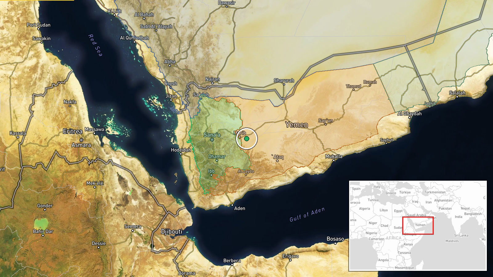
The coordinates (15.4, 45.6) are a regional placeholder with region-level precision and low location confidence, not a confirmed site or settlement. They fall in the northern interior of Yemen, roughly 30 km east of Marib city by coordinates alone. The terrain there is largely desert plains with highland edges, and the point should be read as approximate.
▶ View this event on the live map

Intel Mapper aggregates open-source reports from monitored Telegram and X channels, geolocates them, cross-checks duplicates across sources and assigns a confidence score. Entries are updated as new confirmations arrive. Read how we verify events.