CENTCOM reportedly says it blocked at least $25 billion in Iranian crude oil exports
What happened
The event entry reports that CENTCOM, the US Central Command, said it had blocked at least $25 billion worth of Iranian crude oil exports. The claim was relayed through a post by the X account ConflictTR, whose Turkish-language text attributes it to CENTCOM. The post names no vessel, interdiction date, or method, and no primary CENTCOM statement is linked. The reported area is a broad maritime zone spanning the North Arabian Sea and Gulf of Oman, timestamped 16 October 2026, 19:45 UTC. Because it rests on one secondhand post, the figure should be read as an attributed claim, not a verified result.
Context and assessment
Interdictions of Iranian oil are a recurring feature of the broader pressure campaign against Tehran, which has relied on sanctions, tanker seizures, and naval patrols in the Gulf of Oman and Arabian Sea for years. Crude revenue is central to Iran's economy, and maritime routes through these waters are where cargoes are most often transferred between vessels or routed through a shadow fleet of older tankers with opaque ownership. A large dollar figure, if accurate, would more likely describe a cumulative tally across a sustained campaign than a single seizure, since individual cargoes rarely reach values of that scale. No related events in the Intel Mapper dataset currently link to this entry, so the pattern cannot be checked against neighbouring incidents on the map. Operationally, a publicised tally of this kind can function as a signal to buyers, insurers, and shipping operators as much as a military report, and it may point to heightened enforcement against sanctioned cargoes. The wording, however, is an attributed claim, and the absence of vessel names, dates, or imagery means it could reflect aggregated sanctions enforcement, diplomatic messaging, or figures drawn from several months. Any operational implications remain possibilities rather than established findings.
Sources and confidence
Only one channel is cited: the X account @ConflictTR, which shared a Turkish-language post attributed to CENTCOM. No second outlet, official CENTCOM release, or independent maritime tracking source appears in the data, so cross-confirmation is absent. The confidence score of 6.1 out of 10 reflects a plausible attribution from a known aggregator, but a single secondhand link with no primary document. Confidence would rise with a CENTCOM press release, named vessels, or corroboration from shipping data or wire services. It would fall if the statement cannot be traced to an official source or if the figure turns out to describe cumulative sanctions actions.
Location
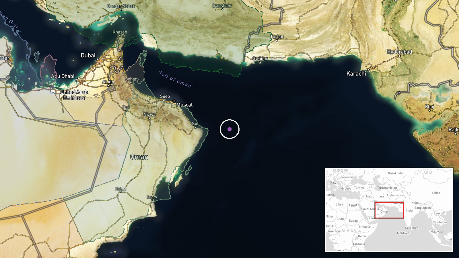
The location is recorded at region precision, with a point near 22.5 degrees north and 61.0 degrees east, placed by the desk rather than by a named vessel position or port. The marker sits in open water of the Arabian Sea, well offshore from the Makran coast shared by Iran and Pakistan and east of the Gulf of Oman approaches. Because the source names only a broad area, the marker should be read as approximate, and the exact interdiction site is unknown.
▶ View this event on the live map

Intel Mapper aggregates open-source reports from monitored Telegram and X channels, geolocates them, cross-checks duplicates across sources and assigns a confidence score. Entries are updated as new confirmations arrive. Read how we verify events.