Single unverified report says Iran has resumed heavy attacks on ships in the Strait of Hormuz
What happened
A single social media post from the X account @WarMonitor3, logged on 16 October 2026 at 22:33 UTC, reports that Iran has begun heavily attacking ships in the Strait of Hormuz again, a considerable increase from earlier levels. The post does not name specific vessels, precise positions within the strait, casualties, or damage, and the event summary is an interpretation of that text rather than a described incident. The author links the activity possibly to a deteriorating economic situation under US blockades and sanctions and asks whether escalation will continue. The event is recorded as a Combat-type incident with Iran as the named actor. Because the claim rests on one channel with no further detail, the report of renewed attacks remains unconfirmed at the time of logging.
Context and assessment
The Strait of Hormuz is the narrow waterway linking the Persian Gulf with the Gulf of Oman, and it carries a large share of the world's seaborne oil and liquefied natural gas. Its narrowest navigable section is only a few dozen kilometres wide, and Iran's coastline lies along its northern shore, which gives Tehran unusual geographic leverage over commercial traffic. Iran has repeatedly used the threat of disruption as pressure during periods of sanctions and naval confrontation, and previous episodes in the 2019 to 2020 period included tanker seizures and harassment incidents, with US naval forces maintaining a presence nearby. The current feed contains no related events, so this report cannot be placed within a verified sequence of incidents, and that gap is itself important. If the claim were accurate, it would more plausibly signal coercive pressure aimed at shipping and sanctions enforcement than conventional battlefield action. The author's suggestion that economic strain is driving the activity is speculative and should be treated as a hypothesis rather than an established motive.
Sources and confidence
The report comes from one channel, the X account @WarMonitor3, and no other source in the record corroborates it. No related events are linked, so there is no independent maritime, governmental, or wire reporting to compare against. The confidence score of 6.0 reflects this single-source basis together with low location confidence. It would rise with independent confirmation from maritime security bodies, named or identified vessels, geolocated imagery, or reporting from established news agencies. It would fall if the account's prior reporting proves unreliable or if no corresponding incidents appear in shipping data.
Location
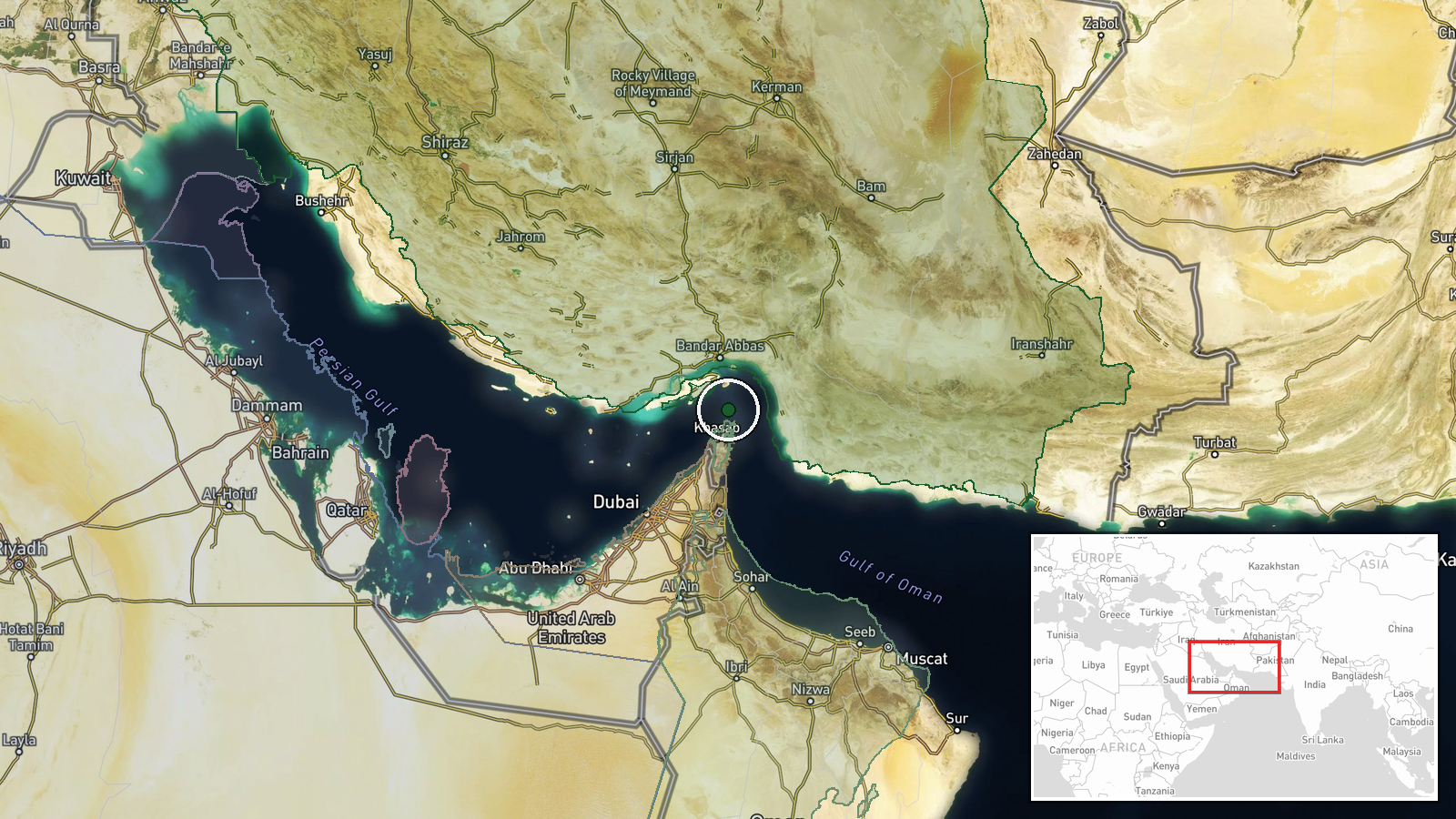
Location precision is at region level, with coordinates of roughly 26.55 N, 56.40 E placed near the central section of the strait rather than at any specific vessel or incident site. The strait lies between Iran's southern coast and Oman's Musandam Peninsula, connecting the Persian Gulf to the Gulf of Oman. Several islands, including Qeshm and Larak, sit within or near the waterway and shape its shipping lanes. The coordinates should be read as an approximate marker for the waterway as a whole.
▶ View this event on the live map

Intel Mapper aggregates open-source reports from monitored Telegram and X channels, geolocates them, cross-checks duplicates across sources and assigns a confidence score. Entries are updated as new confirmations arrive. Read how we verify events.