Reported IRGC RPG strike on a vessel in the northern Gulf off Basra, single-source report
What happened
A breaking report posted on X by the account ConflictTR states that Iran's Islamic Revolutionary Guard Corps struck a vessel in the Persian Gulf off Basra with a rocket-propelled grenade. The original post is written in Turkish and is brief, carrying a 'SONDAKİKA' (breaking news) label and a single sentence with no accompanying imagery. The text does not describe the vessel's type, flag, crew, or condition, and it gives no casualty information. The report is timestamped 17 October 2026 at 07:46 UTC on the platform's record. The summary wording is reportedly based on that one channel, and the attribution to the IRGC rests on the post's own claim rather than on an independent statement. Intel Mapper has recorded the event as a combat incident with Iran as the named actor.
Context and assessment
The northern Gulf, where Basra's port approaches meet open waters shared by Iraq, Kuwait, and Iran, is one of the busiest and most sensitive maritime areas in the region. Basra is Iraq's main outlet for oil exports, so any reported attack on shipping near it carries commercial and diplomatic weight beyond the immediate incident. A rocket-propelled grenade is a short-range anti-armor weapon that is often used against small craft and boats, which suggests the reported target may have been a relatively small or low-speed vessel, though the post does not say so. The most relevant recent event in the data is a reported convoy movement on 16 October in which Iran moved tanks to Abadan, per the same channel. Abadan lies on the Iranian side of the Shatt al-Arab, and the related summary's description of it as near the Iraq-Kuwait border should be treated with caution. A ground movement one day earlier in the same reporting stream could indicate force repositioning in the upper Gulf, but a single convoy report does not establish a link to the maritime incident. The pattern may reflect heightened coastal or naval activity, or the two reports may be unrelated.
Sources and confidence
Only one channel, X account @ConflictTR, is recorded for this event, and no wire service, maritime authority, or second outlet appears in the data to confirm it. The confidence score of 5.5 on the platform's scale is low to moderate, reflecting the single source, the absence of visual evidence, and the unverified attribution to the IRGC. Confidence would rise with imagery or video of the vessel, incident notices from UKMTO or other maritime reporting bodies, vessel-tracking data showing an anomaly, or statements from the IRGC, Iraqi authorities, or other outlets. It would fall if shipping authorities report no incident or if the vessel's operator denies any attack.
Location
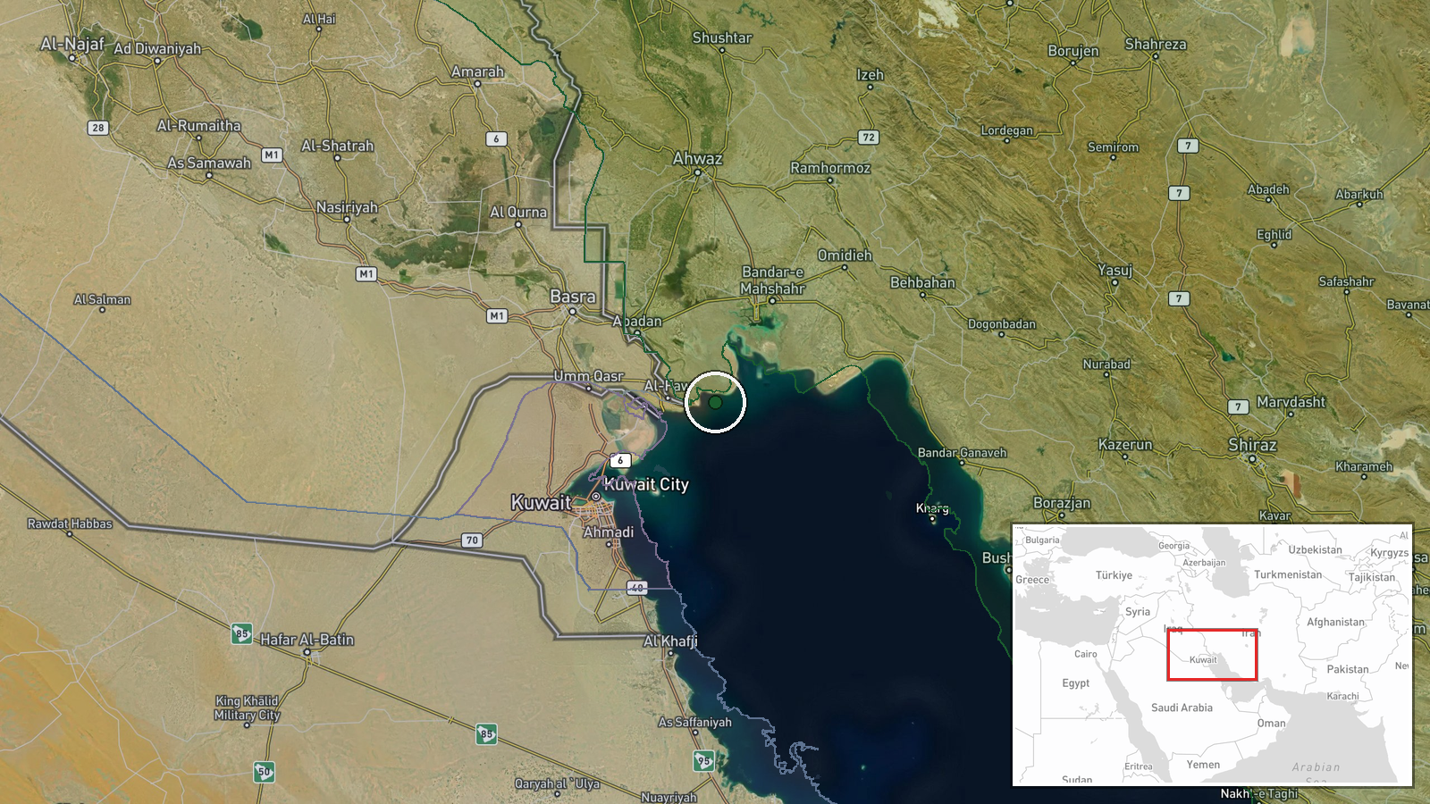
The coordinates (29.95, 48.8) carry region-level precision, so they mark an approximate area of open northern Gulf water rather than a confirmed vessel position. The place label 'Persian Gulf off Basra' comes from the reporting, and the coordinates sit well southeast of Basra city, roughly 100 km or more from its port. The area is shallow and heavily trafficked, with oil terminals, shipping lanes, and the Kuwaiti coastline to the west and north. Precise positioning would require the vessel's name or a timestamped track.
Related events nearby
- Iran moved tanks to Abadan, a city near the Iraq-Kuwait border, per X ConflictTR report.2026-10-16 10:41 UTC · Convoy · Abadan, Iran
▶ View this event on the live map

Intel Mapper aggregates open-source reports from monitored Telegram and X channels, geolocates them, cross-checks duplicates across sources and assigns a confidence score. Entries are updated as new confirmations arrive. Read how we verify events.