US destroyer reportedly enforcing Iran port blockade; CENTCOM cites 138 vessels redirected
What happened
A post from the X account @Osint613 reports that the US destroyer USS Rafael Peralta (DDG 115) is transiting regional waters in support of a naval blockade against Iranian ports. Citing CENTCOM, the post says forces had redirected 138 commercial vessels as of October 17 to ensure strict compliance. The wording follows official military language, and the post links to a source that was not independently available for this record. The report gives no transit time, vessel identities, or details of any incident or use of force. It was logged at 20:06 UTC on October 17, 2026.
Context and assessment
Iran's main commercial ports sit on the Gulf and Gulf of Oman coasts, and the route between them and the wider Indian Ocean runs through the Strait of Hormuz and the Arabian Sea approaches. A sustained blockade of those ports would therefore depend heavily on naval presence in these waters, which is why a reported destroyer transit here is consistent with the broader maritime posture described in the report. The dataset contains no related events, so this report cannot be placed within a recent sequence of incidents on this map, and any pattern claim would be speculative. The reported figure of 138 redirected vessels, if accurate, suggests an interdiction and inspection role rather than kinetic action, since redirection is the typical outcome of a commercial shipping check. Destroyers are multi-role surface combatants, so their presence may signal escort, surveillance or enforcement duties, but the post does not specify which. Operationally, the most useful follow-up would be whether the redirected traffic is visible in vessel-tracking data and whether any ships were stopped, boarded or diverted to particular ports.
Sources and confidence
Only one channel has reported this event, the X account @Osint613, which the record shows as a single source with no corroborating outlets. The post attributes its information to CENTCOM, but the attribution is not independently confirmed here. The score of 6.6 reflects a single unverified repost with an official-sounding statement and a link whose content could not be checked. Confidence would rise with a direct CENTCOM statement or press release, independent vessel-tracking data showing the redirections, or imagery or reporting confirming the ship's presence. It would fall if the wording cannot be traced to an official source or if tracking data contradicts the figure.
Location
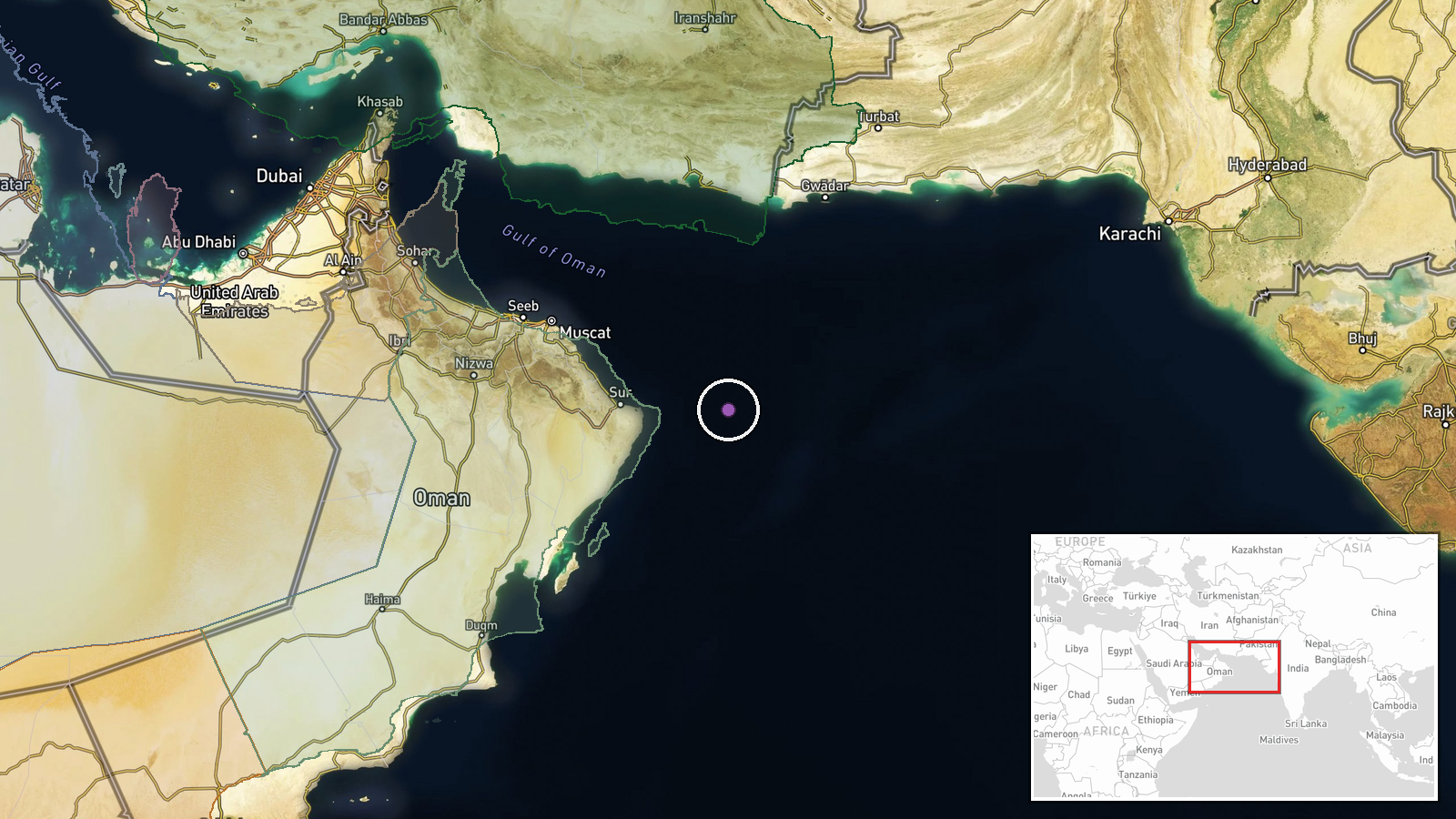
The coordinates, 22.5 north and 61.0 east, are a region-level approximation rather than a fixed point, and the location confidence is low. The point does not correspond to a port, settlement or facility. It lies in open water of the North Arabian Sea near the approaches to the Gulf of Oman, south of Iran's Makran coast. Chabahar, an Iranian port, lies to the northwest of the point along that coastline. The area is largely open sea, so the true position of the reported transit could differ considerably.
▶ View this event on the live map

Intel Mapper aggregates open-source reports from monitored Telegram and X channels, geolocates them, cross-checks duplicates across sources and assigns a confidence score. Entries are updated as new confirmations arrive. Read how we verify events.