Taiwan reports 2 PLA aircraft sorties, 5 PLA Navy ships and 9 official ships around Taiwan
What happened
Taiwan's Ministry of National Defense, posting on X under the handle @MoNDefense, reported that as of 6 a.m. local time (UTC+8) on the day of the report, it had detected two sorties of People's Liberation Army aircraft, five People's Liberation Army Navy vessels and nine official ships operating around Taiwan. The post stated that both aircraft sorties crossed the median line and entered the northern and central parts of Taiwan's Air Defense Identification Zone. The ministry said its forces had monitored the situation and responded. The feed timestamps the event at 01:00 UTC on 18 October 2026. The report is a daily activity count and does not describe weapons use, damage or casualties.
Context and assessment
The median line of the Taiwan Strait is an informal boundary that Taipei has long treated as a reference point, while Beijing does not accept it as legitimate. The Air Defense Identification Zone is a self-declared area that extends beyond Taiwan's territorial airspace, so crossings are normally handled through monitoring, radio warnings and readiness responses rather than through armed clashes. Daily counts of this kind have become a recurring feature of cross-strait reporting since activity levels rose in recent years. The related-events list for this entry is empty, so the feed itself does not reveal a trend, and any broader pattern claim has to rest on general background rather than on linked incidents. Operationally, the combination of aircraft, naval vessels and official ships may point to sustained presence over a single day rather than an isolated flight. A single daily report cannot separate routine patrol activity from deliberate signaling, so the figures are best read as one data point within a longer series.
Sources and confidence
The entry rests on one channel, the Taiwan Ministry of National Defense account on X, which is the government body that normally publishes these daily tallies. No independent outlet, wire service, flight-tracking dataset or Chinese-side statement in the data corroborates the counts. The confidence score of 6.1 reflects a credible official origin combined with a single source and no cross-checking. Confidence would rise if flight-tracking data or ship-tracking records matched the reported numbers, or if the ministry's own later summaries confirmed them. It would fall if the figures were revised or if the ministry's timing or categories proved inconsistent with other records.
Location
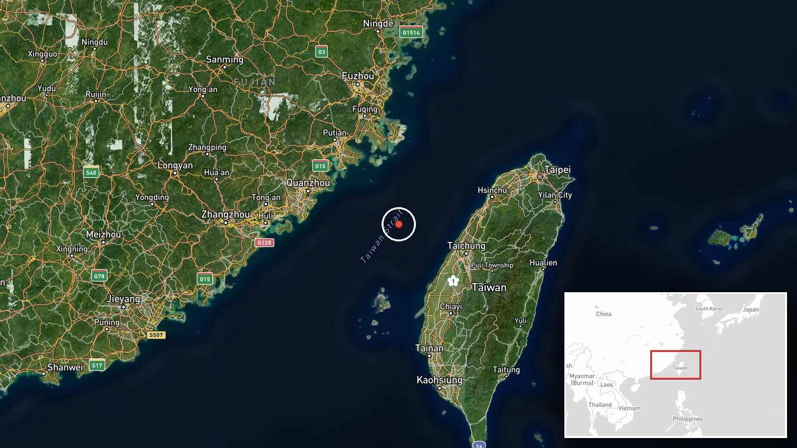
The coordinates of 24.5 N, 119.8 E are region-level and approximate, placed in the Taiwan Strait rather than at a settlement or facility, so they should not be read as an exact activity point. The setting is open sea between the Fujian coast of mainland China and western Taiwan. The Penghu archipelago lies to the south-southeast, and the strait narrows toward the Chinese coastline to the west.
▶ View this event on the live map

Intel Mapper aggregates open-source reports from monitored Telegram and X channels, geolocates them, cross-checks duplicates across sources and assigns a confidence score. Entries are updated as new confirmations arrive. Read how we verify events.