Four IEDs reportedly hit Yemeni army convoy in Arma District, Shabwah; one vehicle burned
What happened
A single social media channel, the X account @Osint613, reports that four improvised explosive devices struck a convoy of the Yemeni National Army in Arma District, in the northeast of Shabwah Governorate, Yemen. The report, dated 18 October 2026 at 20:04 UTC, states that one military vehicle burned and that several casualties were reported. The source wording reads 'Four IEDs hit a Yemeni National Army convoy' and 'A military vehicle burned, several casualties reported,' without giving the number of casualties, their condition, or who was responsible. The post links to one external address. The record's attack-type field is coded as artillery, which does not match the IED description in the report, so that classification should be treated as provisional. The actor is recorded as unknown.
Context and assessment
Shabwah is a southern governorate where government-aligned forces, local security units and armed groups have contested control since the escalation of Yemen's civil war in 2015. Its eastern and central districts have historically seen activity from al-Qaeda in the Arabian Peninsula, and improvised explosive devices have been a recurring tactic across the south for years. Convoy attacks fit a pattern in which roadside devices target logistics movements rather than fixed positions. The dataset contains no related events for this period, so this report cannot be placed within a recent sequence on Intel Mapper, and any broader pattern rests on background knowledge rather than linked incidents. Operationally, several devices along one convoy would suggest pre-positioning and some knowledge of route timing, though this is an inference from the reported method, not a confirmed finding. The artillery coding, if it reflects a second form of fire, would point to a mixed attack, but nothing in the available text supports that reading. The wider significance of the route depends on whether it serves as a supply line for forces elsewhere in Shabwah, which the data does not establish.
Sources and confidence
The report comes from one channel, the X account @Osint613, which is the only listed source. No independent outlet, official Yemeni statement, or second post in the dataset confirms the attack, the casualty claim, or the vehicle damage. The confidence score of 6.8 reflects a single-source report that is plausible for the area but unverified, along with an inconsistency between the IED description and the artillery classification. It is not higher because nothing corroborates it, and not lower because the event type and location fit known patterns in the governorate. Confidence would rise with wire-service or government confirmation, or with photographs or video geolocated to the road. It would fall if the account is found to recycle older material or if the artillery coding proves to describe a different event.
Location
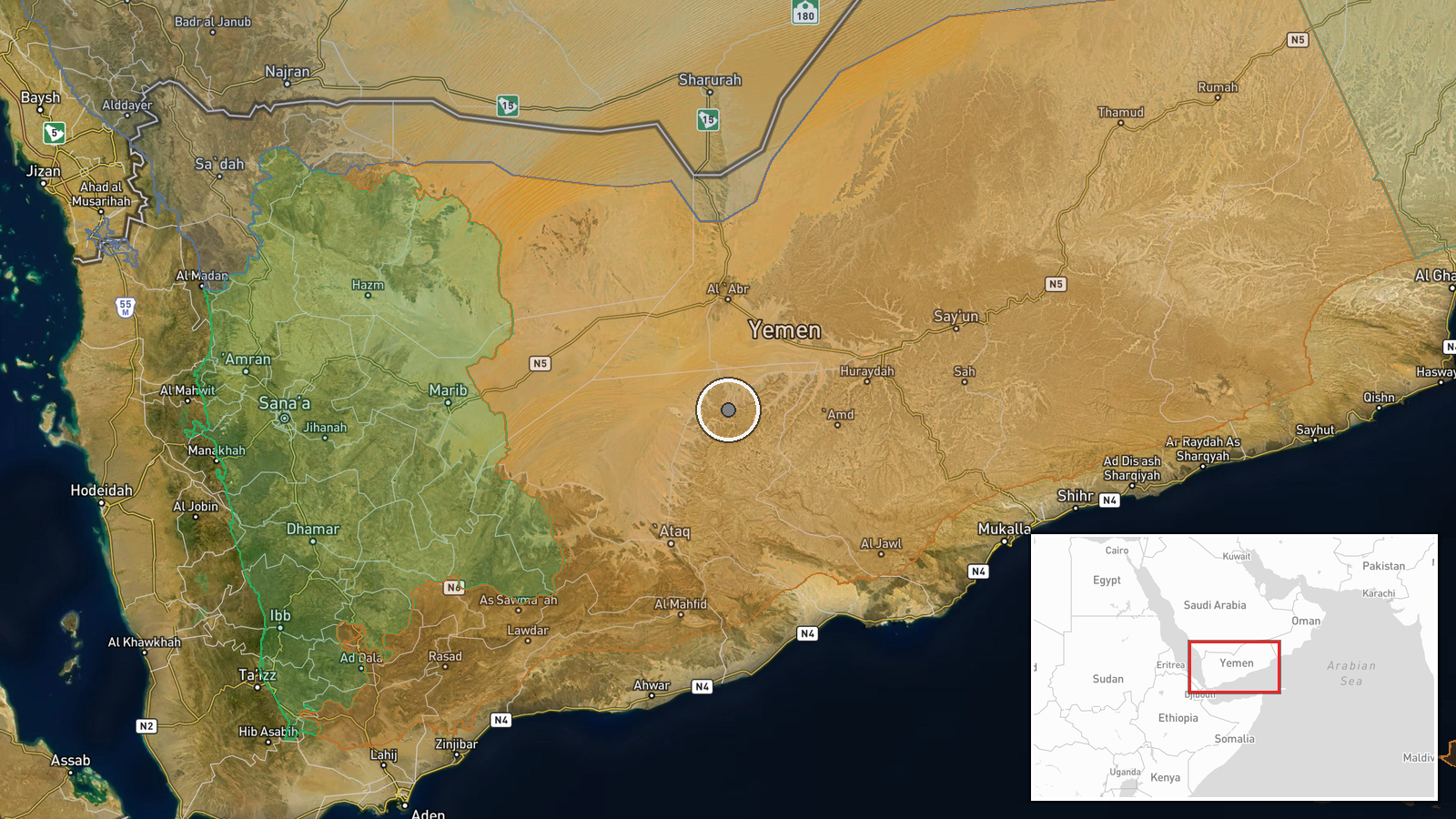
The coordinates 15.4127, 47.2345 are a settlement-level placement for Arma District, not a specific road, checkpoint or site, so the exact location of the convoy is unknown. The location confidence is recorded as normal. Arma lies in the northeast of Shabwah Governorate, an arid and sparsely populated area where roads cross wadi and desert terrain. Such terrain can offer cover for roadside devices and limits the availability of independent local reporting.
▶ View this event on the live map

Intel Mapper aggregates open-source reports from monitored Telegram and X channels, geolocates them, cross-checks duplicates across sources and assigns a confidence score. Entries are updated as new confirmations arrive. Read how we verify events.