Japan reports Chinese destroyer and supply ship transited Osumi Strait into the Pacific
What happened
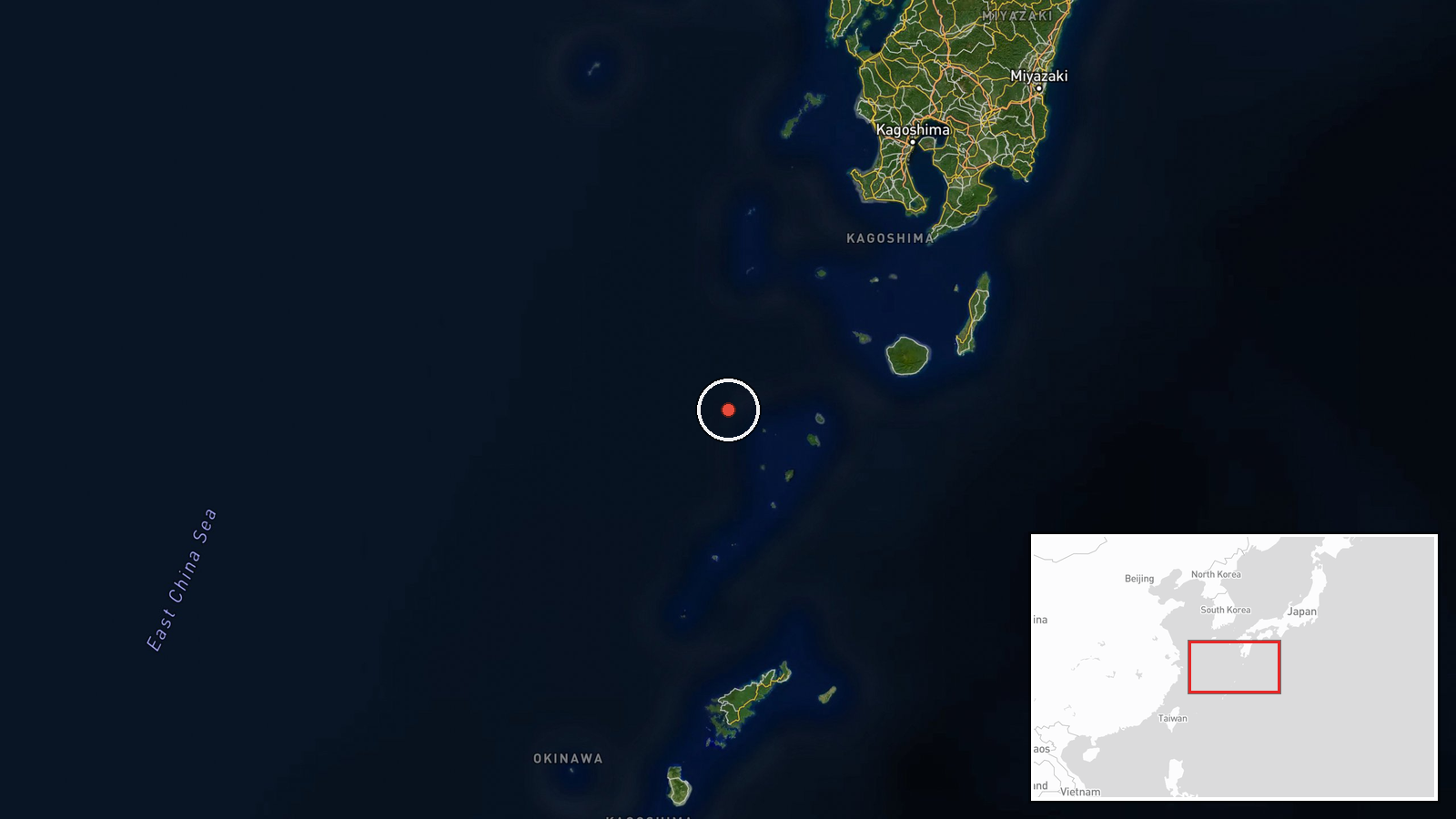
Japan's Joint Staff Office said on Friday, October 16, at about 23:00 local time, that it had identified two People's Liberation Army Navy vessels roughly 140 km west of Yakushima Island, Kagoshima Prefecture, sailing southeast. They were the Luyang III-class guided-missile destroyer, hull number 121, and the Fuchi-class fast combat support ship, hull number 901. On Saturday, October 17, the Joint Staff said it had confirmed the pair moving east through the Osumi Strait and heading into the Pacific Ocean. The original Japanese statement says Maritime Self-Defense Force units, including a surveillance ship from the 3rd Patrol and Defense Unit based at Sasebo and a P-1 maritime patrol aircraft from Kanoya, conducted warning, surveillance and intelligence collection. The report was published as a single post on the Joint Staff's official X account.
Context and assessment
Yakushima and the Osumi Strait sit on the southern approach to Japan's Pacific side, where the Kyushu coast and the Ryukyu chain funnel shipping between the East China Sea and the open Pacific. The Osumi Strait, which lies between Kyushu and Tanegashima, is one of several passages Japan monitors alongside the Miyako, Yonaguni and Tsugaru channels. Chinese naval transits through these gaps have been a recurring feature of the regional picture over the past decade, and Tokyo has typically publicized them to document the movements of PLA Navy surface groups beyond the first island chain. No related events are linked to this record in the database, so it cannot be placed against a sequence of nearby incidents on this map. Operationally, pairing a destroyer with a fast combat support ship suggests a group designed to sustain extended time at sea, since the support vessel provides fuel, stores and replenishment. Publicly available information does not indicate the group's mission, so the transit is best read as a documented movement rather than evidence of a specific intent, unless further official statements say otherwise.
Sources and confidence
The only source in the database is a post from the official X account of Japan's Joint Staff Office, so the event has no independent cross-confirmation. The score of 6.1 reflects that single-channel status balanced against the reliability of an official statement that names hull numbers, ship classes and times. The record's timestamp of 19 October differs from the 16 and 17 October dates in the Japanese text, so the event date should be taken from the statement itself. Corroboration from Ministry of Defense releases or independent ship-tracking data would raise confidence.
Location
The position was given as roughly 140 km west of Yakushima, a settlement-level reference rather than an exact fix, and the map point at 30.03 N, 129.30 E lies in open water of the East China Sea. Yakushima is a mountainous subtropical island south of Kyushu, and the Osumi Strait lies to its northeast between Kyushu and Tanegashima, the route the ships later used to reach the Pacific.
▶ View this event on the live map

Intel Mapper aggregates open-source reports from monitored Telegram and X channels, geolocates them, cross-checks duplicates across sources and assigns a confidence score. Entries are updated as new confirmations arrive. Read how we verify events.